Rocester in the Domesday Book (1086)
Rocester is named in the Domesday Book, compiled by Norman commissioners in 1086, entered under the hundred of Totmonslow in STS. The survey assessed Rocester at 74.1 carucates of taxable land.
At the time of the survey, Rocester supported a recorded population of 107 villagers, 39 smallholders, 2 slaves, 36 freemanmen, working 56 ploughs between them.
The survey records Rocester’s value at 11 shillings in 1086. No pre-Conquest figure survives – not unusual in the North, where records were disrupted by the Harrying and by the patchy coverage of the survey.
The survey lists 2 manors at Rocester under different lords. Splitting a single settlement between multiple tenants was common across the North – Saxon estates broken up and handed to William’s followers after 1066.
Resources Recorded at Rocester (1086)
- Mills: 7 mills (valued at 3.1399999999999997 shillings)
- Meadow: 40 acres & 3 * 2 furlongs mixed measures
- Woodland: 6 * 9 furlongs
Other Settlements in Totmonslow
- Alstonefield
- Alton
- Basford
- Blore
- Bradley [-in-the-Moors]
- Bramshall
- Cauldon
- Caverswall
- Cheadle
- Cheddleton
- Consall
- Crakemarsh
- Croxden
- Denstone
The Meaning of the Name
The origin of the name Rocester is not securely established from its modern form alone; like many settlement names in the North it likely combines an Old English or Old Norse personal name with a landscape term.
Remarkably, the name has changed little since 1086, when the Domesday scribes wrote it as Rocester.
Listed Buildings Near Rocester
Historic England records 21 listed buildings within about a mile of Rocester. Listing protects structures of special architectural or historic interest, graded I (exceptional), II* (particularly important) and II.
Grade II*
- Cross Approximately 40 Yards North of Church of St Michael - 0.57 km
- Banks Farmhouse - 0.85 km
Grade II
- Churnet Bridge and Causeway to West - 0.17 km
- Podmore’s Mill - 0.18 km
- Rose Cottage - 0.27 km
- 58, High Street - 0.28 km
- Queens Arms Hotel - 0.35 km
- The Old Vicarage - 0.55 km
- Milepost at Ngr Sk 1074 3992 - 0.56 km
- Dove Lane Farm Cottage - 0.56 km
- Church of St Michael - 0.58 km
- Former Coach House Immediately North East of Millholme - 0.69 km
- Millholme - 0.7 km
- Tutbury Mill - 0.72 km
- Rocester Bridge - 0.99 km
- Stubwood Methodist Chapel, Forecourt Walls, Railings and Gate - 1.08 km
- Barrowhill - 1.16 km
- Coach house and stables approximately 20 yards north of Barrowh - 1.18 km
- Icehouse Approximately 150 Yards North West of Barrowhill at Ngr Sk 1093 4061 - 1.18 km
- Farmyard Group Approximately 100 Yards North West of Barrowhill - 1.21 km
- Hay Barn Approximately 150 Yards North West of Barrowhill - 1.23 km
Scheduled Monuments Near Rocester
Scheduled monuments are nationally important archaeological sites given legal protection. 2 lie within roughly a mile of Rocester:
- Site of Rocester Abbey and part of Roman town - 0.55 km
- Cross in Rocester churchyard - 0.57 km
Rocester Today
Today Rocester lies within the administrative area of East Staffordshire, and the settlement recorded a population of 1,679 at the 2021 census. Nine and a half centuries separate that figure from the small rural community the Domesday survey recorded here in 1086.
Read more about modern Rocester on Wikipedia .
Nearby Domesday Settlements
Other places recorded in the 1086 survey within a few miles:
- Eaton Dovedale - 2.0 km S
- Sedsall - 2.2 km SE
- Roston - 3.6 km NE
- Marston Montgomery? - 3.6 km SE
- Norbury - 3.6 km NE
- Somersal - 5.0 km SE
Heritage Around Rocester
Photographs of churches, listed buildings and monuments in the vicinity, contributed by volunteers to the Geograph project and reused here under a Creative Commons licence.
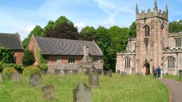
© Alan Walker · Geograph · CC BY-SA 2.0
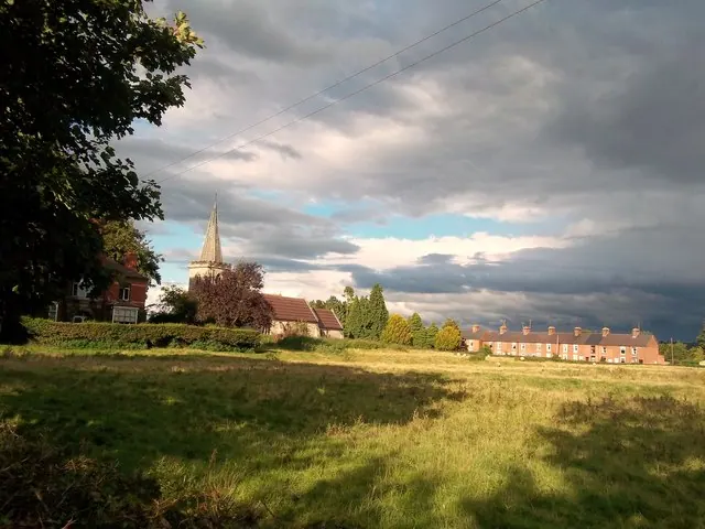
© Jonathan Clitheroe · Geograph · CC BY-SA 2.0
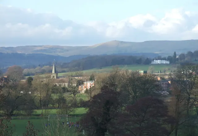
© Peter Taylor · Geograph · CC BY-SA 2.0
Images © their respective photographers, licensed under CC BY-SA 2.0 and reused here with attribution. Photographs depict listed buildings, churches and monuments near this settlement and may show neighbouring villages.
Data derived from the Open Domesday project (opendomesday.org), based on the Domesday Book dataset compiled by Professor J.J.N. Palmer and team. The Domesday Book (1086) is in the public domain.
Found an inaccuracy? [email protected]