Risby in the Domesday Book (1086)
The settlement of Risby is recorded in William I’s Domesday survey of 1086, entered under the hundred of Welton in Yorkshire. The survey assessed Risby at 36 carucates of taxable land.
At the time of the survey, Risby supported a recorded population of 41 villagers, 14 smallholders, 1 slave, 16 freemanmen, working 23 ploughs between them.
By 1086 Risby was worth 42 shillings, up from 40 shillings before the Conquest – a sign this community came through the Conquest without being ruined.
The survey lists 2 manors at Risby under different lords. Splitting a single settlement between multiple tenants was common across the North – Saxon estates broken up and handed to William’s followers after 1066.
Resources Recorded at Risby (1086)
- Mills: 2 mills (valued at 5d)
- Meadow: 20 acres
- Woodland: 1.5 * 1 furlongs
Other Settlements in Welton
- Bentley
- Brantingham
- Brantingham [Thorpe]
- Cottingham
- Ellerker
- Elloughton
- Lund
- Pillwoods [Farm]
- Skidby
- Toschetorp
- Walkington
- Wauldby
- Welton
- [Little] Weighton
The Meaning of the Name
The name Risby is of Scandinavian origin. Its final element derives from the Old Norse word bý, a farmstead or village. The first element is most likely a personal name or an early descriptive term, now difficult to recover with certainty. Taken together the name probably meant something close to ‘a farmstead’.
Names of this type are a fingerprint of Scandinavian settlement: they cluster across the old Danelaw, where Norse-speaking settlers renamed or founded villages from the late 9th century onward.
Remarkably, the name has changed little since 1086, when the Domesday scribes wrote it as Risby.
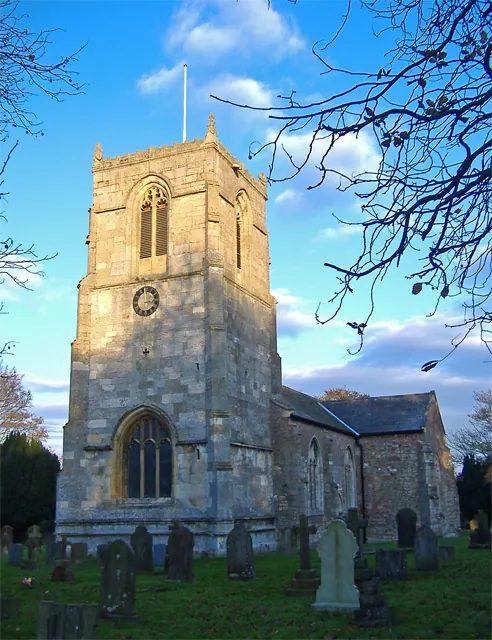
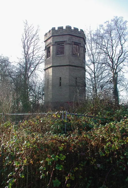
Listed Buildings Near Risby
Historic England records 2 listed buildings within about a mile of Risby. Listing protects structures of special architectural or historic interest, graded I (exceptional), II* (particularly important) and II.
Grade II*
- Church of Saint Michael - 1.21 km
Grade II
- Folly in Fishpond Wood - 1.09 km
Scheduled Monuments Near Risby
Scheduled monuments are nationally important archaeological sites given legal protection. 2 lie within roughly a mile of Risby:
- Risby Jacobean gardens, hall and medieval settlement remains - 0.61 km
- ‘Cellar Heads’ moated site and related ridge and furrow earthworks at Risby Park, 700m north west of Risby Park Farm - 1.09 km
Nearby Domesday Settlements
Other places recorded in the 1086 survey within a few miles:
- Bentley - 1.4 km NE
- Skidby - 1.4 km SE
- Little Weighton - 2.2 km SW
- Walkington - 3.2 km N
- Pillwoods Farm - 4.0 km E
- Riplingham - 4.5 km SW
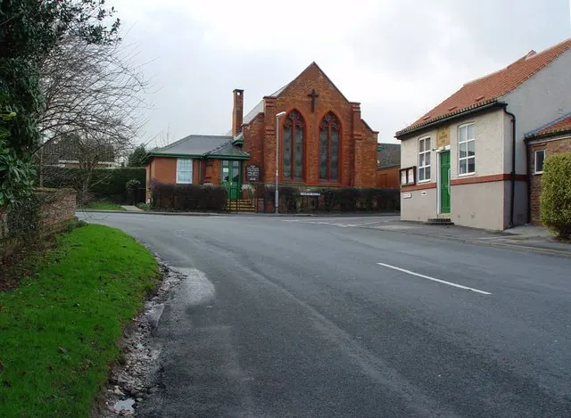
Heritage Around Risby
Photographs of churches, listed buildings and monuments in the vicinity, contributed by volunteers to the Geograph project and reused here under a Creative Commons licence.
© Peter Church · Geograph · CC BY-SA 2.0
© Paul Harrop · Geograph · CC BY-SA 2.0
© Paul Glazzard · Geograph · CC BY-SA 2.0
Images © their respective photographers, licensed under CC BY-SA 2.0 and reused here with attribution. Photographs depict listed buildings, churches and monuments near this settlement and may show neighbouring villages.
Data derived from the Open Domesday project (opendomesday.org), based on the Domesday Book dataset compiled by Professor J.J.N. Palmer and team. The Domesday Book (1086) is in the public domain.
Found an inaccuracy? [email protected]