Ripley in the Domesday Book (1086)
Ripley appears in the Domesday Book of 1086, entered under the hundred of Burghshire in Yorkshire.
Other Settlements in Burghshire
- Addlethorpe
- Aismunderby
- Aldfield
- Allerton [Mauleverer]
- Arkendale
- Askwith
- Azerley
- Barrowby [Grange]
- Beckwith [House]
- Besthaim
- Bestham
- Bewerley
- Bilton
- Birstwith
The Meaning of the Name
The name Ripley is of Anglo-Saxon origin. Its final element derives from the Old English word lēah, a woodland clearing or glade. The first element is most likely a personal name or an early descriptive term, now difficult to recover with certainty. Taken together the name probably meant something close to ‘a clearing’.
Remarkably, the name has changed little since 1086, when the Domesday scribes wrote it as Ripley.
Listed Buildings Near Ripley
Historic England records 54 listed buildings within about a mile of Ripley. Listing protects structures of special architectural or historic interest, graded I (exceptional), II* (particularly important) and II.
Grade II
- Numbers 1-5 South View - 0.12 km
- Numbers 1 and 2 Sunnyside With Outbuilding to Left and Archway to Right - 0.14 km
- Outbuilding Rear of Number 5 Main Street - 0.17 km
- Town Hall and Post Office - 0.17 km
- Outbuilding Rear of Number 6 Main Street - 0.17 km
- Horngarth - 0.17 km
- Village Shop, Wood Close and Wath House - 0.18 km
- 6-10, Main Street - 0.18 km
- 1-5, Main Street - 0.18 km
- K6 Telephone Kiosk Adjacent to Village Post Office - 0.18 km
- Birchwood Farmhouse - 0.18 km
- Numbers 1-4 Estate Cottages - 0.2 km
- Numbers 1-5 Town Hall Cottages - 0.2 km
- Dacre House , Oak House and Oak Cottage - 0.21 km
- Stocks - 0.21 km
- Drinking Fountain With Statue - 0.21 km
- Glebe House - 0.21 km
- Market Cross - 0.21 km
- School House - 0.21 km
- Star House and Star Cottage - 0.21 km
- Vale Lodge - 0.22 km
- Ripley School - 0.22 km
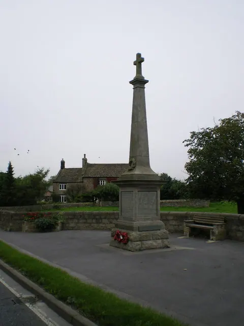
- Ripley War Memorial - 0.22 km
- Engineering Workshops and Stores Approximately 5 Metres North of Star House and Star Cottage - 0.23 km
…and 30 more listed structures in the area.
Scheduled Monuments Near Ripley
Scheduled monuments are nationally important archaeological sites given legal protection. 3 lie within roughly a mile of Ripley:
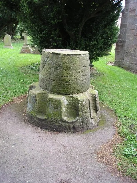
- Village cross with sundial and stocks - 0.21 km
- Cross base in All Saints’ churchyard - 0.26 km
- Ripley Park cross - 1.45 km
Ripley Today
Today Ripley lies within the administrative area of Harrogate, and the settlement recorded a population of 213 at the 2021 census. Nine and a half centuries separate that figure from the small rural community the Domesday survey recorded here in 1086.
Read more about modern Ripley on Wikipedia .
Nearby Domesday Settlements
Other places recorded in the 1086 survey within a few miles:
- Nidd - 2.0 km E
- Whipley Hall - 2.0 km W
- Killinghall - 2.0 km S
- Susacres - 2.2 km NE
- Cayton - 3.2 km N
- South Stainley - 3.6 km NE
Heritage Around Ripley
Photographs of churches, listed buildings and monuments in the vicinity, contributed by volunteers to the Geograph project and reused here under a Creative Commons licence.
© Richard Swales · Geograph · CC BY-SA 2.0
© Richard Law · Geograph · CC BY-SA 2.0
© Betty Longbottom · Geograph · CC BY-SA 2.0
Images © their respective photographers, licensed under CC BY-SA 2.0 and reused here with attribution. Photographs depict listed buildings, churches and monuments near this settlement and may show neighbouring villages.
Data derived from the Open Domesday project (opendomesday.org), based on the Domesday Book dataset compiled by Professor J.J.N. Palmer and team. The Domesday Book (1086) is in the public domain.
Found an inaccuracy? [email protected]