Riddlesden in the Domesday Book (1086)
Riddlesden is named in the Domesday Book, compiled by Norman commissioners in 1086, entered under the hundred of Skyrack in Yorkshire.
Other Settlements in Skyrack
- Adel
- Allerton [Bywater]
- Alwoodley
- Arthington
- Austhorpe
- Baildon
- Bardsey
- Barwick [in Elmet]
- Bichertun
- Bicherun
- Bingley
- Birkby [Hill]
- Bramhope
- Burden [Head]
The Meaning of the Name
The origin of the name Riddlesden is not securely established from its modern form alone; like many settlement names in the North it likely combines an Old English or Old Norse personal name with a landscape term.
Remarkably, the name has changed little since 1086, when the Domesday scribes wrote it as Riddlesden.
Listed Buildings Near Riddlesden
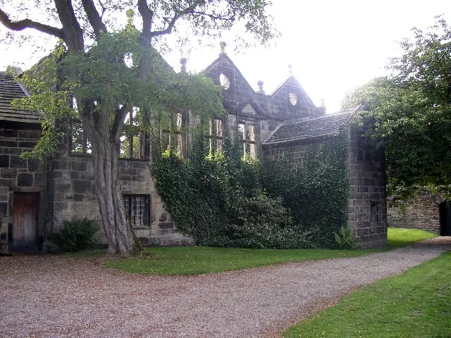
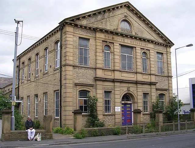
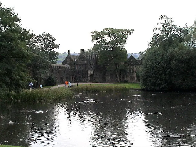
Historic England records 24 listed buildings within about a mile of Riddlesden. Listing protects structures of special architectural or historic interest, graded I (exceptional), II* (particularly important) and II.
Grade I
- West Riddlesden Hall - 0.39 km
- Barn Approximately 80 Metres to North-east of East Riddlesden Hall - 0.49 km
- East Riddlesden Hall - 0.5 km
Grade II*
Grade II
- Low Banks - 0.27 km
- Gate Piers at Entrance to East Riddlesden Hall - 0.43 km
- Barn to East of Entrance to East Riddlesden Hall, Approximately 100 Metres North East of Hall - 0.45 km
- Riddlesden College - 0.45 km
- 7 and 9, Leach Way - 0.47 km
- Mounting Block on South Edge of Lake to North of Riddlesden Hall - 0.48 km
- Garden Wall With Falcons’ Mews and Gate Piers to South West of East Riddlesden Hall - 0.49 km
- Shop Approximately 2 Metres to North East of East Riddlesden Hall - 0.5 km
- Toilets Next to Shop to North East of East Riddlesden Hall - 0.5 km
- Aireworth Mill - 0.63 km
- Bank House - 0.73 km
- Former Farmhouse to South of Rivock Farm - 0.74 km
- Heights Farmhouse and Attached Barn - 0.77 km
- Porter’s Lodge to Dalton Mills - 1.12 km
- Eastwood House in Victoria Park - 1.16 km
- Moorside Farmhouse and Barn - 1.23 km
- Farm Buildings Approximately 60 Metres to North East of Elam Grange - 1.27 km
- Field Head Farmhouse - 1.27 km
- Elam Grange - 1.3 km
- Barn Approximately 70 Metres North North East of Elam Grange - 1.3 km
Scheduled Monuments Near Riddlesden
Scheduled monuments are nationally important archaeological sites given legal protection. 1 lies within roughly a mile of Riddlesden:
Riddlesden Today
Today Riddlesden lies within the administrative area of Keighley.
Read more about modern Riddlesden on Wikipedia .
Nearby Domesday Settlements
Other places recorded in the 1086 survey within a few miles:
- Keighley - 1.4 km SW
- East and West Morton - 2.0 km E
- Utley - 2.0 km W
- Marley - 2.8 km SE
- Micklethwaite - 3.2 km E
- Hainworth - 3.6 km SW
Heritage Around Riddlesden
Photographs of churches, listed buildings and monuments in the vicinity, contributed by volunteers to the Geograph project and reused here under a Creative Commons licence.
© Humphrey Bolton · Geograph · CC BY-SA 2.0
© Betty Longbottom · Geograph · CC BY-SA 2.0
© Andrew McLean · Geograph · CC BY-SA 2.0
Images © their respective photographers, licensed under CC BY-SA 2.0 and reused here with attribution. Photographs depict listed buildings, churches and monuments near this settlement and may show neighbouring villages.
Data derived from the Open Domesday project (opendomesday.org), based on the Domesday Book dataset compiled by Professor J.J.N. Palmer and team. The Domesday Book (1086) is in the public domain.
Found an inaccuracy? [email protected]