Richmond in the Domesday Book (1086)
The 1086 Domesday survey records the settlement of Richmond, entered under the hundred of Land of Count Alan in Yorkshire. The survey assessed Richmond at 6 carucates of taxable land.
At the time of the survey, Richmond supported a recorded population of 4 villagers, 1 smallholder, working 2 ploughs between them.
The drop in value is hard to miss. Before 1066, Richmond was worth 10d; by 1086 that had dropped to 0d – a fall of 100%. Most Yorkshire villages that lost value on this scale were swept up in the Harrying of the North – William’s scorched-earth campaign of 1069–70.
1 of 3 manors within Richmond are recorded as waste in 1086, with the remainder still productive. This partial devastation suggests the settlement was caught in the path of the Harrying of the North but not entirely destroyed - or that recovery had begun in some holdings by the time of the survey.
The survey lists 3 manors at Richmond under different lords. Splitting a single settlement between multiple tenants was common across the North – Saxon estates broken up and handed to William’s followers after 1066.
Resources Recorded at Richmond (1086)
- Woodland: 1 * 1 None
Other Settlements in Land of Count Alan
- Achebi
- Agglethorpe
- Ainderby [Mires]
- Ainderby [Quernhow]
- Aiskew
- Aldbrough
- Allerthorpe [Hall]
- Ascam
- Ascham
- Asebi
- Aske [Hall]
- Askrigg
- Aysgarth
- Baldersby
The Meaning of the Name
The origin of the name Richmond is not securely established from its modern form alone; like many settlement names in the North it likely combines an Old English or Old Norse personal name with a landscape term.
Remarkably, the name has changed little since 1086, when the Domesday scribes wrote it as Richmond.
Listed Buildings Near Richmond
Historic England records 353 listed buildings within about a mile of Richmond. Listing protects structures of special architectural or historic interest, graded I (exceptional), II* (particularly important) and II.
Grade II*
- The Eleanor Bowes Hospital - 0.2 km
- Hill House - 0.23 km
- Garden Wall at Hill House, Gates and Gate Piers at Hill House - 0.24 km
Grade II
- 4 and 6, Anchorage Hill - 0.21 km
- Rookery Neuk - 0.22 km
- No. 1 (The Rookery) and No. 2, Anchorage Hill - 0.22 km
- 13 Maison Dieu - 0.23 km
- 1-11 Maison Dieu - 0.23 km
- 14 Maison Dieu - 0.25 km
- 12 Maison Dieu - 0.25 km
- 16 Maison Dieu - 0.25 km
- 28 Maison Dieu - 0.26 km
- 30 Maison Dieu - 0.26 km
- 34 Maison Dieu - 0.27 km
- 5 and 7, Gallowgate - 0.28 km
- 1 Gallowgate - 0.29 km
- 3, Gallowgate - 0.29 km
- Pear Tree House - 0.3 km
- Oglethorpe House - 0.31 km
- The Green Howards Regimental War Memorial including cross, steps, piers and railings - 0.31 km
- 60, Frenchgate - 0.32 km
- Zetland House - 0.32 km
- 91, Frenchgate - 0.33 km
- Ship Inn - 0.33 km
…and 329 more listed structures in the area.
Scheduled Monuments Near Richmond
Scheduled monuments are nationally important archaeological sites given legal protection. 9 lie within roughly a mile of Richmond:
- Franciscan friary - 0.64 km
- St Martin’s Benedictine Priory, Richmond - 0.77 km
- Section of Scots Dyke linear boundary 75m south west of Sandford House - 0.89 km
- Richmond Castle: eleventh to fourteenth century enclosure castle - 0.9 km
- The Bar, a surviving gateway originally part of Richmond’s medieval town wall - 0.94 km
- Section of the Scots Dyke linear boundary 250m south east of St Martin’s Priory - 0.96 km
- Section of the Scots Dyke linear boundary 225m south of St Martin’s Priory - 0.97 km
- Section of Scots Dyke linear boundary and portion of field system 100m east of Whitefields Farm - 1.05 km
- Richmond Bridge - 1.1 km
Richmond Today
Today Richmond lies within the administrative area of North Yorkshire, and the settlement recorded a population of 8,079 at the 2021 census. Nine and a half centuries separate that figure from the small rural community the Domesday survey recorded here in 1086.
Read more about modern Richmond on Wikipedia .
Nearby Domesday Settlements
Other places recorded in the 1086 survey within a few miles:
Heritage Around Richmond
Photographs of churches, listed buildings and monuments in the vicinity, contributed by volunteers to the Geograph project and reused here under a Creative Commons licence.
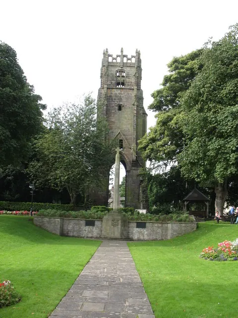
© Gordon Hatton · Geograph · CC BY-SA 2.0
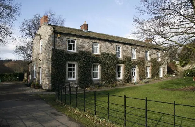
© David Rogers · Geograph · CC BY-SA 2.0

© SMJ · Geograph · CC BY-SA 2.0
Images © their respective photographers, licensed under CC BY-SA 2.0 and reused here with attribution. Photographs depict listed buildings, churches and monuments near this settlement and may show neighbouring villages.
Location
54.4085°N, -1.7304°W · Land of Count Alan hundred, Yorkshire
View larger map on OpenStreetMap →Data derived from the Open Domesday project (opendomesday.org), based on the Domesday Book dataset compiled by Professor J.J.N. Palmer and team. The Domesday Book (1086) is in the public domain.
Found an inaccuracy? [email protected]