Rastrick in the Domesday Book (1086)
The settlement of Rastrick is recorded in William I’s Domesday survey of 1086, entered under the hundred of Morley in Yorkshire.
Other Settlements in Morley
- Allerton
- Armley
- Batley
- Beeston
- Bolton
- Bowling
- Bradford
- Bramley
- Calverley
- Carlton
- Chellow [Grange]
- Clayton
- Clifton
- Cruttonstall
The Meaning of the Name
The origin of the name Rastrick is not securely established from its modern form alone; like many settlement names in the North it likely combines an Old English or Old Norse personal name with a landscape term.
Remarkably, the name has changed little since 1086, when the Domesday scribes wrote it as Rastrick.
Listed Buildings Near Rastrick
Historic England records 30 listed buildings within about a mile of Rastrick. Listing protects structures of special architectural or historic interest, graded I (exceptional), II* (particularly important) and II.
Grade II*
- Cross Base in Churchyard of St Matthews Church - 0.26 km
- Church of St Matthew - 0.28 km
Grade II
- Rastrick Library - 0.08 km
- War Memorial Outside Rastrick Library - 0.1 km
- Stone Built Into West Face of Wall to Number 15 - 0.13 km
- 14 and 14A, Crowtrees Lane - 0.15 km
- 6, Crowtrees Lane - 0.22 km
- Guide Post at Junction of Delf Hill and Tofts Grove at Ngr Se 134212 - 0.27 km
- 10 and 12, Field Lane - 0.28 km
- Entrance gate, railings and gate piers to Rastrick House - 0.29 km
- Lodge at Junction of Field Lane - 0.3 km
- 11 and 13, Church Street - 0.32 km
- 1 and 1A, Church Street, Rastrick - 0.35 km
- 9, 11 and 13, Delf Hill - 0.37 km
- Milestone, 10 Metres Below Entrance to St Matthews Vicarage at Ngr Se 139216 - 0.38 km
- Castle Hill House - 0.4 km
- 1 Stonelea Drive - 0.4 km
- 20, 22 and 24, New Hey Road - 0.5 km
- 115, Rastrick Common - 0.57 km
- Detached Stable to Number 115 - 0.57 km
- Garden pavilion in corner of walled garden to rear of Toothill Court - 0.8 km
- Toothill Court - 0.83 km
- 107 and 109, Lower Edge Road - 0.84 km
- Toothill Hall - 0.85 km
…and 6 more listed structures in the area.
Scheduled Monuments Near Rastrick
Scheduled monuments are nationally important archaeological sites given legal protection. 1 lies within roughly a mile of Rastrick:
Rastrick Today
Today Rastrick lies within the administrative area of Calderdale, and the settlement recorded a population of 11,351 at recent figures. Nine and a half centuries separate that figure from the small rural community the Domesday survey recorded here in 1086.
Read more about modern Rastrick on Wikipedia .
Nearby Domesday Settlements
Other places recorded in the 1086 survey within a few miles:
Heritage Around Rastrick
Photographs of churches, listed buildings and monuments in the vicinity, contributed by volunteers to the Geograph project and reused here under a Creative Commons licence.
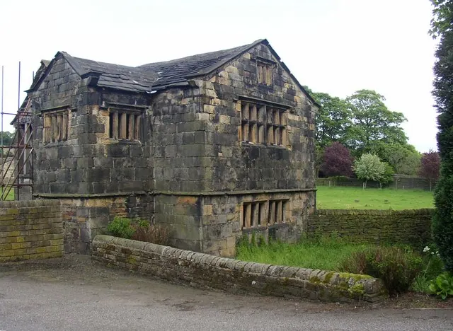
© Humphrey Bolton · Geograph · CC BY-SA 2.0
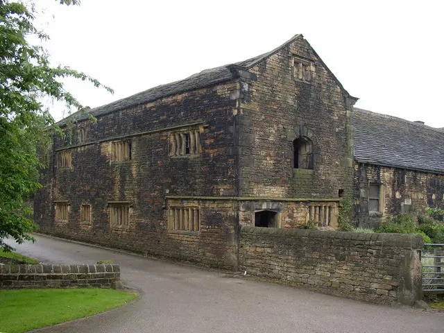
© Humphrey Bolton · Geograph · CC BY-SA 2.0
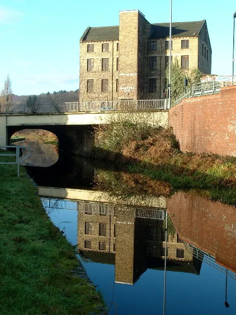
© Nigel Homer · Geograph · CC BY-SA 2.0
Images © their respective photographers, licensed under CC BY-SA 2.0 and reused here with attribution. Photographs depict listed buildings, churches and monuments near this settlement and may show neighbouring villages.
Data derived from the Open Domesday project (opendomesday.org), based on the Domesday Book dataset compiled by Professor J.J.N. Palmer and team. The Domesday Book (1086) is in the public domain.
Found an inaccuracy? [email protected]