Puddington in the Domesday Book (1086)
The settlement of Puddington is recorded in William I’s Domesday survey of 1086, entered under the hundred of Willaston in Cheshire. The survey assessed Puddington at 3.0 carucates of taxable land.
At the time of the survey, Puddington supported a recorded population of 26 villagers, 7 smallholders, working 2 ploughs between them.
The survey lists 5 manors at Puddington under different lords. Splitting a single settlement between multiple tenants was common across the North – Saxon estates broken up and handed to William’s followers after 1066.
Resources Recorded at Puddington (1086)
- Fisheries: 17
- Meadow: 12 acres
- Woodland: 60 acres
Other Settlements in Willaston
The Meaning of the Name
The name Puddington is of Anglo-Saxon origin. Its final element derives from the Old English word tūn, a farmstead or village. The first element is most likely a personal name or an early descriptive term, now difficult to recover with certainty. Taken together the name probably meant something close to ‘a farmstead’.
Remarkably, the name has changed little since 1086, when the Domesday scribes wrote it as Puddington.
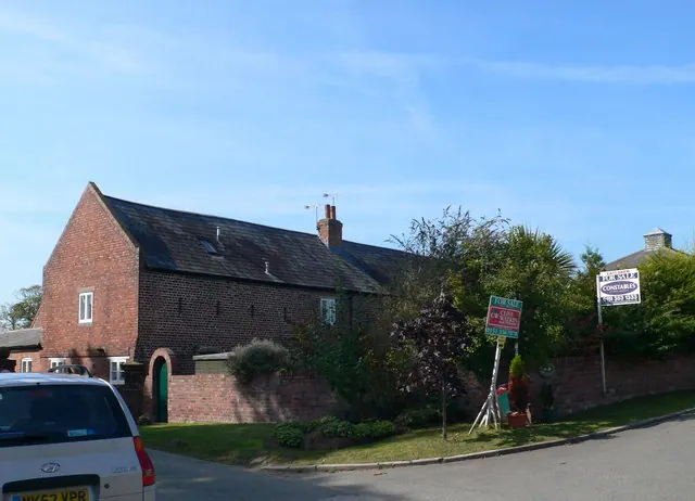
Listed Buildings Near Puddington
Historic England records 33 listed buildings within about a mile of Puddington. Listing protects structures of special architectural or historic interest, graded I (exceptional), II* (particularly important) and II.
Grade II*
- Puddington Old Hall, Priests House and Priests House Flat - 0.15 km
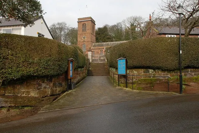
- Church of St Nicholas - 1.23 km
Grade II
- Dovecote 80 Metres North of Puddington Old Hall - 0.08 km
- Courtyard of Farmbuildings 50 Metres North of Puddington Old Hall - 0.09 km
- Hawthorn Dene Lilac Cottage - 0.11 km
- Pair of Farmbuildings 70 Metres South East of the Orchards - 0.12 km
- The Orchards (Divided Into Lower and Upper Flats and Orchard Cottage) - 0.15 km
- Outbuilding 30 Metres West of Puddington Old Hall - 0.15 km
- Footpath Guidepost at Junction of Pipers Lane Opposite the White House - 0.21 km
- The White House - 0.22 km
- Puddington Hall Puddington Hall West - 0.44 km
- Footpath Guidepost 5 Metres North of Top Lodge - 0.52 km
- Barn Farmhouse and Attached Range of Outbuildings - 0.76 km
- Church Farmhouse - 1.17 km
- Church Cottage - 1.17 km
- Elm Farmhouse - 1.18 km
- Plessington Cottage - 1.2 km
- Burton in Wirral Peace Cross - 1.2 km
- Peartree Cottage - 1.21 km
- The White House - 1.21 km
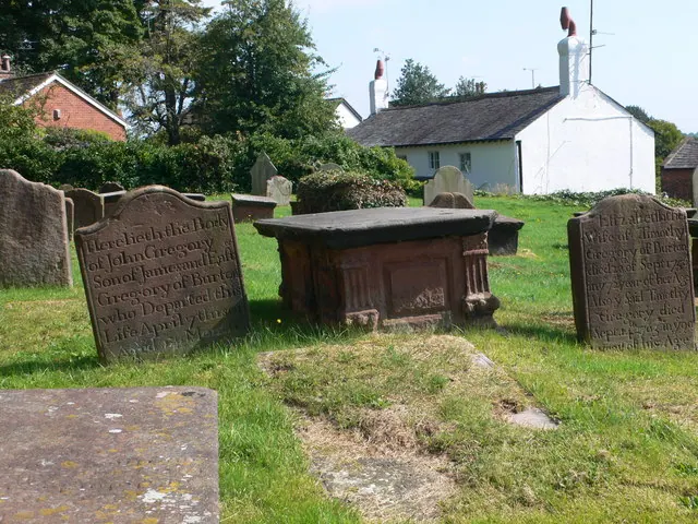
- Group of 18 Chest Tombs Approximately 2 Metres From South East Corner of Church of St Nicholas - 1.21 km
- Sundial in Churchyard of St Nicholas Church - 1.22 km
- Rose Cottage - 1.22 km
- Group of 8 Raised Grave Slabs Approximately 2 Metres From East Gable of Church of St Nicholas - 1.22 km
…and 9 more listed structures in the area.
Scheduled Monuments Near Puddington
Scheduled monuments are nationally important archaeological sites given legal protection. 2 lie within roughly a mile of Puddington:
- Heavy Anti-aircraft gunsite, 250m north east of New Farm Cottages - 0.98 km
- Icehouse 110m south west of Burton Manor College main building - 1.32 km
Puddington Today
Today Puddington lies within the administrative area of Cheshire West and Chester, and the settlement recorded a population of 549 at the 2021 census. Nine and a half centuries separate that figure from the small rural community the Domesday survey recorded here in 1086.
Read more about modern Puddington on Wikipedia .
Nearby Domesday Settlements
Other places recorded in the 1086 survey within a few miles:
- Shotwick - 2.2 km SE
- Ness - 2.8 km NW
- Ledsham - 3.2 km E
- Capenhurst - 4.0 km E
- Hadlow - 4.1 km N
- Little Neston - 4.5 km NW
Heritage Around Puddington
Photographs of churches, listed buildings and monuments in the vicinity, contributed by volunteers to the Geograph project and reused here under a Creative Commons licence.
© Eirian Evans · Geograph · CC BY-SA 2.0
© Galatas · Geograph · CC BY-SA 2.0
© Eirian Evans · Geograph · CC BY-SA 2.0
Images © their respective photographers, licensed under CC BY-SA 2.0 and reused here with attribution. Photographs depict listed buildings, churches and monuments near this settlement and may show neighbouring villages.
Data derived from the Open Domesday project (opendomesday.org), based on the Domesday Book dataset compiled by Professor J.J.N. Palmer and team. The Domesday Book (1086) is in the public domain.
Found an inaccuracy? [email protected]