Prenton in the Domesday Book (1086)
The 1086 Domesday survey records the settlement of Prenton, entered under the hundred of Willaston in Cheshire.
Other Settlements in Willaston
The Meaning of the Name
The name Prenton is of Anglo-Saxon origin. Its final element derives from the Old English word tūn, a farmstead or village. The first element is most likely a personal name or an early descriptive term, now difficult to recover with certainty. Taken together the name probably meant something close to ‘a farmstead’.
Remarkably, the name has changed little since 1086, when the Domesday scribes wrote it as Prenton.
Listed Buildings Near Prenton
Historic England records 21 listed buildings within about a mile of Prenton. Listing protects structures of special architectural or historic interest, graded I (exceptional), II* (particularly important) and II.
Grade II
- Church of St Stephen - 0.27 km
- Prenton War Memorial - 0.28 km
- Mercantile Marine War Memorial - 0.31 km
- Prenton Hall (East) - 0.75 km
- Prenton Hall (West) - 0.76 km
- Former Barn at Lower Farmhouse - 0.85 km
- Lower Farmhouse - 0.85 km
- 11 13, South Bank - 0.85 km
- 20, Talbot Road - 0.87 km
- 3 5 7, South Bank - 0.88 km
- 20, Fairview Road - 1.02 km
- 14, Arno Road - 1.02 km
- 20 22, Rosemount - 1.05 km
- 16, Fairview Road - 1.06 km
- 14, Fairview Road - 1.08 km
- 2, ROSLIN ROAD (See details for further address information) - 1.1 km
- 17, Fairview Road - 1.12 km
- 2 & 4, WILLAN STREET (See details for further address information) - 1.24 km
- Oxton Old Hall - 1.25 km
- Holly Lodge - 1.26 km
- Roman Catholic Church of St Joseph - 1.29 km
Prenton Today
Today Prenton lies within the administrative area of Wirral, and the settlement recorded a population of 14,488 at recent figures. Nine and a half centuries separate that figure from the small rural community the Domesday survey recorded here in 1086.
Read more about modern Prenton on Wikipedia .
Nearby Domesday Settlements
Other places recorded in the 1086 survey within a few miles:
Heritage Around Prenton
Photographs of churches, listed buildings and monuments in the vicinity, contributed by volunteers to the Geograph project and reused here under a Creative Commons licence.
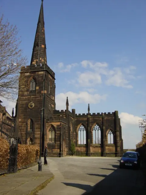
© Sue Adair · Geograph · CC BY-SA 2.0
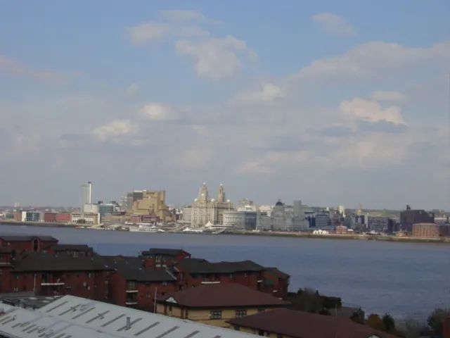
© Sue Adair · Geograph · CC BY-SA 2.0
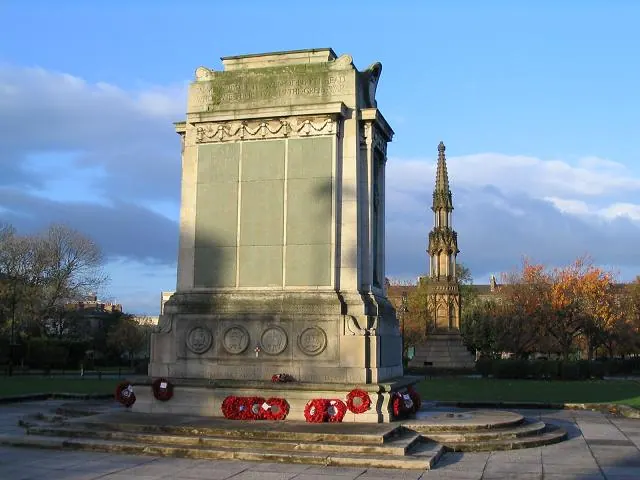
© Peter Craine · Geograph · CC BY-SA 2.0
Images © their respective photographers, licensed under CC BY-SA 2.0 and reused here with attribution. Photographs depict listed buildings, churches and monuments near this settlement and may show neighbouring villages.
Data derived from the Open Domesday project (opendomesday.org), based on the Domesday Book dataset compiled by Professor J.J.N. Palmer and team. The Domesday Book (1086) is in the public domain.
Found an inaccuracy? [email protected]