Poulton in the Domesday Book (1086)
Poulton is named in the Domesday Book, compiled by Norman commissioners in 1086, entered under the hundred of Duddeston in Cheshire. The survey assessed Poulton at 1.6 carucates of taxable land.
At the time of the survey, Poulton supported a recorded population of 8 villagers, 6 freemanmen, working 4 ploughs between them.
By 1086 Poulton was worth 2 shillings, up from 15d before the Conquest – in contrast to many Yorkshire neighbours whose valuations collapsed.
The survey lists 2 manors at Poulton under different lords. Splitting a single settlement between multiple tenants was common across the North – Saxon estates broken up and handed to William’s followers after 1066.
Resources Recorded at Poulton (1086)
- Mills: 1 mill (valued at 13d)
- Meadow: 10 acres
- Woodland: 0.5 league * 1 furlong None
Other Settlements in Duddeston
- Bettisfield
- Bickerton
- Bickley
- Boughton
- Broxton
- Burwardestone
- Burwardsley and [Higher] Burwardsley
- Caldecott
- Calvintone
- Cheaveley
- Cholmondeley
- Chowley
- Christleton
- Clutton
The Meaning of the Name
The name Poulton is of Anglo-Saxon origin. Its final element derives from the Old English word tūn, a farmstead or village. The first element is most likely a personal name or an early descriptive term, now difficult to recover with certainty. Taken together the name probably meant something close to ‘a farmstead’.
Remarkably, the name has changed little since 1086, when the Domesday scribes wrote it as Poulton.
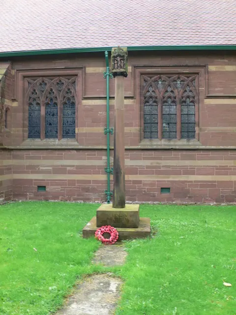
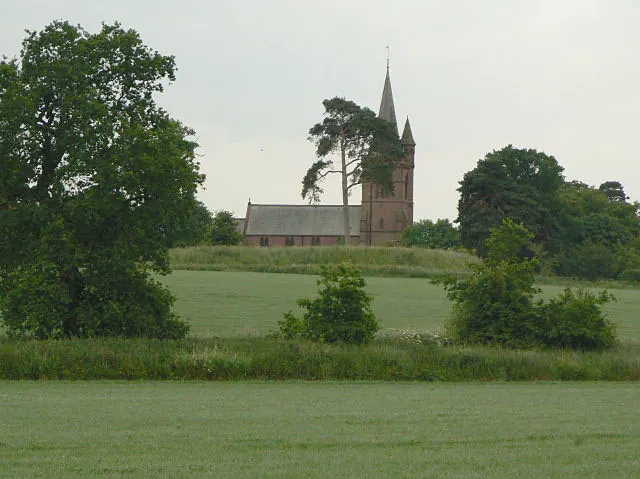
Listed Buildings Near Poulton
Historic England records 13 listed buildings within about a mile of Poulton. Listing protects structures of special architectural or historic interest, graded I (exceptional), II* (particularly important) and II.
Grade II
- Black and White Cottages - 0.31 km
- Poulton Hall Farmhouse - 1.02 km
- Green Farmhouse - 1.12 km
- Green Farm Cottages - 1.2 km
- Thatched Cottage (Left of A Pair) - 1.21 km
- The Thatched Cottage (Right of A Pair) - 1.21 km
- Most Southern Pair of Cottages, North of Corner of Rushmere Lane - 1.24 km
- The Schoolhouse (Former Schoolhouse and Schoolmasters House) - 1.25 km
- Coachmore Hill Lodge - 1.27 km
- Rushmere View - 1.28 km
- Church View Post Office and Attached Cottage - 1.28 km
- Tea House at North End of Dutch Garden - 1.3 km
- Sundial and Pier West of South Porch of Church of St John the Baptist - 1.3 km
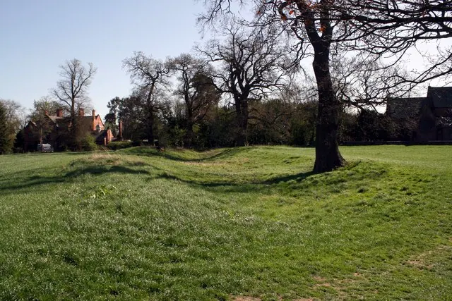
Scheduled Monuments Near Poulton
Scheduled monuments are nationally important archaeological sites given legal protection. 1 lies within roughly a mile of Poulton:
Poulton Today
Today Poulton lies within the administrative area of Poulton and Pulford, and the settlement recorded a population of 92 at recent figures. Nine and a half centuries separate that figure from the small rural community the Domesday survey recorded here in 1086.
Read more about modern Poulton on Wikipedia .
Nearby Domesday Settlements
Other places recorded in the 1086 survey within a few miles:
Heritage Around Poulton
Photographs of churches, listed buildings and monuments in the vicinity, contributed by volunteers to the Geograph project and reused here under a Creative Commons licence.
© Eirian Evans · Geograph · CC BY-SA 2.0
© Alan Murray-Rust · Geograph · CC BY-SA 2.0
© Jeff Buck · Geograph · CC BY-SA 2.0
Images © their respective photographers, licensed under CC BY-SA 2.0 and reused here with attribution. Photographs depict listed buildings, churches and monuments near this settlement and may show neighbouring villages.
Data derived from the Open Domesday project (opendomesday.org), based on the Domesday Book dataset compiled by Professor J.J.N. Palmer and team. The Domesday Book (1086) is in the public domain.
Found an inaccuracy? [email protected]