Paull Holme in the Domesday Book (1086)
Paull Holme appears in the Domesday Book of 1086, entered under the hundred of Holderness [South Hundred] in Yorkshire. The survey assessed Paull Holme at 3.8 carucates of taxable land.
At the time of the survey, Paull Holme supported a recorded population of 8 villagers, 10 smallholders, 4 slaves, working 6 ploughs between them.
By 1086 Paull Holme was worth 5 shillings, up from 4 shillings before the Conquest – one of the few settlements in the area to hold its value through the upheaval.
Resources Recorded at Paull Holme (1086)
- Mills: 1 mill
- Churches: 1
- Cattle: 9
- Pigs: 20
- Sheep: 60
- Horses (cobs): 2
- Meadow: 13 acres
Other Settlements in Holderness [South Hundred]
- Andrebi
- Burstwick
- Camerton [Hall]
- Dimlington
- Easington
- Grimston
- Halsham
- Hilston
- Hollym
- Holmpton
- Keyingham
- Kilnsea
- Monkwith
- Newton [Garth]
The Meaning of the Name
The origin of the name Paull Holme is not securely established from its modern form alone; like many settlement names in the North it likely combines an Old English or Old Norse personal name with a landscape term.
Remarkably, the name has changed little since 1086, when the Domesday scribes wrote it as Paull Holme.
Listed Buildings Near Paull Holme
Historic England records 3 listed buildings within about a mile of Paull Holme. Listing protects structures of special architectural or historic interest, graded I (exceptional), II* (particularly important) and II.
Grade I
- Paull Holme Tower - 0.42 km
Grade II
- The Hall - 0.97 km
- Stables and Adjoining Coach House Approximately 40 Metres East of the Hall - 1.02 km
Scheduled Monuments Near Paull Holme
Scheduled monuments are nationally important archaeological sites given legal protection. 1 lies within roughly a mile of Paull Holme:
- Paull Holme moated site and tower - 0.38 km
Nearby Domesday Settlements
Other places recorded in the 1086 survey within a few miles:
- Thorngumbald - 2.8 km NE
- Paull - 2.8 km NW
- Newton Garth - 3.0 km N
- Camerton Hall - 3.6 km NE
- Burstwick - 5.0 km NE
- Tharlesthorpe - 5.4 km W
Heritage Around [Paull] Holme
Photographs of churches, listed buildings and monuments in the vicinity, contributed by volunteers to the Geograph project and reused here under a Creative Commons licence.
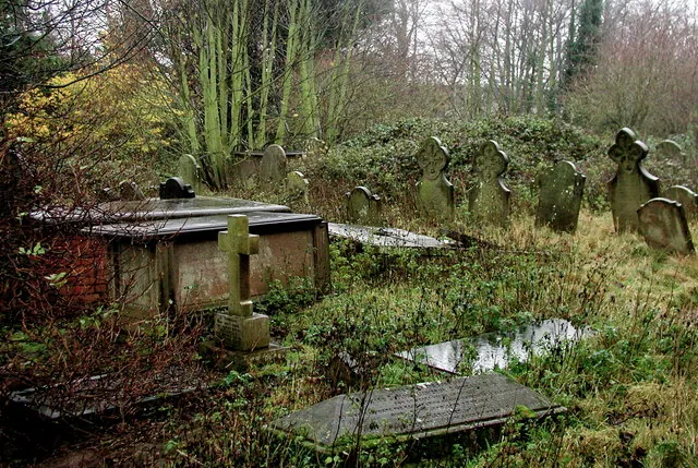
© Paul Glazzard · Geograph · CC BY-SA 2.0
© Andy Beecroft · Geograph · CC BY-SA 2.0
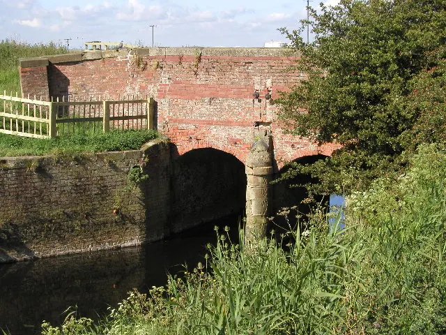
© Andy Beecroft · Geograph · CC BY-SA 2.0
Images © their respective photographers, licensed under CC BY-SA 2.0 and reused here with attribution. Photographs depict listed buildings, churches and monuments near this settlement and may show neighbouring villages.
Location
53.7032°N, -0.2047°W · Holderness [South Hundred] hundred, Yorkshire
View larger map on OpenStreetMap →Data derived from the Open Domesday project (opendomesday.org), based on the Domesday Book dataset compiled by Professor J.J.N. Palmer and team. The Domesday Book (1086) is in the public domain.
Found an inaccuracy? [email protected]