Owthorne in the Domesday Book (1086)
The settlement of Owthorne is recorded in William I’s Domesday survey of 1086, entered under the hundred of Holderness [South Hundred] in Yorkshire. The survey assessed Owthorne at 0.1 carucates of taxable land.
At the time of the survey, Owthorne supported a recorded population of 9 freemanmen.
Other Settlements in Holderness [South Hundred]
- Andrebi
- Burstwick
- Camerton [Hall]
- Dimlington
- Easington
- Grimston
- Halsham
- Hilston
- Hollym
- Holmpton
- Keyingham
- Kilnsea
- Monkwith
- Newton [Garth]
The Meaning of the Name
The origin of the name Owthorne is not securely established from its modern form alone; like many settlement names in the North it likely combines an Old English or Old Norse personal name with a landscape term.
Remarkably, the name has changed little since 1086, when the Domesday scribes wrote it as Owthorne.
Listed Buildings Near Owthorne
Historic England records 6 listed buildings within about a mile of Owthorne. Listing protects structures of special architectural or historic interest, graded I (exceptional), II* (particularly important) and II.
Grade II*
- Church of St Nicholas - 0.88 km
Grade II
- Withernsea Old War Memorial - 0.77 km
- Queen Victoria Diamond Jubilee Commemorative Lamp Standard - 0.8 km
- Withernsea Lighthouse and Adjoining Pair of Lighthouse Keepers Houses - 0.85 km
- Outbuildings, Adjoining Garden Wall and Gateway at Withernsea Lighthouse - 0.86 km
- Church of St Matthew (C of E) - 0.9 km
Owthorne Today
Today Owthorne lies within the administrative area of Withernsea.
Read more about modern Owthorne on Wikipedia .
Nearby Domesday Settlements
Other places recorded in the 1086 survey within a few miles:
- Redmere - 1.0 km W
- Withernsea - 1.0 km S
- Waxholme - 2.2 km NW
- Rimswell - 3.0 km W
- Hollym - 3.0 km S
- Great and Little Newsome - 4.5 km SW
Heritage Around [Ow]thorne
Photographs of churches, listed buildings and monuments in the vicinity, contributed by volunteers to the Geograph project and reused here under a Creative Commons licence.
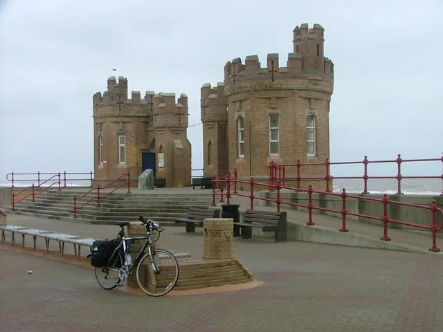
© Malc McDonald · Geograph · CC BY-SA 2.0
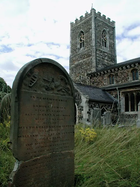
© Paul Glazzard · Geograph · CC BY-SA 2.0
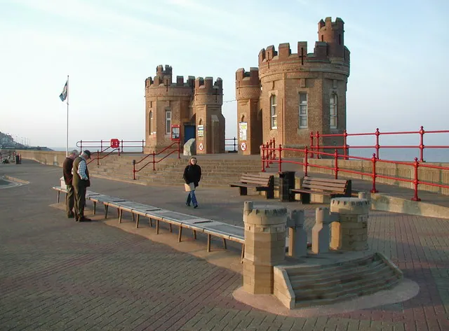
© Paul Glazzard · Geograph · CC BY-SA 2.0
Images © their respective photographers, licensed under CC BY-SA 2.0 and reused here with attribution. Photographs depict listed buildings, churches and monuments near this settlement and may show neighbouring villages.
Location
53.7353°N, 0.0393°E · Holderness [South Hundred] hundred, Yorkshire
View larger map on OpenStreetMap →Data derived from the Open Domesday project (opendomesday.org), based on the Domesday Book dataset compiled by Professor J.J.N. Palmer and team. The Domesday Book (1086) is in the public domain.
Found an inaccuracy? [email protected]