Owston in the Domesday Book (1086)
Owston is named in the Domesday Book, compiled by Norman commissioners in 1086, entered under the hundred of Osgodcross in Yorkshire.
Other Settlements in Osgodcross
- Arksey
- Badsworth
- Beal
- Burgh[wallis]
- Campsall
- Darrington
- Featherstone
- Ferry [Fryston]
- Hamphall [Stubbs]
- Hensall
- Hessle
- Kellington
- Knottingley
- Minsthorpe
The Meaning of the Name
The name Owston is of Anglo-Saxon origin. Its final element derives from the Old English word tūn, a farmstead or village. The first element is most likely a personal name or an early descriptive term, now difficult to recover with certainty. Taken together the name probably meant something close to ‘a farmstead’.
Remarkably, the name has changed little since 1086, when the Domesday scribes wrote it as Owston.
Listed Buildings Near Owston
Historic England records 19 listed buildings within about a mile of Owston. Listing protects structures of special architectural or historic interest, graded I (exceptional), II* (particularly important) and II.
Grade I
- Church of All Saints - 0.58 km
Grade II*
Grade II
- Doncaster Lodge - 0.44 km
- Iron Gates and Piers Immediately to South East of Doncaster Lodge - 0.45 km
- Church Lodge - 0.52 km
- Outbuilding approximately 50 metres to north east of Vine Cottage - 0.6 km
- Remains of Cross Approximately 12 Metres to West of Tower to Church of All Saints - 0.61 km
- Garden Cottage Home Farmhouse - 0.63 km
- Cartshed Immediately to East of Pear Tree Cottage - 0.63 km
- Owston Hall Cart Shelter - 0.64 km
- Vine Cottage - 0.64 km
- Pear Tree Cottage and Attached Outbuilding - 0.65 km
- Outbuilding Approximately 30 Metres to Rear of Vine Cottage - 0.65 km
- Stableyard Cottages - 0.66 km
- Owston Hall Stables and Attached Walls Enclosing Courtyard - 0.67 km
- Kitchen Garden Wall Approximately 175 Metres to North West of Owston Hall - 0.81 km
- East Farmhouse - 0.85 km
- Stable With Dovecote Attached to East End of Sutton Farmhouse - 1.04 km
- Vine Farmhouse - 1.07 km
Scheduled Monuments Near Owston
Scheduled monuments are nationally important archaeological sites given legal protection. 2 lie within roughly a mile of Owston:
- Earthworks on Sutton Common - 1.02 km
- Sutton Common bowl barrow - 1.46 km
Owston Today
Today Owston lies within the administrative area of Doncaster, and the settlement recorded a population of 145 at the 2021 census. Nine and a half centuries separate that figure from the small rural community the Domesday survey recorded here in 1086.
Read more about modern Owston on Wikipedia .
Nearby Domesday Settlements
Other places recorded in the 1086 survey within a few miles:
- Sutton - 1.0 km N
- Skellow - 2.2 km SW
- Burghwallis - 2.2 km NW
- Adwick le Street - 3.2 km S
- Campsall - 3.2 km N
- Newsham - 3.2 km N
Heritage Around Owston
Photographs of churches, listed buildings and monuments in the vicinity, contributed by volunteers to the Geograph project and reused here under a Creative Commons licence.
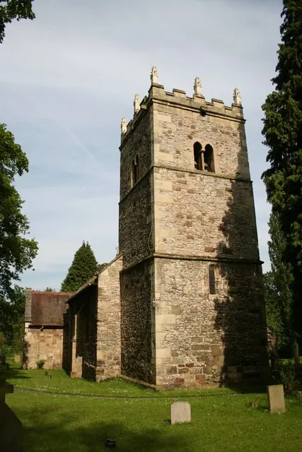
© Richard Croft · Geograph · CC BY-SA 2.0
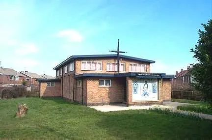
© Bill Henderson · Geograph · CC BY-SA 2.0
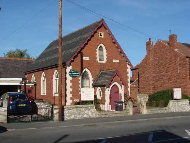
© Bill Henderson · Geograph · CC BY-SA 2.0
Images © their respective photographers, licensed under CC BY-SA 2.0 and reused here with attribution. Photographs depict listed buildings, churches and monuments near this settlement and may show neighbouring villages.
Data derived from the Open Domesday project (opendomesday.org), based on the Domesday Book dataset compiled by Professor J.J.N. Palmer and team. The Domesday Book (1086) is in the public domain.
Found an inaccuracy? [email protected]