Over Dinsdale Grange in the Domesday Book (1086)
The 1086 Domesday survey records the settlement of Over Dinsdale Grange, entered under the hundred of Land of Count Alan in Yorkshire.
Other Settlements in Land of Count Alan
- Achebi
- Agglethorpe
- Ainderby [Mires]
- Ainderby [Quernhow]
- Aiskew
- Aldbrough
- Allerthorpe [Hall]
- Ascam
- Ascham
- Asebi
- Aske [Hall]
- Askrigg
- Aysgarth
- Baldersby
The Meaning of the Name
The name Over Dinsdale Grange is of Scandinavian origin. Its final element derives from the Old Norse word dalr, a valley. The first element is most likely a personal name or an early descriptive term, now difficult to recover with certainty. Taken together the name probably meant something close to ‘a valley’.
Names of this type are a fingerprint of Scandinavian settlement: they cluster across the old Danelaw, where Norse-speaking settlers renamed or founded villages from the late 9th century onward.
Remarkably, the name has changed little since 1086, when the Domesday scribes wrote it as Over Dinsdale Grange.
Listed Buildings Near Over Dinsdale Grange
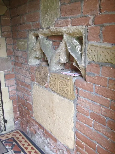
Historic England records 18 listed buildings within about a mile of Over Dinsdale Grange. Listing protects structures of special architectural or historic interest, graded I (exceptional), II* (particularly important) and II.
Grade II*
- Stone Coffin and Lid About 3.5 Metres West of Church of St John the Baptist - 0.28 km
- Cross Shaft Fragment About 5 Metres South West of Church of St John the Baptist - 0.29 km
- The Manor House - 0.47 km
Grade II
- Church of St John the Baptist - 0.28 km
- Mounting Block About 15 Metres South West of Church of St John the Baptist - 0.31 km
- Bridge About 30 Metres South of the Manor House - 0.49 km
- Manor House Farmhouse - 0.64 km
- Dinsdale Park Residential School - 0.73 km
- Castle Hill - 0.93 km
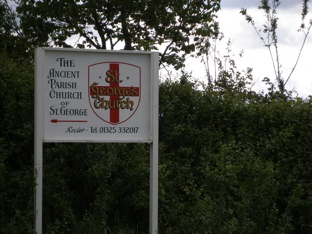
- Church of St Lawrence - 0.94 km
- Middleton One Row St Laurence’s War Memorial - 0.94 km
- South View - 1.01 km
- Jessamine House - 1.01 km
- 15, the Front - 1.02 km
- Tees View - 1.02 km
- Deanery Cottage the Deanery - 1.04 km
- Yohn House - 1.05 km
- 2 Arched Stone Doorways in Garden Left of Number 64 (Mown Meadows) - 1.2 km
Scheduled Monuments Near Over Dinsdale Grange
Scheduled monuments are nationally important archaeological sites given legal protection. 3 lie within roughly a mile of Over Dinsdale Grange:
- Anglo-Saxon cross in St John the Baptist’s churchyard - 0.29 km
- Medieval moated manorial site of Low Dinsdale at the Manor House - 0.48 km
- Tower Hill motte castle, 370m north-east of Dinsdale Spa - 0.83 km
Over Dinsdale Grange Today
Today Over Dinsdale Grange lies within the administrative area of Hambleton, and the settlement recorded a population of 74 at the 2021 census. Nine and a half centuries separate that figure from the small rural community the Domesday survey recorded here in 1086.
Read more about modern Over Dinsdale on Wikipedia .
Nearby Domesday Settlements
Other places recorded in the 1086 survey within a few miles:
- Eryholme - 2.8 km SW
- Girsby - 3.2 km S
- Low Hail - 4.5 km SW
- High Worsall - 4.5 km SE
- Low Worsall - 5.1 km E
- Croft - 6.3 km W
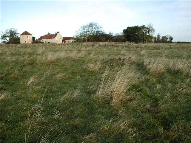
Heritage Around [Over] Dinsdale [Grange]
Photographs of churches, listed buildings and monuments in the vicinity, contributed by volunteers to the Geograph project and reused here under a Creative Commons licence.
© Mick Garratt · Geograph · CC BY-SA 2.0
© Gordon Hatton · Geograph · CC BY-SA 2.0
© Carol Rose · Geograph · CC BY-SA 2.0
Images © their respective photographers, licensed under CC BY-SA 2.0 and reused here with attribution. Photographs depict listed buildings, churches and monuments near this settlement and may show neighbouring villages.
Location
54.4975°N, -1.4673°W · Land of Count Alan hundred, Yorkshire
View larger map on OpenStreetMap →Data derived from the Open Domesday project (opendomesday.org), based on the Domesday Book dataset compiled by Professor J.J.N. Palmer and team. The Domesday Book (1086) is in the public domain.
Found an inaccuracy? [email protected]