Ormesby in the Domesday Book (1086)
The settlement of Ormesby is recorded in William I’s Domesday survey of 1086, entered under the hundred of Langbaurgh in Yorkshire. The survey assessed Ormesby at 9 carucates of taxable land.
The valuation dropped between 1066 and 1086. Before 1066, Ormesby was worth 1.5 shillings; by 1086 that had dropped to 8d – a fall of 73%. Most Yorkshire villages that lost value on this scale were swept up in the Harrying of the North – William’s scorched-earth campaign of 1069–70.
The survey lists 2 manors at Ormesby under different lords. Splitting a single settlement between multiple tenants was common across the North – Saxon estates broken up and handed to William’s followers after 1066.
Other Settlements in Langbaurgh
- Acklam
- Airy [Holme]
- Aislaby
- Arnodestorp
- Baldebi
- Barnaby
- Barwick
- Battersby
- Bergolbi
- Berguluesbi
- Blaten [Carr]
- Borrowby
- Breck
- Brotton
The Meaning of the Name
The name Ormesby is of Scandinavian origin. Its final element derives from the Old Norse word bý, a farmstead or village. The first element is most likely a personal name or an early descriptive term, now difficult to recover with certainty. Taken together the name probably meant something close to ‘a farmstead’.
Names of this type are a fingerprint of Scandinavian settlement: they cluster across the old Danelaw, where Norse-speaking settlers renamed or founded villages from the late 9th century onward.
Remarkably, the name has changed little since 1086, when the Domesday scribes wrote it as Ormesby.
Listed Buildings Near Ormesby
Historic England records 21 listed buildings within about a mile of Ormesby. Listing protects structures of special architectural or historic interest, graded I (exceptional), II* (particularly important) and II.
Grade I
- Stableblock, Circa 80 Metres North-east of Ormesby Hall - 0.68 km
- Ormesby Hall, Adjoining Outbuildings and Screen Walls - 0.68 km
Grade II
- Brown Monument, Circa 18 Metres North East of Church of St Cuthbert - 0.54 km
- Bridge, Circa 70 Metres South West of Ormesby House - 0.54 km
- War Memorial in the Churchyard of St Cuthbert - 0.54 km
- Standing Stone, Circa 17 Metres South of Church of St Cuthbert - 0.55 km
- Church of St Cuthbert - 0.56 km
- Coffin and Headstone One Metre North of Church of St Cuthbert - 0.56 km
- Queen Victoria Jubilee Memorial - 0.57 km
- East Lodge - 0.61 km
- Bridge, Circa 170 Metres North East of Ormesby Hall - 0.64 km
- Outbuildings, Wall and Mounting Block Circa 130 Metres North-east of Ormesby Hall - 0.65 km
- Boundary Stone North, Circa 30 Metres North of Number 9A - 0.88 km
- Pigsty Range Circa 35 Metres North of Ormesby Grange Farmhouse - 0.92 km
- Barn and Byre Ranges Circa 20 Metres West of Ormesby Grange Farmhouse - 0.94 km
- Stable, Circa 10 Metres North West of Ormesby Grange Farmhouse - 0.94 km
- Boundary Stone Approximately 680 Metres to North of Upsall Hall at Ngr Nz547 164 - 1.13 km
- Stable Block, Screen Walls and Lodge, 35 Metres North West of Upsall Hall - 1.18 km
- 33-55, HIGH STREET (See details for further address information) - 1.19 km
- 57-61, High Street - 1.22 km
- Upsall Hall, Gatepiers, Service Wing and Laundry - 1.22 km
Ormesby Today
Today Ormesby lies within the administrative area of Redcar and Cleveland, and the settlement recorded a population of 10,714 at recent figures. Nine and a half centuries separate that figure from the small rural community the Domesday survey recorded here in 1086.
Read more about modern Ormesby on Wikipedia .
Nearby Domesday Settlements
Other places recorded in the 1086 survey within a few miles:
- Tollesby - 2.0 km W
- Marton in Cleveland - 2.2 km SW
- Normanby - 2.2 km NE
- Eston - 2.8 km NE
- Morton Grange - 2.8 km SE
- Upsall Hall - 3.0 km E
Heritage Around Ormesby
Photographs of churches, listed buildings and monuments in the vicinity, contributed by volunteers to the Geograph project and reused here under a Creative Commons licence.
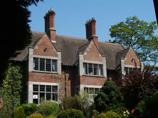
© Mike Guess · Geograph · CC BY-SA 2.0
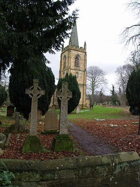
© Stephen McCulloch · Geograph · CC BY-SA 2.0
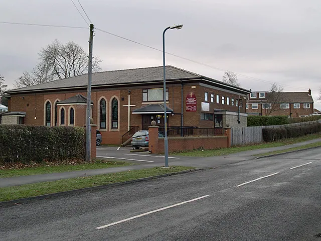
© Stephen McCulloch · Geograph · CC BY-SA 2.0
Images © their respective photographers, licensed under CC BY-SA 2.0 and reused here with attribution. Photographs depict listed buildings, churches and monuments near this settlement and may show neighbouring villages.
Data derived from the Open Domesday project (opendomesday.org), based on the Domesday Book dataset compiled by Professor J.J.N. Palmer and team. The Domesday Book (1086) is in the public domain.
Found an inaccuracy? [email protected]