Opetone in the Domesday Book (1086)
Opetone is named in the Domesday Book, compiled by Norman commissioners in 1086, entered under the hundred of Land of Count Alan in Yorkshire.
Other Settlements in Land of Count Alan
- Achebi
- Agglethorpe
- Ainderby [Mires]
- Ainderby [Quernhow]
- Aiskew
- Aldbrough
- Allerthorpe [Hall]
- Ascam
- Ascham
- Asebi
- Aske [Hall]
- Askrigg
- Aysgarth
- Baldersby
The Meaning of the Name
The origin of the name Opetone is not securely established from its modern form alone; like many settlement names in the North it likely combines an Old English or Old Norse personal name with a landscape term.
Remarkably, the name has changed little since 1086, when the Domesday scribes wrote it as Opetone.
Listed Buildings Near Opetone
Historic England records 11 listed buildings within about a mile of Opetone. Listing protects structures of special architectural or historic interest, graded I (exceptional), II* (particularly important) and II.
Grade I
- Snape Castle - 0.41 km
Grade II*
- Thorp Perrow Hall - 1.03 km
Grade II
- Cruck Barn Adjacent to the Castle Arms - 0.14 km
- West Garth House - 0.14 km
- Castle Arms - 0.14 km
- The Old Blacksmith’s Cottage - 0.22 km
- Lilac Cottage - 0.23 km
- Dovecote Approximately 100 Metres to East of Snape Castle - 0.3 km
- Stables Approximately 30 Metres to East of Snape Castle - 0.33 km
- Springfield House - 0.42 km
- 2 Gateways to Snape Castle 20 Metres to South of Castle - 0.42 km
Scheduled Monuments Near Opetone
Scheduled monuments are nationally important archaeological sites given legal protection. 2 lie within roughly a mile of Opetone:
- Roman buildings and field system in Snape - 0.17 km
- Snape Castle, the chapel and ruined portions - 0.42 km
Opetone Today
Today Opetone lies within the administrative area of Hambleton, and the settlement recorded a population of 404 at the 2021 census. Nine and a half centuries separate that figure from the small rural community the Domesday survey recorded here in 1086.
Read more about modern Snape with Thorp on Wikipedia .
Nearby Domesday Settlements
Other places recorded in the 1086 survey within a few miles:
- Achebi - 0.0 km N
- Opetune - 0.0 km N
- Thorp Perrow - 1.0 km N
- Firby - 2.0 km N
- Well - 2.0 km S
- Thornton Watlass - 3.2 km W
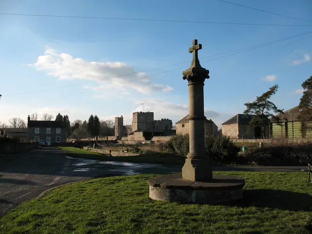
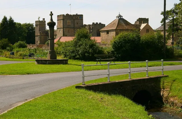
Heritage Around Opetone
Photographs of churches, listed buildings and monuments in the vicinity, contributed by volunteers to the Geograph project and reused here under a Creative Commons licence.

© Nick W · Geograph · CC BY-SA 2.0
© Gordon Hatton · Geograph · CC BY-SA 2.0
© David Rogers · Geograph · CC BY-SA 2.0
Images © their respective photographers, licensed under CC BY-SA 2.0 and reused here with attribution. Photographs depict listed buildings, churches and monuments near this settlement and may show neighbouring villages.
Location
54.2553°N, -1.5932°W · Land of Count Alan hundred, Yorkshire
View larger map on OpenStreetMap →Data derived from the Open Domesday project (opendomesday.org), based on the Domesday Book dataset compiled by Professor J.J.N. Palmer and team. The Domesday Book (1086) is in the public domain.
Found an inaccuracy? [email protected]