Old Malton in the Domesday Book (1086)
Old Malton appears in the Domesday Book of 1086, entered under the hundred of Maneshou in Yorkshire.
Other Settlements in Maneshou
- Amotherby
- Ampleforth
- Appleton [le Street]
- Beadlam
- Brawby
- Broughton
- Cawton
- Coulton
- Fadmoor
- Fryton
- Gillamoor
- Gilling [East]
- Griff [Farm]
- Grimston
The Meaning of the Name
The name Old Malton is of Anglo-Saxon origin. Its final element derives from the Old English word tūn, a farmstead or village. The first element is most likely a personal name or an early descriptive term, now difficult to recover with certainty. Taken together the name probably meant something close to ‘a farmstead’.
Remarkably, the name has changed little since 1086, when the Domesday scribes wrote it as Old Malton.
Listed Buildings Near Old Malton
Historic England records 201 listed buildings within about a mile of Old Malton. Listing protects structures of special architectural or historic interest, graded I (exceptional), II* (particularly important) and II.
Grade I
- Walls Bounding Churchyard of St Mary’s Priory Church - 0.24 km
- Priory Church of St Mary - 0.26 km
Grade II*
- Old Abbey and Attached Outbuildings - 0.25 km
Grade II
- 11 and 13, Town Street - 0.01 km
- Mounting Block Approximately 3.5 Metres North West of Number 4A - 0.02 km
- 4A, Town Street - 0.03 km
- 7 and 9, Town Street - 0.03 km
- Post Office - 0.03 km
- 3 and 5, Town Street - 0.05 km
- 21, Town Street - 0.06 km
- 23, Town Street - 0.07 km
- 25, Town Street - 0.12 km
- 27, Town Street - 0.13 km
- Number 29 and Attached Outbuildings at Rear - 0.2 km
- Barn Approximately 9 Metres North East of Number 29 - 0.22 km
- Gas Lamp Approximately 30 Metres West of St Mary’s Priory Church - 0.22 km
- Gas Lamp Post Approximately 5 Metres West of St Mary’s Priory Church - 0.23 km
- Holgate’s House - 0.25 km
- Manor Farmhouse - 0.26 km
- Number 35 and Attached Barn - 0.26 km
- Nabun House - 0.28 km
- The Gannock House - 0.28 km
- The Royal Oak Public House - 0.33 km
- Hunters Hall - 0.37 km
…and 177 more listed structures in the area.
Scheduled Monuments Near Old Malton
Scheduled monuments are nationally important archaeological sites given legal protection. 3 lie within roughly a mile of Old Malton:
- Old Malton Priory Church (ruined portions) - 0.28 km
- Roman fort - 0.84 km
- Site of Malton Castle - 1.03 km
Old Malton Today
Today Old Malton lies within the administrative area of Malton.
Read more about modern Old Malton on Wikipedia .
Nearby Domesday Settlements
Other places recorded in the 1086 survey within a few miles:
Heritage Around [Old] Malton
Photographs of churches, listed buildings and monuments in the vicinity, contributed by volunteers to the Geograph project and reused here under a Creative Commons licence.
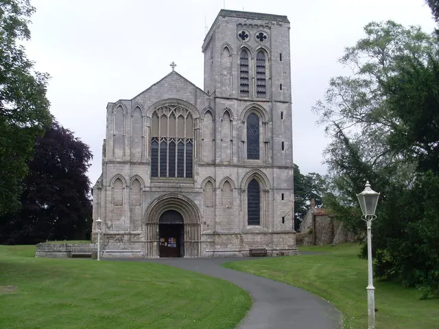
© David Hillas · Geograph · CC BY-SA 2.0
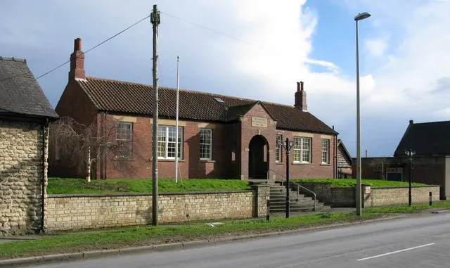
© David Rogers · Geograph · CC BY-SA 2.0
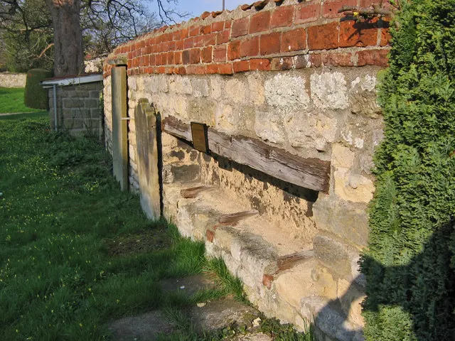
© Stephen Horncastle · Geograph · CC BY-SA 2.0
Images © their respective photographers, licensed under CC BY-SA 2.0 and reused here with attribution. Photographs depict listed buildings, churches and monuments near this settlement and may show neighbouring villages.
Data derived from the Open Domesday project (opendomesday.org), based on the Domesday Book dataset compiled by Professor J.J.N. Palmer and team. The Domesday Book (1086) is in the public domain.
Found an inaccuracy? [email protected]