Odulfesmare in the Domesday Book (1086)
The settlement of Odulfesmare is recorded in William I’s Domesday survey of 1086, entered under the hundred of Dic in Yorkshire.
Other Settlements in Dic
- Aislaby
- Allerston
- Appleton [le Moors]
- Aschelesmersc
- Aschilesmares
- Barton [le Street]
- Baschebi
- Baschesbi
- Brompton
- Burniston
- Burton [Dale]
- Cawthorn
- Cayton
- Chigogemers
The Meaning of the Name
The origin of the name Odulfesmare is not securely established from its modern form alone; like many settlement names in the North it likely combines an Old English or Old Norse personal name with a landscape term.
Remarkably, the name has changed little since 1086, when the Domesday scribes wrote it as Odulfesmare.
Listed Buildings Near Odulfesmare
Historic England records 225 listed buildings within about a mile of Odulfesmare. Listing protects structures of special architectural or historic interest, graded I (exceptional), II* (particularly important) and II.
Grade II*
- Beck Isle Museum - 0.32 km
Grade II
- 24 and 25, Under Cliffe - 0.13 km
- 14-19, Under Cliffe - 0.14 km
- 13, Train Lane - 0.16 km
- Friends’ Meeting House - 0.23 km
- 9, Castlegate - 0.24 km
- 10, Castlegate - 0.24 km
- 12 and 13, Castlegate - 0.24 km
- 11, Castlegate - 0.24 km
- 14, 14A and 15, Castlegate - 0.25 km
- 16, Castlegate - 0.25 km
- 17 and 18, Castlegate - 0.25 km
- 19, Castlegate - 0.26 km
- 23-27, Park Terrace - 0.28 km
- Farm Buildings to North of Beck Isle Museum - 0.29 km
- 14, 19 and 21, Brant Hill - 0.3 km
- Pickering Railway Station, Main Building (Including Station House and Retaining Walls) - 0.3 km
- Beck Isle Cottage - 0.31 km
- Premises to left of Fern Leigh occupied by J Watson - 0.32 km
- Fern Leigh - 0.32 km
- 24, Castlegate - 0.34 km
- Rose Cottage - 0.34 km
- 5, Castlegate - 0.34 km
- Langdale House - 0.34 km
…and 201 more listed structures in the area.
Scheduled Monuments Near Odulfesmare
Scheduled monuments are nationally important archaeological sites given legal protection. 3 lie within roughly a mile of Odulfesmare:
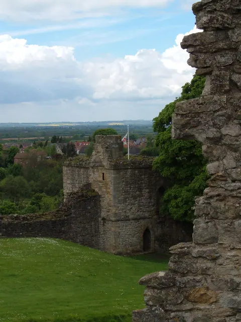
- Pickering Castle: 11th century motte and bailey castle and 13th century shell keep castle - 0.25 km
- Beacon Hill ringwork siege castle and Royal Observer Corps post - 0.32 km
- St Nicholas’ medieval hospital 550m East of Brick Yard Farm - 1.19 km
Nearby Domesday Settlements
Other places recorded in the 1086 survey within a few miles:
- Aschelesmersc - 0.0 km N
- Aschilesmares - 0.0 km N
- Maxudesmares - 0.0 km N
- Maxudesmersc - 0.0 km N
- Ouduluesmersc - 0.0 km N
- Pickering - 0.0 km N
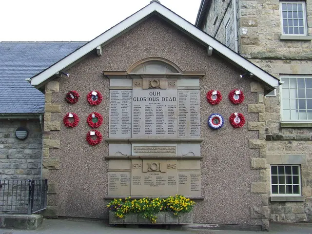
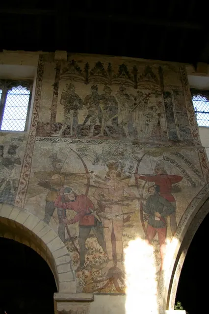
Heritage Around Odulfesmare
Photographs of churches, listed buildings and monuments in the vicinity, contributed by volunteers to the Geograph project and reused here under a Creative Commons licence.
© Alison Stamp · Geograph · CC BY-SA 2.0
© Keith Evans · Geograph · CC BY-SA 2.0
© Charles Rispin · Geograph · CC BY-SA 2.0
Images © their respective photographers, licensed under CC BY-SA 2.0 and reused here with attribution. Photographs depict listed buildings, churches and monuments near this settlement and may show neighbouring villages.
Data derived from the Open Domesday project (opendomesday.org), based on the Domesday Book dataset compiled by Professor J.J.N. Palmer and team. The Domesday Book (1086) is in the public domain.
Found an inaccuracy? [email protected]