Nunnington in the Domesday Book (1086)
Nunnington is named in the Domesday Book, compiled by Norman commissioners in 1086, entered under the hundred of Maneshou in Yorkshire.
Other Settlements in Maneshou
- Amotherby
- Ampleforth
- Appleton [le Street]
- Beadlam
- Brawby
- Broughton
- Cawton
- Coulton
- Fadmoor
- Fryton
- Gillamoor
- Gilling [East]
- Griff [Farm]
- Grimston
The Meaning of the Name
The name Nunnington is of Anglo-Saxon origin. Its final element derives from the Old English word tūn, a farmstead or village. The first element is most likely a personal name or an early descriptive term, now difficult to recover with certainty. Taken together the name probably meant something close to ‘a farmstead’.
Remarkably, the name has changed little since 1086, when the Domesday scribes wrote it as Nunnington.
Listed Buildings Near Nunnington
Historic England records 23 listed buildings within about a mile of Nunnington. Listing protects structures of special architectural or historic interest, graded I (exceptional), II* (particularly important) and II.
Grade I
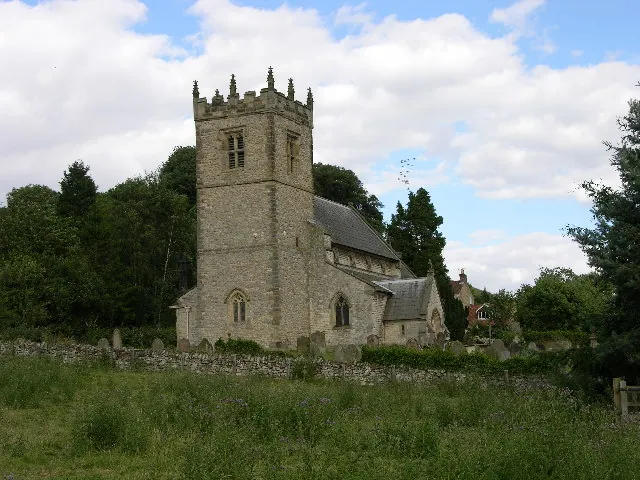
- Church of All Saints and St James - 0.41 km
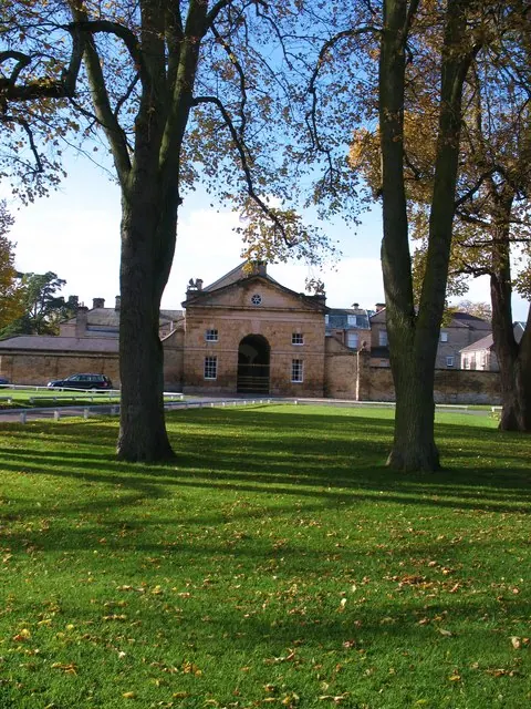
- Nunnington Hall - 0.42 km
Grade II*
- Nunnington Bridge - 0.32 km
Grade II
- The Gables and Attached Outbuilding - 0.07 km
- House occupied by Mrs Buckland and Thwaite Cottage - 0.09 km
- Bridge Cottage - 0.11 km
- Telephone Box Adjacent to Glebe House - 0.11 km
- Glebe House - 0.11 km
- Old School - 0.11 km
- Teal House and Attached Cottage - 0.11 km
- Manor Farmhouse and Attached Front Railings - 0.12 km
- The Bungalow - 0.15 km
- Number 5 and Elleron - 0.17 km
- The House - 0.22 km
- Outbuildings Approximately 10 Metres West of the Royal Oak - 0.32 km
- Royal Oak - 0.33 km
- Pin Cottage - 0.35 km
- Jasmine House - 0.36 km
- Gatepiers Approximately 50 Metres West of Nunnington Hall, Attached Wall to North Pier, and 30 Metres of Wall Attached to South Pier - 0.36 km
- Graham Hall Cottages - 0.39 km
- Garden Walls, Gateways and Gate Piers Attached to Nunnington Hall - 0.5 km
- Gatepiers, and Attached Walls, Approximately 130 Metres East of High Orchard - 0.57 km
- Nunnington Mill - 0.91 km
Nunnington Today
Today Nunnington lies within the administrative area of Ryedale, and the settlement recorded a population of 251 at the 2021 census. Nine and a half centuries separate that figure from the small rural community the Domesday survey recorded here in 1086.
Read more about modern Nunnington on Wikipedia .
Nearby Domesday Settlements
Other places recorded in the 1086 survey within a few miles:
- Riccal House - 1.4 km NE
- East Newton - 2.0 km W
- West Newton Grange - 2.0 km W
- Middelham - 2.2 km NE
- Stonegrave - 2.2 km SW
- East and West Ness - 3.0 km E
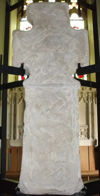
Heritage Around Nunnington
Photographs of churches, listed buildings and monuments in the vicinity, contributed by volunteers to the Geograph project and reused here under a Creative Commons licence.
© Stuart and Fiona Jackson · Geograph · CC BY-SA 2.0
© Matthew Hatton · Geograph · CC BY-SA 2.0
© Gordon Hatton · Geograph · CC BY-SA 2.0
Images © their respective photographers, licensed under CC BY-SA 2.0 and reused here with attribution. Photographs depict listed buildings, churches and monuments near this settlement and may show neighbouring villages.
Data derived from the Open Domesday project (opendomesday.org), based on the Domesday Book dataset compiled by Professor J.J.N. Palmer and team. The Domesday Book (1086) is in the public domain.
Found an inaccuracy? [email protected]