Nostell Priory in the Domesday Book (1086)
The 1086 Domesday survey records the settlement of Nostell Priory, entered under the hundred of Osgodcross in Yorkshire.
Other Settlements in Osgodcross
- Arksey
- Badsworth
- Beal
- Burgh[wallis]
- Campsall
- Darrington
- Featherstone
- Ferry [Fryston]
- Hamphall [Stubbs]
- Hensall
- Hessle
- Kellington
- Knottingley
- Minsthorpe
The Meaning of the Name
The origin of the name Nostell Priory is not securely established from its modern form alone; like many settlement names in the North it likely combines an Old English or Old Norse personal name with a landscape term.
Remarkably, the name has changed little since 1086, when the Domesday scribes wrote it as Nostell Priory.
Listed Buildings Near Nostell Priory
Historic England records 34 listed buildings within about a mile of Nostell Priory. Listing protects structures of special architectural or historic interest, graded I (exceptional), II* (particularly important) and II.
Grade I
- Stables at Nostell Priory - 0.14 km
- Nostell Priory - 0.2 km
- Church of St Michael and Our Lady (Wragby Parish Church) - 0.24 km
Grade II*
- Farm Building Known As Monks Refectory Approximately 100 Metres West of Church of St Michael and All Saints - 0.21 km
- Nostell Bridge - 0.37 km
Grade II
- Estate Office in Nostell Priory Estate Yard - 0.15 km
- The Kennels in Nostell Priory Estate Yard - 0.15 km
- Two Vases, Approximately 5 Metres South East and South West Respectively of Sundial in Rose Garden to South of Stables to Nostell Priory - 0.15 km
- Circular Pond With Central Fountain and Statue - 0.16 km
- Sundial Approximately 20 Metres South of Stables to Nostell Priory - 0.16 km
- Garden Gate at West Side of Rose Garden on South Side of Stables to Nostell Priory - 0.18 km
- Cottage and Outbuildings to South of Estate Office in Nostell Priory Estate Yard - 0.19 km
- Farmbuildings to South West of Monk’s Rectory in Nostell Priory Estate Yard - 0.2 km
- Farmbuilding to North of Old Brewhouse in Nostell Priory Eastate Yard - 0.21 km
- Garden Railings With 2 Gates, Between North Wing of Nostell Priory and Middle Lake - 0.22 km
- Farmbuildings to North West of the Lodge at Nostell Priory Estate Yard - 0.23 km
- Old Brewhouse on West Side of Entrance to Home Farm - 0.24 km
- Hollings Monument Approximately 1 Metre East of Porch of Church of St Michael and Our Lady - 0.25 km
- Hammond Monument Approximately 1 Metre South of South Aisle of Church of St Michael and Our Lady - 0.25 km
- The Lodge to Nostell Priory Estate Yard - 0.26 km
- Galverley and Crawshaw Monuments Approximately 10 Metres South of Church of St Michael and Our Lady - 0.26 km
- Cruse Monument Approximately 2 Metres East of Chancel of Church of St Michael and Our Lady - 0.26 km
- Nettleton Monument Approximately 5 Metres South East of Church of St Michael and Our Lady - 0.27 km
- Wragby Lodge, With Gateway and Screen Walls - 0.3 km
…and 10 more listed structures in the area.
Scheduled Monuments Near Nostell Priory
Scheduled monuments are nationally important archaeological sites given legal protection. 1 lies within roughly a mile of Nostell Priory:
Nostell Priory Today
Today Nostell Priory lies within the administrative area of Huntwick with Foulby and Nostell.
Read more about modern Nostell on Wikipedia .
Nearby Domesday Settlements
Other places recorded in the 1086 survey within a few miles:
- West Hardwick - 1.4 km NE
- Purston Jaglin - 2.8 km NE
- Hessle - 3.0 km E
- Crofton - 3.2 km W
- Kinsley - 3.2 km S
- Ryhill - 3.6 km SW
Heritage Around Nostell [Priory]
Photographs of churches, listed buildings and monuments in the vicinity, contributed by volunteers to the Geograph project and reused here under a Creative Commons licence.
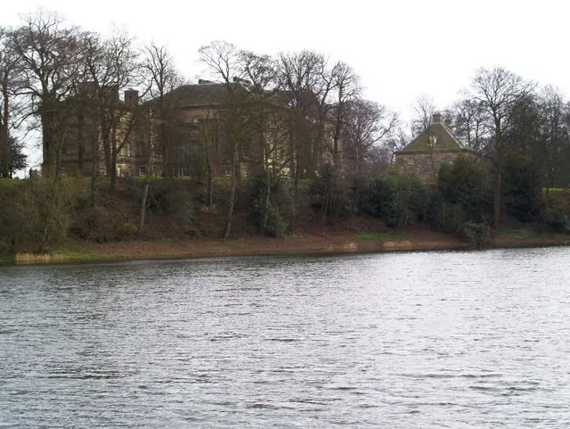
© Steve Fareham · Geograph · CC BY-SA 2.0
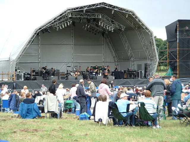
© Ian Russell · Geograph · CC BY-SA 2.0
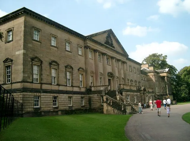
© John Davidson · Geograph · CC BY-SA 2.0
Images © their respective photographers, licensed under CC BY-SA 2.0 and reused here with attribution. Photographs depict listed buildings, churches and monuments near this settlement and may show neighbouring villages.
Data derived from the Open Domesday project (opendomesday.org), based on the Domesday Book dataset compiled by Professor J.J.N. Palmer and team. The Domesday Book (1086) is in the public domain.
Found an inaccuracy? [email protected]