Norton in the Domesday Book (1086)
Norton appears in the Domesday Book of 1086, entered under the hundred of Scard in Yorkshire. The survey assessed Norton at 1.5 carucates of taxable land.
At the time of the survey, Norton supported a recorded population of 4 smallholders, 2 freemanmen, working 1 plough between them.
Resources Recorded at Norton (1086)
- Meadow: 8 acres
Other Settlements in Scard
- Birdsall
- Buckton [Holms]
- Burdale
- Duggleby
- Kennythorpe
- Langton
- Linton
- Rillington
- Scagglethorpe
- Scampston
- Settrington
- Sutton [Grange]
- Thorpe [Bassett]
- Towthorpe
The Meaning of the Name
The name Norton is of Anglo-Saxon origin. Its final element derives from the Old English word tūn, a farmstead or village, while the first element appears to represent the northern. Taken together the name probably meant something close to ’the northern farmstead’.
Remarkably, the name has changed little since 1086, when the Domesday scribes wrote it as Norton.
Listed Buildings Near Norton
Historic England records 233 listed buildings within about a mile of Norton. Listing protects structures of special architectural or historic interest, graded I (exceptional), II* (particularly important) and II.
Grade II
- 84A, Commercial Street - 0.06 km
- 90, Commercial Street - 0.08 km
- 64-70, Commercial Street - 0.09 km
- 3, Scarborough Road - 0.14 km
- The Union - 0.15 km
- 49, Commercial Street - 0.18 km
- The Elms - 0.23 km
- Number 16 and Railings Attached to Steps to Front - 0.26 km
- 8,10 and 12, Commercial Street - 0.29 km
- Numbers 4 and 6 and Attached Railings to Front Steps - 0.29 km
- King’s Mill - 0.35 km
- 2-8, Langton Road - 0.35 km
- Gascoignes Jewellers - 0.35 km
- 10-16, Langton Road - 0.37 km
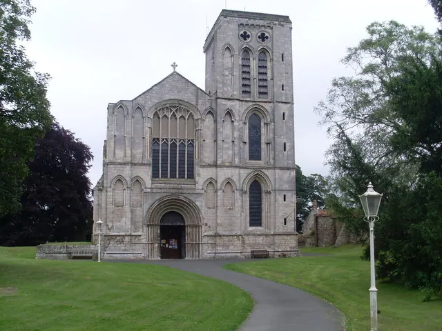
- Church of St Peter - 0.48 km
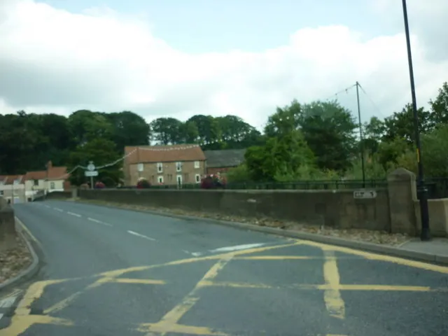
- Malton Bridge - 0.5 km
- Workshop Approximately 40 Metres South East of Number 104 - 0.5 km
- Malton Bridge - 0.51 km
- Number 104 and Attached Outbuildings to West - 0.52 km
- 47, Castlegate - 0.54 km
- 45, Castlegate - 0.55 km
- 94 and 96, Castlegate - 0.58 km
- 37, Castlegate - 0.58 km
- Castle Dykes - 0.59 km
…and 209 more listed structures in the area.
Scheduled Monuments Near Norton
Scheduled monuments are nationally important archaeological sites given legal protection. 3 lie within roughly a mile of Norton:
- Roman fort - 0.51 km
- Site of Malton Castle - 0.66 km
- Old Malton Priory Church (ruined portions) - 1.08 km
Norton Today
Today Norton lies within the administrative area of Ryedale, and the settlement recorded a population of 8,184 at the 2021 census. Nine and a half centuries separate that figure from the small rural community the Domesday survey recorded here in 1086.
Read more about modern Norton-on-Derwent on Wikipedia .
Nearby Domesday Settlements
Other places recorded in the 1086 survey within a few miles:
- Old Malton - 1.0 km N
- Sutton Grange - 1.0 km S
- Welham - 2.2 km SW
- Broughton - 3.6 km NW
- Ryton - 4.0 km N
- Salescale - 4.0 km N
Heritage Around Norton
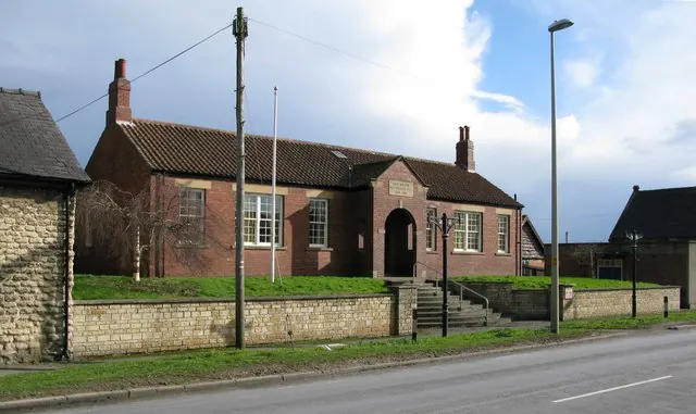
Photographs of churches, listed buildings and monuments in the vicinity, contributed by volunteers to the Geograph project and reused here under a Creative Commons licence.
© David Hillas · Geograph · CC BY-SA 2.0
© David Rogers · Geograph · CC BY-SA 2.0
© Ian S · Geograph · CC BY-SA 2.0
Images © their respective photographers, licensed under CC BY-SA 2.0 and reused here with attribution. Photographs depict listed buildings, churches and monuments near this settlement and may show neighbouring villages.
Data derived from the Open Domesday project (opendomesday.org), based on the Domesday Book dataset compiled by Professor J.J.N. Palmer and team. The Domesday Book (1086) is in the public domain.
Found an inaccuracy? [email protected]