Norton Conyers in the Domesday Book (1086)
Norton Conyers appears in the Domesday Book of 1086, entered under the hundred of Hallikeld in Yorkshire.
Other Settlements in Hallikeld
- Brampton [Hall]
- Caldeuuelle
- Cundall
- Dishforth
- Ellenthorpe [Hall]
- Givendale
- Hashundebi
- Holme
- Howgrave
- Hutton [Conyers]
- Kirby [Hill]
- Leckby [Palace]
- Markington
- Milby
The Meaning of the Name
The name Norton Conyers is of Anglo-Saxon origin. Its final element derives from the Old English word tūn, a farmstead or village, while the first element appears to represent the northern. Taken together the name probably meant something close to ’the northern farmstead’.
Remarkably, the name has changed little since 1086, when the Domesday scribes wrote it as Norton Conyers.
Listed Buildings Near Norton Conyers
Historic England records 30 listed buildings within about a mile of Norton Conyers. Listing protects structures of special architectural or historic interest, graded I (exceptional), II* (particularly important) and II.
Grade II*
- Stable Block With Wall and Gate Piers Approximately 200 Metres to West of Norton Conyers House - 0.32 km
- Norton Conyers House - 0.45 km
- Gateway Adjacent to Wath Lodge - 0.69 km
Grade II
- Orangery in Walled Garden at Norton Conyers House - 0.23 km
- Statue and Surround to Pool Approximately 4 Metres to South of Orangery at Norton Conyers House - 0.24 km
- Garden Walls, With North Gate Piers and South Gate and Gate Piers at Norton Conyers House - 0.26 km
- Gate Piers Approximately 8 Metres to North of North-east Corner of Walled Garden at Norton Conyers House - 0.27 km
- 2 Urns Approximately 1 Metre South of South Garden Wall at Norton Conyers House - 0.29 km
- Statue and Pedestal Approximately 4 Metres South of Stable Block at Norton Conyers House - 0.33 km
- Gate and Gate Piers With Attached Ha-ha Approximately 5 Metres From North-east Corner of Stable Block at Norton Conyers House - 0.34 km
- Statue and Pedestal on West Side of Path From Norton Conyers House to Stables - 0.39 km
- 4 Urns Approximately 20 Metres West of Norton Conyers House - 0.4 km
- Statue and Pedestal Approximately 40 Metres West of Norton Conyers House - 0.4 km
- The Old Stables, With Clock Tower and Wall Adjoining Norton Conyers House - 0.49 km
- Ha-ha in Front of Norton Conyers House With Gateway to South of Stables - 0.67 km
- Wath Lodge - 0.69 km
- Norton Gate, Comprising Gates, Gate Piers, Adjacent Wall and Corner Piers - 0.84 km
- Ivy House - 0.86 km
- Garage Approximately 2 Metres West of Grammar School - 0.99 km
- K6 Telephone Kiosk - 0.99 km
- The Grammar School - 1.0 km
- Overthrow With Lamp Holder Over West Gateway to Church of St Mary - 1.09 km
- The Rectory - 1.11 km
- Chest Tomb Approximately 5 Metres South of South Door of Church of St Mary - 1.12 km
…and 6 more listed structures in the area.
Norton Conyers Today
Today Norton Conyers lies within the administrative area of Harrogate, and the settlement recorded a population of 30 at the 2021 census. Nine and a half centuries separate that figure from the small rural community the Domesday survey recorded here in 1086.
Read more about modern Norton Conyers on Wikipedia .
Nearby Domesday Settlements
Other places recorded in the 1086 survey within a few miles:
- Wath - 1.4 km NE
- Melmerby - 2.2 km NE
- Nunwick - 2.2 km SE
- Middleton Quernhow - 2.8 km NE
- Howgrave - 3.0 km N
- Sutton Howgrave - 3.0 km N
Heritage Around Norton [Conyers]
Photographs of churches, listed buildings and monuments in the vicinity, contributed by volunteers to the Geograph project and reused here under a Creative Commons licence.
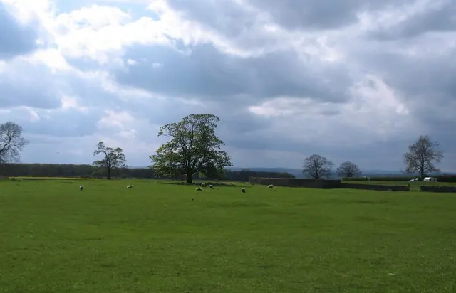
© Gordon Hatton · Geograph · CC BY-SA 2.0
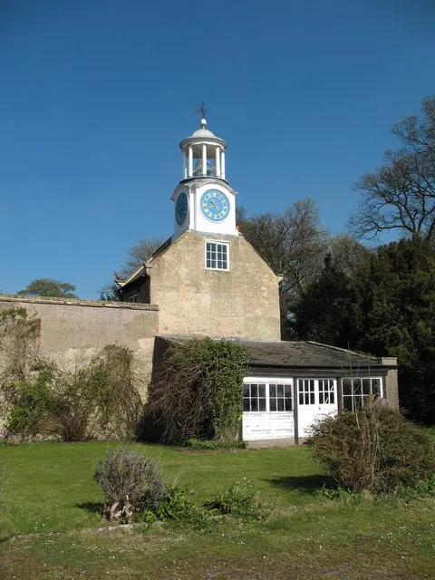
© Gordon Hatton · Geograph · CC BY-SA 2.0
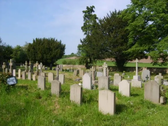
© William Metcalfe · Geograph · CC BY-SA 2.0
Images © their respective photographers, licensed under CC BY-SA 2.0 and reused here with attribution. Photographs depict listed buildings, churches and monuments near this settlement and may show neighbouring villages.
Data derived from the Open Domesday project (opendomesday.org), based on the Domesday Book dataset compiled by Professor J.J.N. Palmer and team. The Domesday Book (1086) is in the public domain.
Found an inaccuracy? [email protected]