Normanby in the Domesday Book (1086)
The 1086 Domesday survey records the settlement of Normanby, entered under the hundred of Maneshou in Yorkshire. The survey assessed Normanby at 6.2 carucates of taxable land.
At the time of the survey, Normanby supported a recorded population of 21 villagers, 10 smallholders, working 9 ploughs between them.
By 1086 Normanby was worth 6.5 shillings, up from 6.3 shillings before the Conquest – which sets it apart from the many nearby villages left waste or devalued.
The survey lists 4 manors at Normanby under different lords. Splitting a single settlement between multiple tenants was common across the North – Saxon estates broken up and handed to William’s followers after 1066.
Resources Recorded at Normanby (1086)
- Mills: 1 mill (valued at 2d)
- Meadow: 13 acres
- Woodland: 300 acres
Other Settlements in Maneshou
- Amotherby
- Ampleforth
- Appleton [le Street]
- Beadlam
- Brawby
- Broughton
- Cawton
- Coulton
- Fadmoor
- Fryton
- Gillamoor
- Gilling [East]
- Griff [Farm]
- Grimston
The Meaning of the Name
The name Normanby is of Scandinavian origin. Its final element derives from the Old Norse word bý, a farmstead or village, while the first element appears to represent the northern. Taken together the name probably meant something close to ’the northern farmstead’.
Names of this type are a fingerprint of Scandinavian settlement: they cluster across the old Danelaw, where Norse-speaking settlers renamed or founded villages from the late 9th century onward.
Remarkably, the name has changed little since 1086, when the Domesday scribes wrote it as Normanby.
Listed Buildings Near Normanby
Historic England records 10 listed buildings within about a mile of Normanby. Listing protects structures of special architectural or historic interest, graded I (exceptional), II* (particularly important) and II.
Grade II*
- Church of St Andrew - 0.22 km
Grade II
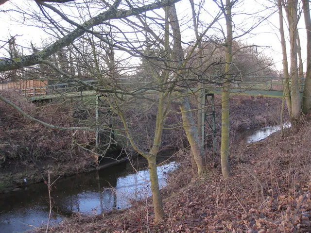
- Normanby Bridge Over River Seven - 0.05 km
- Farmbuildings Approximately 10 Metres North of Bridge Farmhouse - 0.1 km
- Bridge Farmhouse Attached Front Wall and Gate Piers - 0.1 km
- Outbuilding Approximately 15 Metres South-west of Church of St Andrew With Attached Wall and Gateposts - 0.21 km
- Blacksmiths House and Attached Front Garden Railings and Gateposts - 0.25 km
- Normanby House - 0.35 km
- Normanby Hill - 0.46 km
- Milepost - 0.59 km
- Bragg Farmhouse and Attached Cottage - 0.81 km
Normanby Today
Today Normanby lies within the administrative area of Ryedale, and the settlement recorded a population of 127 at the 2021 census. Nine and a half centuries separate that figure from the small rural community the Domesday survey recorded here in 1086.
Read more about modern Normanby on Wikipedia .
Nearby Domesday Settlements
Other places recorded in the 1086 survey within a few miles:
- Thornton Riseborough - 1.4 km NE
- Marton - 2.0 km N
- Salton - 2.2 km SW
- Great Barugh - 2.2 km SE
- Brawby - 3.0 km S
- North Holme House - 3.2 km W
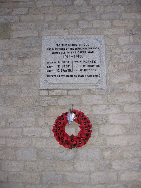
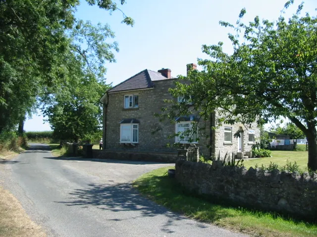
Heritage Around Normanby
Photographs of churches, listed buildings and monuments in the vicinity, contributed by volunteers to the Geograph project and reused here under a Creative Commons licence.
© Pauline E · Geograph · CC BY-SA 2.0
© Pauline E · Geograph · CC BY-SA 2.0
© Phil Catterall · Geograph · CC BY-SA 2.0
Images © their respective photographers, licensed under CC BY-SA 2.0 and reused here with attribution. Photographs depict listed buildings, churches and monuments near this settlement and may show neighbouring villages.
Data derived from the Open Domesday project (opendomesday.org), based on the Domesday Book dataset compiled by Professor J.J.N. Palmer and team. The Domesday Book (1086) is in the public domain.
Found an inaccuracy? [email protected]