Newton le Willows in the Domesday Book (1086)
The settlement of Newton le Willows is recorded in William I’s Domesday survey of 1086, entered under the hundred of Land of Count Alan in Yorkshire.
Other Settlements in Land of Count Alan
- Achebi
- Agglethorpe
- Ainderby [Mires]
- Ainderby [Quernhow]
- Aiskew
- Aldbrough
- Allerthorpe [Hall]
- Ascam
- Ascham
- Asebi
- Aske [Hall]
- Askrigg
- Aysgarth
- Baldersby
The Meaning of the Name
The name Newton le Willows is of Anglo-Saxon origin. Its final element derives from the Old English word tūn, a farmstead or village, while the first element appears to represent the new. Taken together the name probably meant something close to ’the new farmstead’.
Remarkably, the name has changed little since 1086, when the Domesday scribes wrote it as Newton le Willows.
Listed Buildings Near Newton le Willows
Historic England records 13 listed buildings within about a mile of Newton le Willows. Listing protects structures of special architectural or historic interest, graded I (exceptional), II* (particularly important) and II.
Grade I
- Church of St Patrick - 1.26 km
Grade II*
- Dalesend - 1.28 km
Grade II
- The Hall - 0.21 km
- Newton Bridge - 0.52 km
- Chapel at Aysgarth School - 0.83 km
- Garden Walls Approximately 200 Metres South West of Dalesend - 1.09 km
- The Green Tree - 1.23 km
- Hewgill Chest Tomb Approximately 11 Metres South of South East Corner of Church of St Patrick - 1.24 km
- Milner Tombstone Approximately 3 Metres South of South East Corner of Nave of Church of St Patrick - 1.24 km
- Collinson Chest Tomb Approximately 8 Metres South East of South East Corner of Church of St Patrick - 1.24 km
- Chest Tomb Approximately 10 Metres South of South East Corner of Church of St Patrick - 1.25 km
- Group of 3 Carter Chest Tombs Approximately 3 Metres South of Priest’s Door of Church of St Patrick - 1.25 km
- Chest Tomb Approximately One Metre South of Church of St Patrick - 1.26 km
Newton le Willows Today
Today Newton le Willows lies within the administrative area of Richmondshire, and the settlement recorded a population of 452 at the 2021 census. Nine and a half centuries separate that figure from the small rural community the Domesday survey recorded here in 1086.
Read more about modern Newton-le-Willows on Wikipedia .
Nearby Domesday Settlements
Other places recorded in the 1086 survey within a few miles:
- Patrick Brompton - 1.0 km N
- Ruswick - 2.0 km W
- Hesselton - 2.8 km NW
- Burrill - 2.8 km SE
- Cowling - 2.8 km SE
- Great Crakehall - 3.0 km E
Heritage Around Newton [le Willows]
Photographs of churches, listed buildings and monuments in the vicinity, contributed by volunteers to the Geograph project and reused here under a Creative Commons licence.
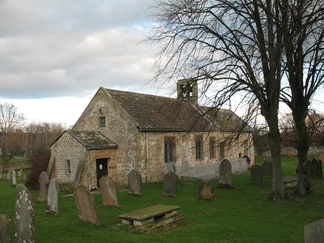
© Gordon Hatton · Geograph · CC BY-SA 2.0
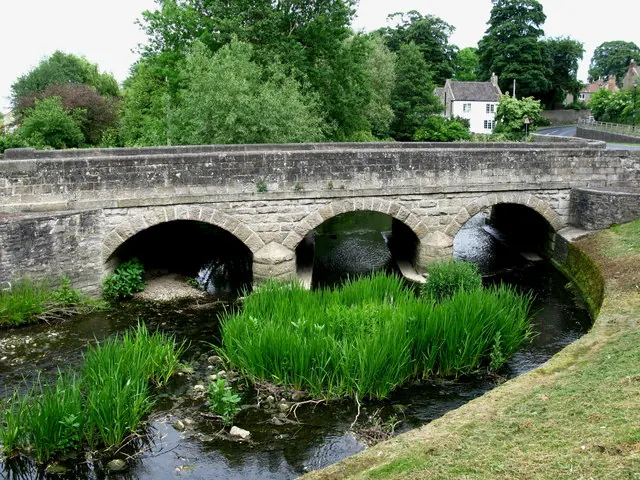
© David Rogers · Geograph · CC BY-SA 2.0
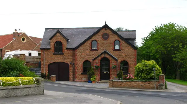
© David Rogers · Geograph · CC BY-SA 2.0
Images © their respective photographers, licensed under CC BY-SA 2.0 and reused here with attribution. Photographs depict listed buildings, churches and monuments near this settlement and may show neighbouring villages.
Location
54.3005°N, -1.6696°W · Land of Count Alan hundred, Yorkshire
View larger map on OpenStreetMap →Data derived from the Open Domesday project (opendomesday.org), based on the Domesday Book dataset compiled by Professor J.J.N. Palmer and team. The Domesday Book (1086) is in the public domain.
Found an inaccuracy? [email protected]