Newton Kyme in the Domesday Book (1086)
The settlement of Newton Kyme is recorded in William I’s Domesday survey of 1086, entered under the hundred of Barkston in Yorkshire.
Other Settlements in Barkston
- Barkston
- Barlow
- Birkin
- Bramham
- Brayton
- Burton [Hall]
- Camblesforth
- Carlton
- Clifford
- Drax
- Fairburn
- Grimston [Grange]
- Hambleton
- Hazelwood [Castle]
The Meaning of the Name
The name Newton Kyme is of Anglo-Saxon origin. Its final element derives from the Old English word tūn, a farmstead or village, while the first element appears to represent the new. Taken together the name probably meant something close to ’the new farmstead’.
Remarkably, the name has changed little since 1086, when the Domesday scribes wrote it as Newton Kyme.
Listed Buildings Near Newton Kyme
Historic England records 19 listed buildings within about a mile of Newton Kyme. Listing protects structures of special architectural or historic interest, graded I (exceptional), II* (particularly important) and II.
Grade I
- Church of St Andrew - 0.41 km
Grade II*
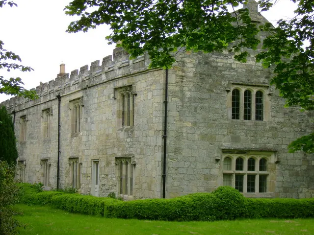
- Newton-kyme Hall - 0.44 km
Grade II
- Boundary Stone 1000M East of Milestone Opposite Junction With Croft Lane - 0.35 km
- Ha-ha Approximately 25 Metres to South of Newton-kyme Hall - 0.39 km
- Graveslab, Churchyard of St Andrew, Approximately 4 Metres South-west of South Porch - 0.39 km
- Graveslab, Churchyard of St Andrew, Approximately 4 Metres East of South Porch - 0.4 km
- Base of Cross, Churchyard of St Andrews, Approximately 5 Metres South-east of South Porch - 0.4 km
- Wall and Railings Adjoining the Rectory - 0.44 km
- Sundial Approximately 10 Metres South of the Old Schoolhouse (Qv) - 0.45 km
- The Old Schoolhouse - 0.46 km
- The Rectory - 0.46 km
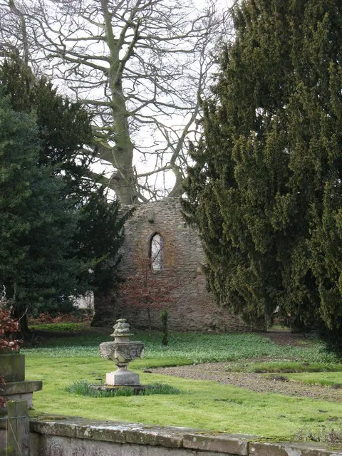
- Ruined Remains of Newton-kyme Castle Approximately 25 Metres East of Newton-kyme Hall - 0.46 km
- The Dower House - 0.46 km
- Icehouse Approximately 8 Metres North-east of Newton-kyme Hall - 0.48 km
- Groom’s House - 0.49 km
- Coach-house and Stables - 0.5 km
- Wall, Gate and Railings to Fold Yard to the Dower House - 0.51 km
- Milestone Opposite Junction With Croft Lane - 0.72 km
- Milestone One Mile East of Milestone Opposite Junction With Croft Lane - 0.91 km
Scheduled Monuments Near Newton Kyme
Scheduled monuments are nationally important archaeological sites given legal protection. 3 lie within roughly a mile of Newton Kyme:
- Fortified manor house known as Kyme Castle - 0.46 km
- Two Roman forts, two Roman camps, vicus, Iron Age enclosure, Bronze Age barrows and Neolithic henge monument west of Newton Kyme - 1.19 km
- Toulston medieval village, manor house site and early garden earthworks - 1.37 km
Newton Kyme Today
Today Newton Kyme lies within the administrative area of Newton Kyme cum Toulston, and the settlement recorded a population of 275 at recent figures. Nine and a half centuries separate that figure from the small rural community the Domesday survey recorded here in 1086.
Read more about modern Newton Kyme on Wikipedia .
Nearby Domesday Settlements
Other places recorded in the 1086 survey within a few miles:
Heritage Around Newton [Kyme]
Photographs of churches, listed buildings and monuments in the vicinity, contributed by volunteers to the Geograph project and reused here under a Creative Commons licence.
© Gordon Hatton · Geograph · CC BY-SA 2.0
© Sean Diver · Geograph · CC BY-SA 2.0
© Betty Longbottom · Geograph · CC BY-SA 2.0
Images © their respective photographers, licensed under CC BY-SA 2.0 and reused here with attribution. Photographs depict listed buildings, churches and monuments near this settlement and may show neighbouring villages.
Data derived from the Open Domesday project (opendomesday.org), based on the Domesday Book dataset compiled by Professor J.J.N. Palmer and team. The Domesday Book (1086) is in the public domain.
Found an inaccuracy? [email protected]