Newton Garth in the Domesday Book (1086)
The 1086 Domesday survey records the settlement of Newton Garth, entered under the hundred of Holderness [South Hundred] in Yorkshire.
Other Settlements in Holderness [South Hundred]
- Andrebi
- Burstwick
- Camerton [Hall]
- Dimlington
- Easington
- Grimston
- Halsham
- Hilston
- Hollym
- Holmpton
- Keyingham
- Kilnsea
- Monkwith
- Nuthill
The Meaning of the Name
The name Newton Garth is of Anglo-Saxon origin. Its final element derives from the Old English word tūn, a farmstead or village, while the first element appears to represent the new. Taken together the name probably meant something close to ’the new farmstead’.
Remarkably, the name has changed little since 1086, when the Domesday scribes wrote it as Newton Garth.
Listed Buildings Near Newton Garth
Historic England records 44 listed buildings within about a mile of Newton Garth. Listing protects structures of special architectural or historic interest, graded I (exceptional), II* (particularly important) and II.
Grade II*
- The New Hall - 1.07 km
- The Old Hall - 1.15 km
- Hedon Town Hall - 1.18 km
- Church of St Mary and St Joseph - 1.2 km
Grade II
- Harbour Farmhouse - 0.49 km
- Two Ranges of Farm Buildings, One Attached to North of Harbour Farmhouse and Running Along North Side of Farmyard; the Other Returning Along East Side of Farmyard. - 0.51 km
- Mill House - 0.58 km
- 54 and 56, Sheriff Highway - 0.76 km
- Lambert House - 0.83 km
- Two Outbuildings to no 11, Flanking East Side of Sheriff Highway - 1.05 km
- 36 and 38A, Fletcher Gate - 1.09 km
- 38, Fletcher Gate - 1.09 km
- 32 and 34, Fletcher Gate - 1.09 km
- 1, St Augustine’s Gate - 1.1 km
- The Cottage and Range of Outhouses to East - 1.1 km
- 8 and 10, St Augustine’s Gate - 1.11 km
- 9, St Augustine’s Gate - 1.12 km
- 11, St Augustine’s Gate - 1.13 km
- 15 and 17, St Augustine’s Gate - 1.16 km
- 22-26, St Augustine’s Gate - 1.16 km
- 21, St Augustine’s Gate - 1.18 km
- 34, St Augustine’s Gate - 1.2 km
- 36, St Augustine’s Gate - 1.21 km
- Presbytery Adjoining East Side of Church of St Mary and St Joseph Wall and Archway South of Presbytery Fronting Grape Lane - 1.21 km
…and 20 more listed structures in the area.
Scheduled Monuments Near Newton Garth
Scheduled monuments are nationally important archaeological sites given legal protection. 2 lie within roughly a mile of Newton Garth:
- Hedon medieval town - 1.08 km
- Ravenspurn cross - 1.33 km
Nearby Domesday Settlements
Other places recorded in the 1086 survey within a few miles:
- Paull - 2.2 km SW
- Thorngumbald - 2.2 km SE
- Preston - 3.0 km N
- Paull Holme - 3.0 km S
- Camerton Hall - 3.2 km E
- Nuthill - 3.6 km NE
Heritage Around Newton [Garth]
Photographs of churches, listed buildings and monuments in the vicinity, contributed by volunteers to the Geograph project and reused here under a Creative Commons licence.
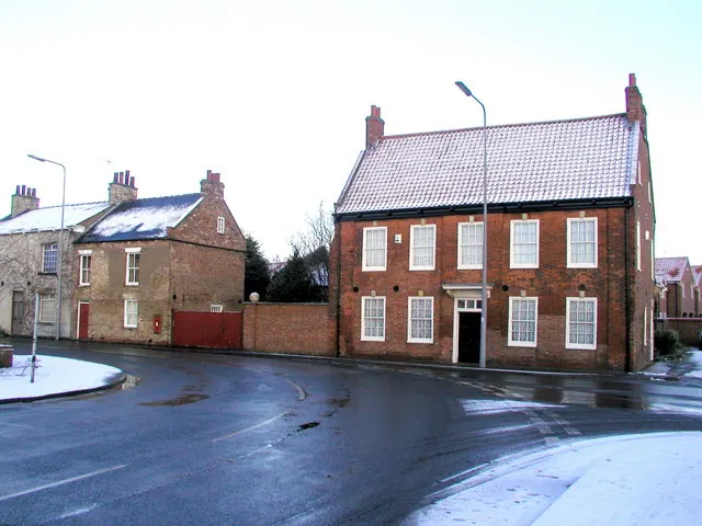
© Andy Beecroft · Geograph · CC BY-SA 2.0
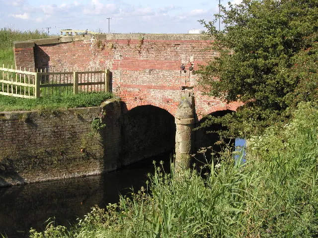
© Andy Beecroft · Geograph · CC BY-SA 2.0
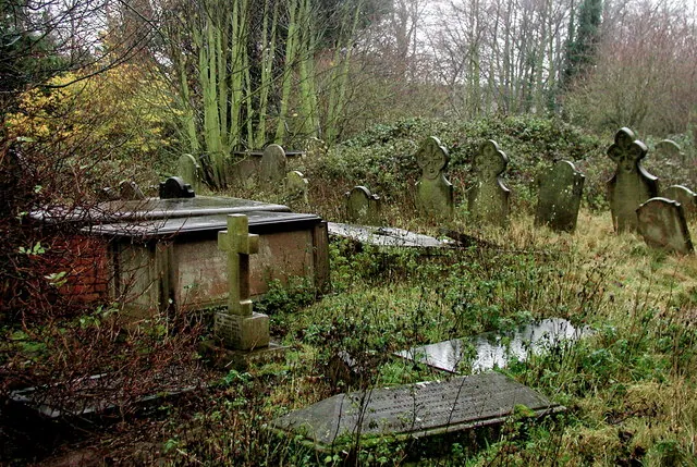
© Paul Glazzard · Geograph · CC BY-SA 2.0
Images © their respective photographers, licensed under CC BY-SA 2.0 and reused here with attribution. Photographs depict listed buildings, churches and monuments near this settlement and may show neighbouring villages.
Location
53.7302°N, -0.2035°W · Holderness [South Hundred] hundred, Yorkshire
View larger map on OpenStreetMap →Data derived from the Open Domesday project (opendomesday.org), based on the Domesday Book dataset compiled by Professor J.J.N. Palmer and team. The Domesday Book (1086) is in the public domain.
Found an inaccuracy? [email protected]