Newsome Farm in the Domesday Book (1086)
Newsome Farm appears in the Domesday Book of 1086, entered under the hundred of Burghshire in Yorkshire.
Other Settlements in Burghshire
- Addlethorpe
- Aismunderby
- Aldfield
- Allerton [Mauleverer]
- Arkendale
- Askwith
- Azerley
- Barrowby [Grange]
- Beckwith [House]
- Besthaim
- Bestham
- Bewerley
- Bilton
- Birstwith
The Meaning of the Name
The origin of the name Newsome Farm is not securely established from its modern form alone; like many settlement names in the North it likely combines an Old English or Old Norse personal name with a landscape term.
Remarkably, the name has changed little since 1086, when the Domesday scribes wrote it as Newsome Farm.
Listed Buildings Near Newsome Farm
Historic England records 9 listed buildings within about a mile of Newsome Farm. Listing protects structures of special architectural or historic interest, graded I (exceptional), II* (particularly important) and II.
Grade II*
- Church of All Saints - 1.2 km
Grade II
- John Metcalf Memorial Approximately 15 Metres From East End of North Aisle of Church of All Saints - 1.18 km
- Chantry House Massey Garth - 1.2 km
- Mounting Block - 1.24 km
- Archway With Gates and Flanking Walls and Inner, Freestanding Archway to the Old Rectory - 1.25 km
- Dovecote Approximately 30 Metres West of Old Hall - 1.26 km
- The Old Rectory - 1.28 km
- Old Hall - 1.28 km
- Pump Against North East Corner of Old Hall - 1.29 km
Scheduled Monuments Near Newsome Farm
Scheduled monuments are nationally important archaeological sites given legal protection. 2 lie within roughly a mile of Newsome Farm:
- Green Howe bowl barrow, 280m south of Bank House - 1.29 km
- Spofforth Castle magnates’ residence - 1.56 km
Nearby Domesday Settlements
Other places recorded in the 1086 survey within a few miles:
- Caldeuuelle - 1.0 km W
- Cradeuuelle - 1.0 km W
- Spofforth - 1.0 km W
- Kirk and North Deighton - 2.0 km E
- Great Braham - 2.2 km NW
- Little Braham - 2.2 km NW
Heritage Around Newsome [Farm]
Photographs of churches, listed buildings and monuments in the vicinity, contributed by volunteers to the Geograph project and reused here under a Creative Commons licence.
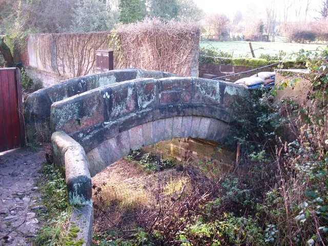
© Gordon Hatton · Geograph · CC BY-SA 2.0
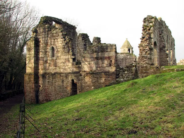
© John Sutton · Geograph · CC BY-SA 2.0
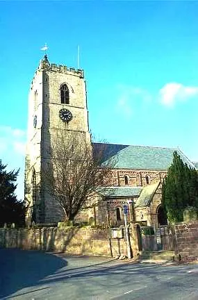
© Bill Henderson · Geograph · CC BY-SA 2.0
Images © their respective photographers, licensed under CC BY-SA 2.0 and reused here with attribution. Photographs depict listed buildings, churches and monuments near this settlement and may show neighbouring villages.
Data derived from the Open Domesday project (opendomesday.org), based on the Domesday Book dataset compiled by Professor J.J.N. Palmer and team. The Domesday Book (1086) is in the public domain.
Found an inaccuracy? [email protected]