Newsholme in the Domesday Book (1086)
Newsholme is named in the Domesday Book, compiled by Norman commissioners in 1086, entered under the hundred of Craven in Yorkshire.
Other Settlements in Craven
- Addingham
- Airton
- Anley
- Appletreewick
- Arncliffe
- Arnford
- Barnoldswick
- Bashall [Eaves]
- Battersby [Barn]
- Beamsley
- Birkby [Hall]
- Bogeuurde
- Bolton [Abbey]
- Bolton [by Bowland]
The Meaning of the Name
The name Newsholme is of Scandinavian origin. Its final element derives from the Old Norse word holmr, an island or patch of raised ground in marsh, while the first element appears to represent the new. Taken together the name probably meant something close to ’the new island’.
Names of this type are a fingerprint of Scandinavian settlement: they cluster across the old Danelaw, where Norse-speaking settlers renamed or founded villages from the late 9th century onward.
Remarkably, the name has changed little since 1086, when the Domesday scribes wrote it as Newsholme.
Listed Buildings Near Newsholme
Historic England records 10 listed buildings within about a mile of Newsholme. Listing protects structures of special architectural or historic interest, graded I (exceptional), II* (particularly important) and II.
Grade II
- Toll House - 0.21 km
- Milestone South West of Listers Farmhouse at Sd 83985149 - 0.38 km
- Listers Farmhouse - 0.4 km
- Paythorne Bridge - 0.53 km
- Stankas Hall Farmhouse - 0.65 km
- Harper’s Farmhouse - 0.68 km
- Denholme Farmhouse - 0.71 km
- Paythorne Methodist Church - 0.73 km
- Paa Farmhouse - 0.92 km
- Milestone at Sd 83015040 - 1.21 km
Scheduled Monuments Near Newsholme
Scheduled monuments are nationally important archaeological sites given legal protection. 4 lie within roughly a mile of Newsholme:
- Site of the Old Hall - 0.11 km
- Paythorne Bridge - 0.54 km
- Castle Haugh Ringwork, Newsholme - 0.92 km
- Little Painley bowl barrow - 1.54 km
Newsholme Today
Today Newsholme lies within the administrative area of Ribble Valley, and the settlement recorded a population of 52 at the 2021 census. Nine and a half centuries separate that figure from the small rural community the Domesday survey recorded here in 1086.
Read more about modern Newsholme on Wikipedia .
Nearby Domesday Settlements
Other places recorded in the 1086 survey within a few miles:
Heritage Around Newsholme
Photographs of churches, listed buildings and monuments in the vicinity, contributed by volunteers to the Geograph project and reused here under a Creative Commons licence.
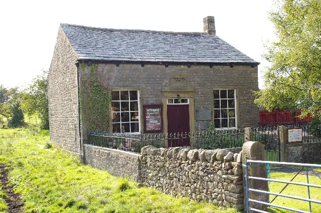
© Alexander P Kapp · Geograph · CC BY-SA 2.0
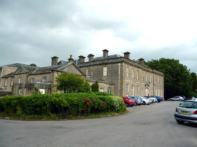
© Dr Neil Clifton · Geograph · CC BY-SA 2.0
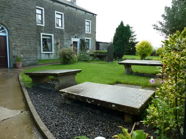
© Alexander P Kapp · Geograph · CC BY-SA 2.0
Images © their respective photographers, licensed under CC BY-SA 2.0 and reused here with attribution. Photographs depict listed buildings, churches and monuments near this settlement and may show neighbouring villages.
Data derived from the Open Domesday project (opendomesday.org), based on the Domesday Book dataset compiled by Professor J.J.N. Palmer and team. The Domesday Book (1086) is in the public domain.
Found an inaccuracy? [email protected]