Newsham in the Domesday Book (1086)
Newsham appears in the Domesday Book of 1086, entered under the hundred of Land of Count Alan in Yorkshire.
Other Settlements in Land of Count Alan
- Achebi
- Agglethorpe
- Ainderby [Mires]
- Ainderby [Quernhow]
- Aiskew
- Aldbrough
- Allerthorpe [Hall]
- Ascam
- Ascham
- Asebi
- Aske [Hall]
- Askrigg
- Aysgarth
- Baldersby
The Meaning of the Name
The name Newsham is of Anglo-Saxon origin. Its final element derives from the Old English word hām, a homestead or village, while the first element appears to represent the new. Taken together the name probably meant something close to ’the new homestead’.
Remarkably, the name has changed little since 1086, when the Domesday scribes wrote it as Newsham.
Listed Buildings Near Newsham
Historic England records 22 listed buildings within about a mile of Newsham. Listing protects structures of special architectural or historic interest, graded I (exceptional), II* (particularly important) and II.
Grade II
- Newsham Hall - 0.44 km
- Boundary House - 0.44 km
- Gate Piers to Newsham Hall - 0.46 km
- Market Cross and Stocks - 0.47 km
- Newsham House - 0.47 km
- Diamond Napier House - 0.47 km
- Central House and Adjoining Cottage - 0.49 km
- Building Approximately 25 Metres South-west of Central House - 0.5 km
- House to East of Woodbine Cottage - 0.51 km
- Woodbine Cottage - 0.51 km
- Orchard House - 0.52 km
- House to South of Woodbine Cottage - 0.53 km
- Hill Top - 0.6 km
- Newsham Mill - 0.62 km
- Outbuilding Approximately 8 Metres South of Hill Top - 0.62 km
- Newsham Lodge - 0.62 km
- Bridge Approximately 50 Metres North of Newsham Lodge - 0.64 km
- Foxgrove - 0.7 km
- Broughton House - 0.73 km
- Earby Hall - 0.88 km
- Guide Post Opposite Smallways Inn - 0.88 km
- Dalton Fields - 1.21 km
Newsham Today
Today Newsham lies within the administrative area of Richmondshire, and the settlement recorded a population of 345 at the 2021 census. Nine and a half centuries separate that figure from the small rural community the Domesday survey recorded here in 1086.
Read more about modern Newsham on Wikipedia .
Nearby Domesday Settlements
Other places recorded in the 1086 survey within a few miles:
- Broughton House - 1.0 km S
- Barningham - 2.0 km W
- Dalton - 2.2 km SE
- Dalton - 2.2 km SE
- Hutton Magna - 2.8 km NE
- Brignall - 3.6 km NW
Heritage Around Newsham
Photographs of churches, listed buildings and monuments in the vicinity, contributed by volunteers to the Geograph project and reused here under a Creative Commons licence.
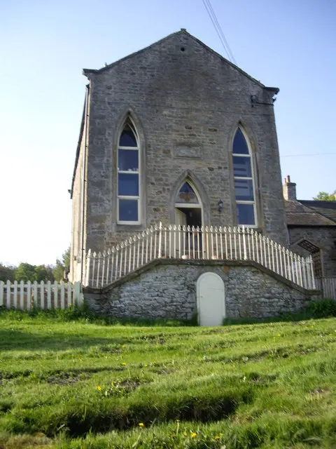
© Stanley Howe · Geograph · CC BY-SA 2.0
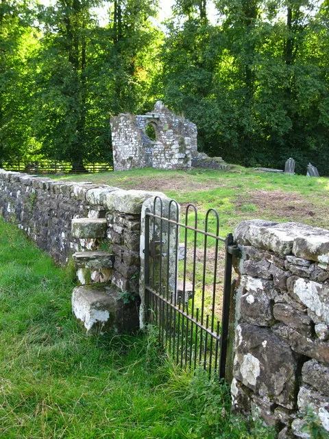
© David Rogers · Geograph · CC BY-SA 2.0
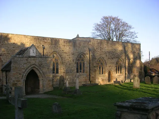
© Oliver Dixon · Geograph · CC BY-SA 2.0
Images © their respective photographers, licensed under CC BY-SA 2.0 and reused here with attribution. Photographs depict listed buildings, churches and monuments near this settlement and may show neighbouring villages.
Location
54.4896°N, -1.8379°W · Land of Count Alan hundred, Yorkshire
View larger map on OpenStreetMap →Data derived from the Open Domesday project (opendomesday.org), based on the Domesday Book dataset compiled by Professor J.J.N. Palmer and team. The Domesday Book (1086) is in the public domain.
Found an inaccuracy? [email protected]