Newbold Astbury in the Domesday Book (1086)
Newbold Astbury appears in the Domesday Book of 1086, entered under the hundred of Middlewich in Cheshire. The survey assessed Newbold Astbury at 0.2 carucates of taxable land.
At the time of the survey, Newbold Astbury supported a recorded population of 2 villagers, working 1 plough between them.
The survey records Newbold Astbury’s value at 5d in 1086. No pre-Conquest figure survives – not unusual in the North, where records were disrupted by the Harrying and by the patchy coverage of the survey.
Resources Recorded at Newbold Astbury (1086)
- Woodland: 2 acres
Other Settlements in Middlewich
- Alsager
- Bostock
- Brereton
- Byley
- Clive
- Congleton
- Croxton
- Davenham
- Davenport
- Goostrey
- Hassall
- Kinderton
- Lach [Dennis]
- Leftwich
The Meaning of the Name
The name Newbold Astbury is of Anglo-Saxon origin. Its final element derives from the Old English word burh, a fortified place. The first element is most likely a personal name or an early descriptive term, now difficult to recover with certainty. Taken together the name probably meant something close to ‘a stronghold’.
Remarkably, the name has changed little since 1086, when the Domesday scribes wrote it as Newbold Astbury.
Listed Buildings Near Newbold Astbury
Historic England records 21 listed buildings within about a mile of Newbold Astbury. Listing protects structures of special architectural or historic interest, graded I (exceptional), II* (particularly important) and II.
Grade I
- Church of St Mary - 0.07 km
Grade II*
- Glebe Farmhouse - 0.08 km
- Canopied tomb of a member of the Venables Family in Churchyard of St. Mary at NGR SJ 84644 61570 - 0.12 km
- Astbury Rectory - 0.23 km
Grade II
- Black and White Cottages - 0.08 km
- Cross base and shaft in Churchyard of St. Mary - 0.09 km
- 3, the Green - 0.09 km
- Gateway to Churchyard of St Mary - 0.09 km
- Greenbank - 0.1 km
- Tombstone circa 1 yard to south of the Venables tomb in Churchyard of St. Mary at NGR 8463 6158 - 0.11 km
- Tombstone circa 1 yard to north of the Venables tomb in Churchyard of St. Mary at NGR 8463 6158 - 0.12 km
- Royal Oak Cottage - 0.16 km
- K6 Telephone Kiosk - 0.18 km
- St Mary’s Cottage - 0.22 km
- Styeheath Cottages - 0.29 km
- Fragment of Plague Cross to South of Number 7 - 0.53 km
- Brook Farmhouse - 0.77 km
- Ciss Green Farmhouse - 1.03 km
- Canal Bridge no 79 - 1.24 km
- Canal Bridge no 80 - 1.26 km
- Brownlow Cottages - 1.28 km
Scheduled Monuments Near Newbold Astbury
Scheduled monuments are nationally important archaeological sites given legal protection. 3 lie within roughly a mile of Newbold Astbury:
- Standing cross in St Mary’s churchyard - 0.09 km
- Canopied tomb in St Mary’s churchyard - 0.11 km
- Roman camp at Bent Farm - 1.02 km
Newbold Astbury Today
Today Newbold Astbury lies within the administrative area of Newbold Astbury, and the settlement recorded a population of 569 at the 2021 census. Nine and a half centuries separate that figure from the small rural community the Domesday survey recorded here in 1086.
Read more about modern Astbury on Wikipedia .
Nearby Domesday Settlements
Other places recorded in the 1086 survey within a few miles:
- Congleton - 2.2 km NE
- Church Lawton and Buglawton - 3.6 km NE
- Somerford Booths - 4.1 km N
- Somerford - 5.0 km NW
- Davenport - 6.4 km NW
- North Rode - 6.4 km NE
Heritage Around Newbold [Astbury]
Photographs of churches, listed buildings and monuments in the vicinity, contributed by volunteers to the Geograph project and reused here under a Creative Commons licence.
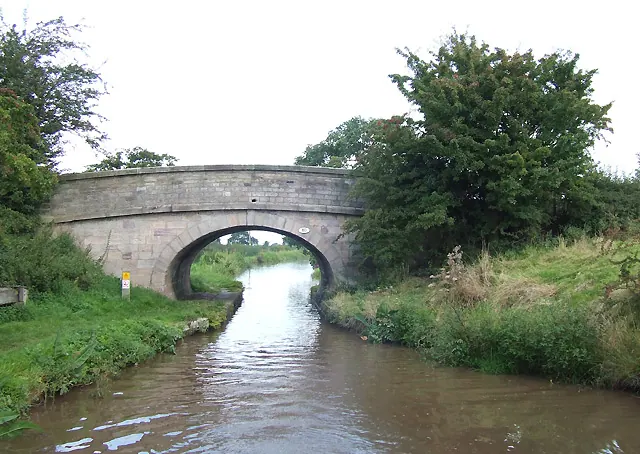
© Roger D Kidd · Geograph · CC BY-SA 2.0
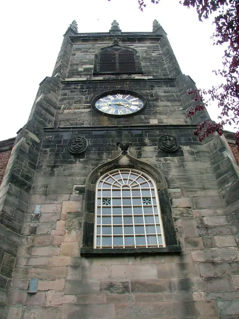
© Neil Lewin · Geograph · CC BY-SA 2.0
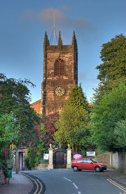
© Chris Sheard · Geograph · CC BY-SA 2.0
Images © their respective photographers, licensed under CC BY-SA 2.0 and reused here with attribution. Photographs depict listed buildings, churches and monuments near this settlement and may show neighbouring villages.
Data derived from the Open Domesday project (opendomesday.org), based on the Domesday Book dataset compiled by Professor J.J.N. Palmer and team. The Domesday Book (1086) is in the public domain.
Found an inaccuracy? [email protected]