Nether Silton in the Domesday Book (1086)
Nether Silton is named in the Domesday Book, compiled by Norman commissioners in 1086, entered under the hundred of Allerton in Yorkshire.
Other Settlements in Allerton
- Ainderby [Steeple]
- Appleton [Wiske]
- Arncliffe [Hall]
- Birkby
- Borrowby
- Brompton
- Cowesby
- Crosby [Grange]
- Dale [Town]
- Deighton
- Ellerbeck
- Foxton
- Girsby
- Hawnby
The Meaning of the Name
The name Nether Silton is of Anglo-Saxon origin. Its final element derives from the Old English word tūn, a farmstead or village. The first element is most likely a personal name or an early descriptive term, now difficult to recover with certainty. Taken together the name probably meant something close to ‘a farmstead’.
Remarkably, the name has changed little since 1086, when the Domesday scribes wrote it as Nether Silton.
Listed Buildings Near Nether Silton
Historic England records 28 listed buildings within about a mile of Nether Silton. Listing protects structures of special architectural or historic interest, graded I (exceptional), II* (particularly important) and II.
Grade II*
- Church of St Mary - 0.69 km
Grade II
- Forge Cottage - 0.12 km
- North Farm - 0.12 km
- K6 Telephone Kiosk - 0.13 km
- School Farm - 0.15 km
- Joiners Shop Occupied by Mr Dennis - 0.16 km
- Church of All Saints - 0.16 km
- Blue House - 0.18 km
- Outbuilding (Now Garage) Approximately 10 Metres to North of Silton Hall - 0.2 km
- Silton Hall - 0.21 km
- Manor Farmhouse and Attached Stable Block - 0.21 km
- Stone Pillar Approximately 75 Metres to West of Manor Farmhouse - 0.23 km
- Mounting Block Approximately 20 Metres to South West of Church of Saint Mary - 0.67 km
- Group of 3 Tomb Stones to James Todd, Mary Liddy, Margaret Dale and One Other, Approximately 10 Metres to South of the East End of the Nave, of the Church of St Mary - 0.67 km
- 2 Tomb Stones to Abel Hardwick and R Hardwick, 15 Metres to South of Centre of Chancel of Church of St Mary - 0.67 km
- Double Tombstone Approximately 7 Metres to South of East End of Chancel of Church of St Mary - 0.67 km
- Tombstone of William Wilson Approximately 10 Metres to South of East End of Chancel of Church of St Mary - 0.67 km
- Tombstone of George Taylor Approximately 3 Metres to South of East End of Chancel of Church of St Mary - 0.67 km
- Headstone and Footstone Approximately 2 Metres to South of East End of Chancel of Church of St Mary - 0.68 km
- Headstone of James Wieldon Approximately 5 Metres to South of Centre of Chancel of Church of St Mary - 0.68 km
- Limekiln Approximately 200 Metres to North of Manor Farmhouse - 0.71 km
- Manor House Farmhouse - 0.87 km
- Holly Tree Cottage - 0.94 km
- Manor Cottage - 0.95 km
…and 4 more listed structures in the area.
Nether Silton Today
Today Nether Silton lies within the administrative area of Hambleton, and the settlement recorded a population of 95 at the 2021 census. Nine and a half centuries separate that figure from the small rural community the Domesday survey recorded here in 1086.
Read more about modern Nether Silton on Wikipedia .
Nearby Domesday Settlements
Other places recorded in the 1086 survey within a few miles:
Heritage Around [Nether] Silton
Photographs of churches, listed buildings and monuments in the vicinity, contributed by volunteers to the Geograph project and reused here under a Creative Commons licence.
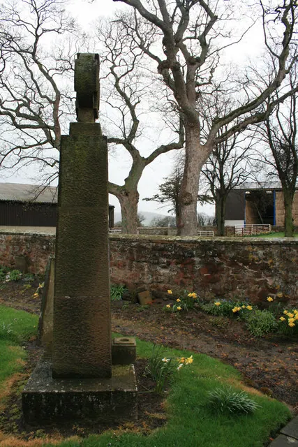
© David Lally · Geograph · CC BY-SA 2.0
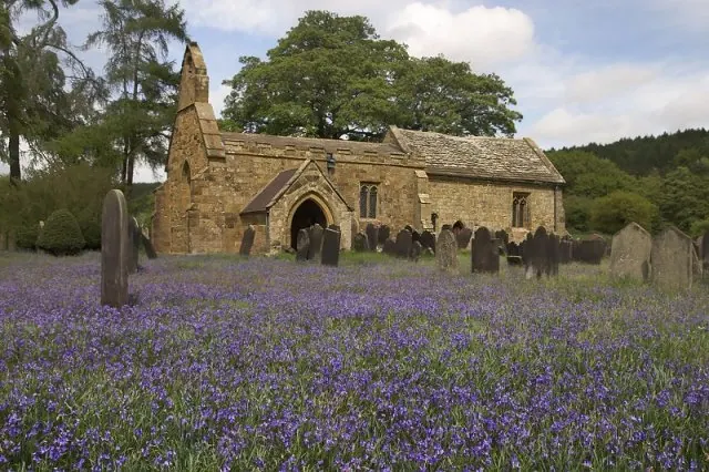
© Colin Grice · Geograph · CC BY-SA 2.0
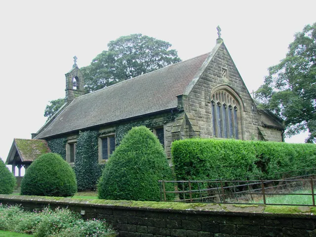
© Bill Henderson · Geograph · CC BY-SA 2.0
Images © their respective photographers, licensed under CC BY-SA 2.0 and reused here with attribution. Photographs depict listed buildings, churches and monuments near this settlement and may show neighbouring villages.
Data derived from the Open Domesday project (opendomesday.org), based on the Domesday Book dataset compiled by Professor J.J.N. Palmer and team. The Domesday Book (1086) is in the public domain.
Found an inaccuracy? [email protected]