Nether Alderley in the Domesday Book (1086)
The 1086 Domesday survey records the settlement of Nether Alderley, entered under the hundred of Hamestan in Cheshire.
Other Settlements in Hamestan
- Adlington
- Bosley
- Bramhall
- Bredbury
- Butley
- Capesthorne
- Cheadle
- Chelford
- Cranage
- Gawsworth
- Henbury
- Hollingworth
- Hungrewenitune
- Kermincham
The Meaning of the Name
The name Nether Alderley is of Anglo-Saxon origin. Its final element derives from the Old English word lēah, a woodland clearing or glade, while the first element appears to represent the old. Taken together the name probably meant something close to ’the old clearing’.
Remarkably, the name has changed little since 1086, when the Domesday scribes wrote it as Nether Alderley.
Listed Buildings Near Nether Alderley
Historic England records 41 listed buildings within about a mile of Nether Alderley. Listing protects structures of special architectural or historic interest, graded I (exceptional), II* (particularly important) and II.
Grade I
- Church of St Mary - 0.53 km
Grade II*
- The Old Hall - 0.29 km
- Nether Alderley Mill and Dam Wall - 0.34 km
- Old School - 0.55 km
Grade II
- The Stanley Obelisk - 0.15 km
- Former Stables 45 Metres North of the Old Hall - 0.27 km
- Gate Piers to Alderley Mill Cottage - 0.28 km
- Brick Garden Walls to Alderley Mill Cottage and the Apple House - 0.3 km
- Apple House - 0.3 km
- Gate Piers, Wing Walls and Bridge Over Moat to the Old Hall - 0.3 km
- Flume Head - 0.36 km
- Corner Pier and Garden Wall to South West of the Old Hall - 0.36 km
- White Gate Cottage - 0.37 km
- Anne’s Cottage - 0.37 km
- Yew Tree Cottage - 0.4 km
- Church Cottages Millbrook Cottage - 0.4 km
- Eagle and Child Cottage - 0.42 km
- Former Stables at Eagle and Child Cottage - 0.42 km
- Rectory Cottage - 0.46 km
- The Rectory - 0.49 km
- Village Cross - 0.52 km
- Churchyard walls, gate piers and gates, to Church of St Mary - 0.53 km
- Cross Farmhouse - 0.53 km
- Churchyard Cross - 0.54 km
…and 17 more listed structures in the area.
Scheduled Monuments Near Nether Alderley
Scheduled monuments are nationally important archaeological sites given legal protection. 4 lie within roughly a mile of Nether Alderley:
- Cross at Nether Alderley on the crossroads of Welsh Row and Congleton Road - 0.52 km
- Churchyard cross at St Mary’s Church - 0.53 km
- Wood Mine cobalt works and associated mines, 340m east of White Barn Farm - 1.24 km
- The Great Merestone medieval boundary marker on Finlow Hill, 245m east of Mottram House - 1.57 km
Nether Alderley Today
Today Nether Alderley lies within the administrative area of Cheshire East, and the settlement recorded a population of 909 at the 2021 census. Nine and a half centuries separate that figure from the small rural community the Domesday survey recorded here in 1086.
Read more about modern Nether Alderley on Wikipedia .
Nearby Domesday Settlements
Other places recorded in the 1086 survey within a few miles:
- Over Alderley - 2.0 km E
- Chelford - 3.6 km SW
- Capesthorne - 4.0 km S
- Warford - 4.1 km W
- Henbury - 5.0 km SE
- Mottram St Andrew - 5.0 km NE
Heritage Around [Nether] Alderley
Photographs of churches, listed buildings and monuments in the vicinity, contributed by volunteers to the Geograph project and reused here under a Creative Commons licence.
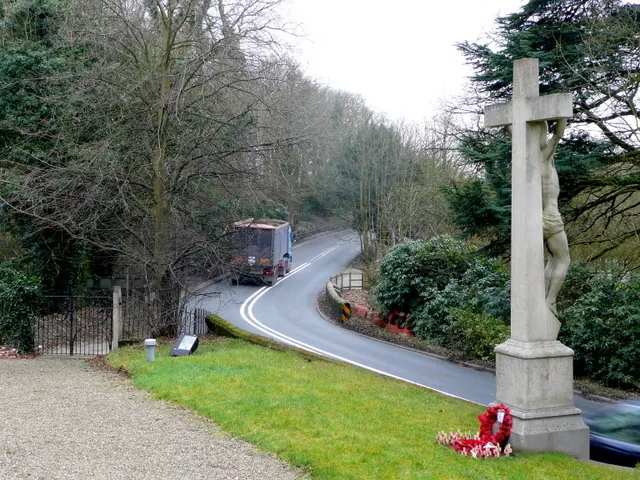
© Jonathan Billinger · Geograph · CC BY-SA 2.0
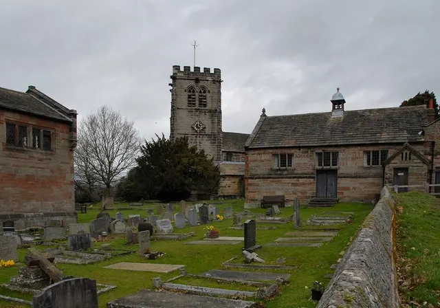
© Galatas · Geograph · CC BY-SA 2.0
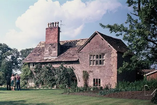
© John H Darch · Geograph · CC BY-SA 2.0
Images © their respective photographers, licensed under CC BY-SA 2.0 and reused here with attribution. Photographs depict listed buildings, churches and monuments near this settlement and may show neighbouring villages.
Data derived from the Open Domesday project (opendomesday.org), based on the Domesday Book dataset compiled by Professor J.J.N. Palmer and team. The Domesday Book (1086) is in the public domain.
Found an inaccuracy? [email protected]