Mulgrave Castle in the Domesday Book (1086)
Mulgrave Castle is named in the Domesday Book, compiled by Norman commissioners in 1086, entered under the hundred of Langbaurgh in Yorkshire.
Other Settlements in Langbaurgh
- Acklam
- Airy [Holme]
- Aislaby
- Arnodestorp
- Baldebi
- Barnaby
- Barwick
- Battersby
- Bergolbi
- Berguluesbi
- Blaten [Carr]
- Borrowby
- Breck
- Brotton
The Meaning of the Name
The origin of the name Mulgrave Castle is not securely established from its modern form alone; like many settlement names in the North it likely combines an Old English or Old Norse personal name with a landscape term.
Remarkably, the name has changed little since 1086, when the Domesday scribes wrote it as Mulgrave Castle.
Listed Buildings Near Mulgrave Castle
Historic England records 11 listed buildings within about a mile of Mulgrave Castle. Listing protects structures of special architectural or historic interest, graded I (exceptional), II* (particularly important) and II.
Grade I
- Old Mulgrave Castle - 0.38 km
Grade II
- Rock Head Cottage - 0.78 km
- High Leas Farmhouse and Attached Stable - 0.86 km
- Barn and Byres to South West of High Leas Farmhouse - 0.87 km
- Barnby Sleights Farmhouse and Stable to Right - 0.96 km
- Barn, Byres, Stables and Cartshed to North of Barnby Sleights Farmhouse - 0.96 km
- Espsyke Farmhouse - 1.01 km
- Byre and stable-cartshed to north of Low Farmhouse - 1.25 km
- Barn to North-east of Low Farmhouse - 1.25 km
- Stable/byre to North-west of Low Farmhouse - 1.28 km
- Low Farmhouse and Attached Outbuilding - 1.28 km
Scheduled Monuments Near Mulgrave Castle
Scheduled monuments are nationally important archaeological sites given legal protection. 3 lie within roughly a mile of Mulgrave Castle:
- Old Mulgrave Castle: an enclosure castle incorporated into an 18th century planned landscape - 0.39 km
- Foss Castle: a motte and bailey, precursor to Old Mulgrave Castle - 0.48 km
- Ash Holm alum works, 350m south east of Mulgrave Castle - 0.6 km
Nearby Domesday Settlements
Other places recorded in the 1086 survey within a few miles:
- Hutton Mulgrave - 1.0 km S
- Dunsley - 2.0 km E
- East and West Barnby - 2.2 km NW
- Lythe - 2.2 km NE
- Goldsborough - 3.0 km N
- Newholm - 3.2 km E
Heritage Around [Mul]grave [Castle]
Photographs of churches, listed buildings and monuments in the vicinity, contributed by volunteers to the Geograph project and reused here under a Creative Commons licence.
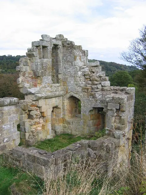
© Stephen Horncastle · Geograph · CC BY-SA 2.0
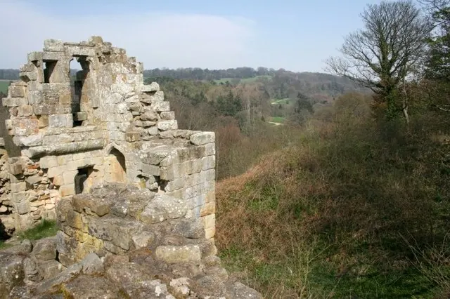
© Mick Garratt · Geograph · CC BY-SA 2.0
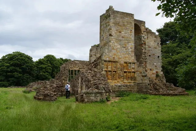
© Bill Boaden · Geograph · CC BY-SA 2.0
Images © their respective photographers, licensed under CC BY-SA 2.0 and reused here with attribution. Photographs depict listed buildings, churches and monuments near this settlement and may show neighbouring villages.
Data derived from the Open Domesday project (opendomesday.org), based on the Domesday Book dataset compiled by Professor J.J.N. Palmer and team. The Domesday Book (1086) is in the public domain.
Found an inaccuracy? [email protected]