Mount Grace in the Domesday Book (1086)
The settlement of Mount Grace is recorded in William I’s Domesday survey of 1086, entered under the hundred of Allerton in Yorkshire.
Other Settlements in Allerton
- Ainderby [Steeple]
- Appleton [Wiske]
- Arncliffe [Hall]
- Birkby
- Borrowby
- Brompton
- Cowesby
- Crosby [Grange]
- Dale [Town]
- Deighton
- Ellerbeck
- Foxton
- Girsby
- Hawnby
The Meaning of the Name
The origin of the name Mount Grace is not securely established from its modern form alone; like many settlement names in the North it likely combines an Old English or Old Norse personal name with a landscape term.
Remarkably, the name has changed little since 1086, when the Domesday scribes wrote it as Mount Grace.
Listed Buildings Near Mount Grace
Historic England records 9 listed buildings within about a mile of Mount Grace. Listing protects structures of special architectural or historic interest, graded I (exceptional), II* (particularly important) and II.
Grade I
- Mount Grace Priory - 0.31 km
Grade II*
- Mount Grace House - 0.25 km
Grade II
- Staddle Bridge House - 0.54 km
- Gates, Piers and Railings to South of Cleveland Tontine Inn - 0.84 km
- The Cleveland Tontine Inn - 0.85 km
- Mount Grace Lady Chapel and Lady Chapel Lodge - 0.87 km
- Stable Block to North of Cleveland Tontine Inn - 0.9 km
- Swinestye Game Hill Farmhouse - 1.17 km
- Park House - 1.24 km
Scheduled Monuments Near Mount Grace
Scheduled monuments are nationally important archaeological sites given legal protection. 2 lie within roughly a mile of Mount Grace:
- Mount Grace Priory Carthusian monastery: monastic precinct, fishponds, moat, mill and well-houses - 0.28 km
- Lady’s Chapel - 0.86 km
Nearby Domesday Settlements
Other places recorded in the 1086 survey within a few miles:
- Osmotherley - 1.4 km SE
- Ingleby Arncliffe - 2.0 km N
- East Harlsey - 2.2 km NW
- Morton Grange - 2.2 km NW
- Arncliffe Hall - 2.2 km NE
- Ellerbeck - 2.2 km SW
Heritage Around Mount Grace
Photographs of churches, listed buildings and monuments in the vicinity, contributed by volunteers to the Geograph project and reused here under a Creative Commons licence.
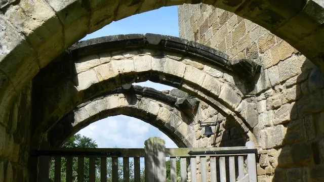
© Paul Howarth · Geograph · CC BY-SA 2.0
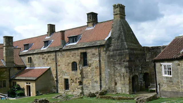
© Paul Howarth · Geograph · CC BY-SA 2.0
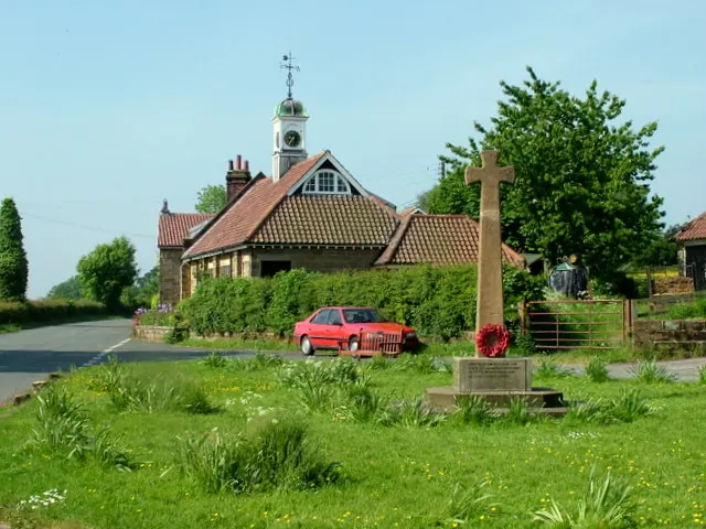
© George Tod · Geograph · CC BY-SA 2.0
Images © their respective photographers, licensed under CC BY-SA 2.0 and reused here with attribution. Photographs depict listed buildings, churches and monuments near this settlement and may show neighbouring villages.
Data derived from the Open Domesday project (opendomesday.org), based on the Domesday Book dataset compiled by Professor J.J.N. Palmer and team. The Domesday Book (1086) is in the public domain.
Found an inaccuracy? [email protected]