Moulton in the Domesday Book (1086)
The 1086 Domesday survey records the settlement of Moulton, entered under the hundred of Middlewich in Cheshire. The survey assessed Moulton at 2 carucates of taxable land.
At the time of the survey, Moulton supported a recorded population of 6 villagers, 3 smallholders, 4 slaves, working 5 ploughs between them.
By 1086 Moulton was worth 1 shilling, up from 12d before the Conquest – which sets it apart from the many nearby villages left waste or devalued.
Resources Recorded at Moulton (1086)
- Woodland: 2 furlongs
Other Settlements in Middlewich
- Alsager
- Bostock
- Brereton
- Byley
- Clive
- Congleton
- Croxton
- Davenham
- Davenport
- Goostrey
- Hassall
- Kinderton
- Lach [Dennis]
- Leftwich
The Meaning of the Name
The name Moulton is of Anglo-Saxon origin. Its final element derives from the Old English word tūn, a farmstead or village. The first element is most likely a personal name or an early descriptive term, now difficult to recover with certainty. Taken together the name probably meant something close to ‘a farmstead’.
Remarkably, the name has changed little since 1086, when the Domesday scribes wrote it as Moulton.
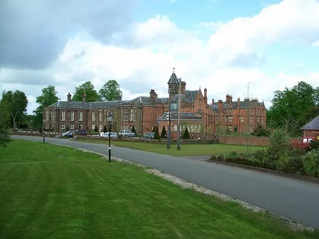
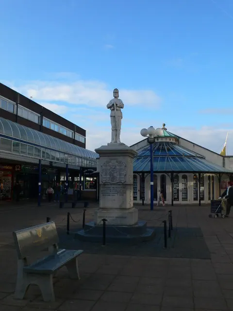
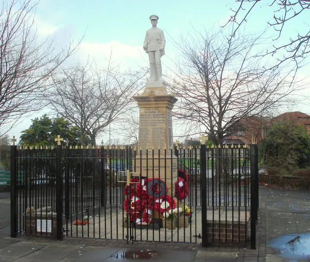
Listed Buildings Near Moulton
Historic England records 5 listed buildings within about a mile of Moulton. Listing protects structures of special architectural or historic interest, graded I (exceptional), II* (particularly important) and II.
Grade II
- Church of St Stephen - 0.18 km
- War Memorial - 0.22 km
- Vicarage - 0.47 km
- Flood Gates and Sluice Bridge - 1.2 km
- Bradford Mill House - 1.25 km
Scheduled Monuments Near Moulton
Scheduled monuments are nationally important archaeological sites given legal protection. 1 lies within roughly a mile of Moulton:
Moulton Today
Today Moulton lies within the administrative area of Cheshire West and Chester, and the settlement recorded a population of 2,934 at the 2021 census. Nine and a half centuries separate that figure from the small rural community the Domesday survey recorded here in 1086.
Read more about modern Moulton on Wikipedia .
Nearby Domesday Settlements
Other places recorded in the 1086 survey within a few miles:
Heritage Around Moulton
Photographs of churches, listed buildings and monuments in the vicinity, contributed by volunteers to the Geograph project and reused here under a Creative Commons licence.
© Steve Leech · Geograph · CC BY-SA 2.0
© Eirian Evans · Geograph · CC BY-SA 2.0
© David Marten · Geograph · CC BY-SA 2.0
Images © their respective photographers, licensed under CC BY-SA 2.0 and reused here with attribution. Photographs depict listed buildings, churches and monuments near this settlement and may show neighbouring villages.
Data derived from the Open Domesday project (opendomesday.org), based on the Domesday Book dataset compiled by Professor J.J.N. Palmer and team. The Domesday Book (1086) is in the public domain.
Found an inaccuracy? [email protected]