Morley in the Domesday Book (1086)
Morley appears in the Domesday Book of 1086, entered under the hundred of Morley in Yorkshire.
Other Settlements in Morley
- Allerton
- Armley
- Batley
- Beeston
- Bolton
- Bowling
- Bradford
- Bramley
- Calverley
- Carlton
- Chellow [Grange]
- Clayton
- Clifton
- Cruttonstall
The Meaning of the Name
The name Morley is of Anglo-Saxon origin. Its final element derives from the Old English word lēah, a woodland clearing or glade. The first element is most likely a personal name or an early descriptive term, now difficult to recover with certainty. Taken together the name probably meant something close to ‘a clearing’.
Remarkably, the name has changed little since 1086, when the Domesday scribes wrote it as Morley.
Listed Buildings Near Morley
Historic England records 45 listed buildings within about a mile of Morley. Listing protects structures of special architectural or historic interest, graded I (exceptional), II* (particularly important) and II.
Grade II
- Croft House - 0.17 km
- St Peters Sunday School - 0.17 km
- Church of St Peter - 0.2 km
- Milestone in Front of Fairmead - 0.2 km
- Crank Mills - 0.38 km
- Swindon House Yew Tree Cottage - 0.39 km
- 2-6, CHAPEL HILL (See details for further address information) - 0.39 km
- Springfield House - 0.43 km
- Dawson House and Warhouse - 0.47 km
- Pair of Slabs to Martha Balmforth 1795 and Benjamin Hopperton 1785 Approximately 20 Metres East of Corner of North Transept of Church of St Mary - 0.48 km
- Group of 3 Chest Tombs to Elizabeth Ellis 1723 William Robuck 1720 and Joseph Hall 1739 Approximately 20 Metres East of East Window of Church of St Mary - 0.49 km
- Table tomb to Sarah Jubb, approximately 1 metre east of north-east corner of church - 0.49 km
- Group of 5 Tombs Approximately 8 Metres East of Canted Bay on East End of Church of St Mary - 0.5 km
- Group of 3 Raised Tomb Slabs Set Between Central Buttresses to North Aisle of Church of St Mary - 0.5 km
- Church of St Mary in the Wood (Congregational) - 0.51 km
- Group of 9 Raised Slabs Approximately 6 Metres South South East of Church of St Mary - 0.51 km
- Group of four raised slabs set round north-east corner of Scatcherd Mausoleum - 0.51 km
- Morley Hall - 0.52 km
- Group of 6 Raised Slabs Close to South Buttress of Nave of Church of St Mary - 0.52 km
- Group of 3 Raised Tombs Approximately 10 Metres North of Scatcherd Mausoleum - 0.52 km
- Chest Tomb to Anne Lister 1735 and Raised Grave Slab to William Havden 1699 Approximately 10 Metres North West of Corner Buttress of Church of St Mary - 0.52 km
- Scatcherd Mausoleum (St Marys Churchyard) - 0.52 km
- Raised Slab to Elizabeth Reyner Approximately 8 Metres North of North West Corner of Scatcherd Mausoleum - 0.52 km
- Pair of Chest Tombs to the Asquith Family C1827 and 1854 Approximately 25 Metres North West of West Door of Church of St Mary - 0.53 km
…and 21 more listed structures in the area.
Morley Today
Today Morley lies within the administrative area of Leeds, and the settlement recorded a population of 35,776 at the 2021 census. Nine and a half centuries separate that figure from the small rural community the Domesday survey recorded here in 1086.
Read more about modern Morley on Wikipedia .
Nearby Domesday Settlements
Other places recorded in the 1086 survey within a few miles:
- Beeston - 2.8 km NE
- West Ardsley - 3.6 km SE
- Middleton - 4.0 km E
- Drighlington - 4.1 km W
- Reestones - 4.1 km N
- Farnley - 4.1 km N
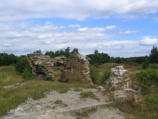
Heritage Around Morley
Photographs of churches, listed buildings and monuments in the vicinity, contributed by volunteers to the Geograph project and reused here under a Creative Commons licence.
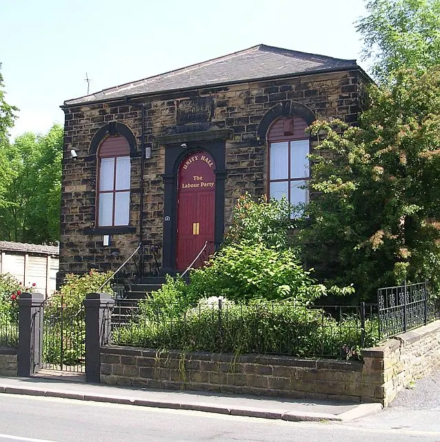
© Betty Longbottom · Geograph · CC BY-SA 2.0

© Steve Partridge · Geograph · CC BY-SA 2.0
© Mick Melvin · Geograph · CC BY-SA 2.0
Images © their respective photographers, licensed under CC BY-SA 2.0 and reused here with attribution. Photographs depict listed buildings, churches and monuments near this settlement and may show neighbouring villages.
Data derived from the Open Domesday project (opendomesday.org), based on the Domesday Book dataset compiled by Professor J.J.N. Palmer and team. The Domesday Book (1086) is in the public domain.
Found an inaccuracy? [email protected]