Misperton in the Domesday Book (1086)
The 1086 Domesday survey records the settlement of Misperton, entered under the hundred of Maneshou in Yorkshire. The survey assessed Misperton at 20 carucates of taxable land.
At the time of the survey, Misperton supported a recorded population of 42 villagers, 10 smallholders, working 47 ploughs between them.
The survey records Misperton’s value at 21 shillings in 1086. No pre-Conquest figure survives – not unusual in the North, where records were disrupted by the Harrying and by the patchy coverage of the survey.
Resources Recorded at Misperton (1086)
- Woodland: 3 * 1 leagues
Other Settlements in Maneshou
- Amotherby
- Ampleforth
- Appleton [le Street]
- Beadlam
- Brawby
- Broughton
- Cawton
- Coulton
- Fadmoor
- Fryton
- Gillamoor
- Gilling [East]
- Griff [Farm]
- Grimston
The Meaning of the Name
The name Misperton is of Anglo-Saxon origin. Its final element derives from the Old English word tūn, a farmstead or village. The first element is most likely a personal name or an early descriptive term, now difficult to recover with certainty. Taken together the name probably meant something close to ‘a farmstead’.
Remarkably, the name has changed little since 1086, when the Domesday scribes wrote it as Misperton.
Listed Buildings Near Misperton
Historic England records 4 listed buildings within about a mile of Misperton. Listing protects structures of special architectural or historic interest, graded I (exceptional), II* (particularly important) and II.
Grade II*
- Church of St Laurence - 0.32 km
Grade II
- Old Rectory and Railings Attached to Doorstep - 0.25 km
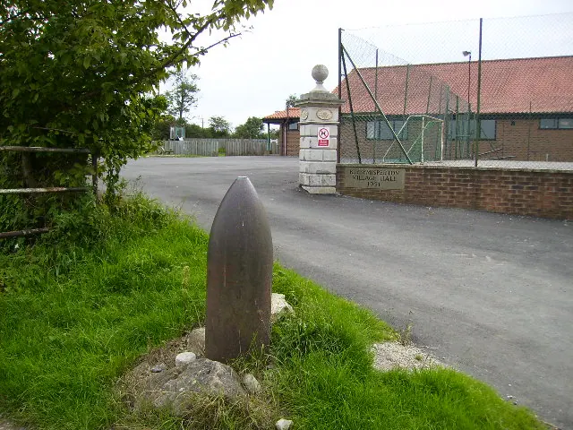
- Obelisk approximately 350 metres north-east of Kirby Misperton Hall - 0.61 km
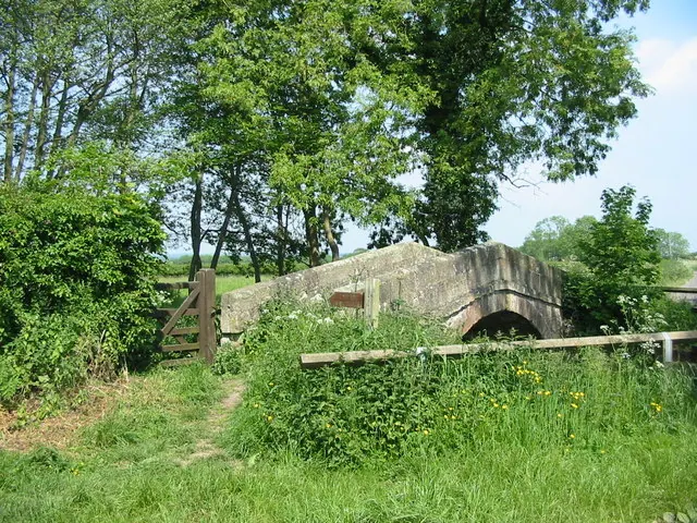
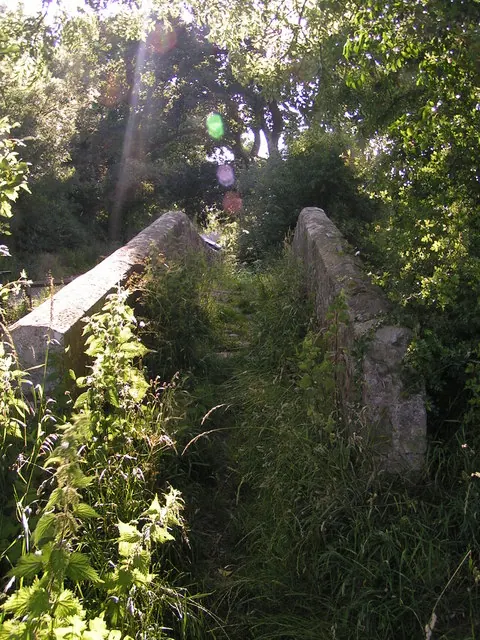
- Kirby Misperton Bridge - 1.14 km
Misperton Today
Today Misperton lies within the administrative area of Ryedale, and the settlement recorded a population of 310 at the 2021 census. Nine and a half centuries separate that figure from the small rural community the Domesday survey recorded here in 1086.
Read more about modern Kirby Misperton on Wikipedia .
Nearby Domesday Settlements
Other places recorded in the 1086 survey within a few miles:
- Kirby Misperton - 0.0 km N
- Kirby Misperton - 0.0 km N
- Little Barugh - 1.0 km W
- Great Barugh - 3.0 km W
- Great and Little Habton - 3.6 km SW
- Brawby - 4.1 km W
Heritage Around Misperton
Photographs of churches, listed buildings and monuments in the vicinity, contributed by volunteers to the Geograph project and reused here under a Creative Commons licence.
© Phil Catterall · Geograph · CC BY-SA 2.0
© Phil Catterall · Geograph · CC BY-SA 2.0
© Karen Vernon · Geograph · CC BY-SA 2.0
Images © their respective photographers, licensed under CC BY-SA 2.0 and reused here with attribution. Photographs depict listed buildings, churches and monuments near this settlement and may show neighbouring villages.
Data derived from the Open Domesday project (opendomesday.org), based on the Domesday Book dataset compiled by Professor J.J.N. Palmer and team. The Domesday Book (1086) is in the public domain.
Found an inaccuracy? [email protected]