Millington in the Domesday Book (1086)
The 1086 Domesday survey records the settlement of Millington, entered under the hundred of Warter in Yorkshire. The survey assessed Millington at 2.4 carucates of taxable land.
At the time of the survey, Millington supported a recorded population of 15 villagers, 9 smallholders, 9 slaves, working 8 ploughs between them.
The survey records Millington’s value at 3.5 shillings in 1086. No pre-Conquest figure survives – not unusual in the North, where records were disrupted by the Harrying and by the patchy coverage of the survey.
The survey lists 2 manors at Millington under different lords. Splitting a single settlement between multiple tenants was common across the North – Saxon estates broken up and handed to William’s followers after 1066.
Resources Recorded at Millington (1086)
- Cattle: 11
- Pigs: 6
- Sheep: 76
- Meadow: 8 acres
- Woodland: 7 furlongs
Other Settlements in Warter
- Grimthorpe [Manor]
- Hawold
- Heslington
- Huggate
- Kilnwick [Percy]
- Langwith [Lodge]
- Meltonby
- Naburn
- Warter
- Wetwang
- Yapham
- [Great] Givendale
- [Little] Givendale
- [North] Dalton
The Meaning of the Name
The name Millington is of Anglo-Saxon origin. Its final element derives from the Old English word tūn, a farmstead or village. The first element is most likely a personal name or an early descriptive term, now difficult to recover with certainty. Taken together the name probably meant something close to ‘a farmstead’.
Remarkably, the name has changed little since 1086, when the Domesday scribes wrote it as Millington.
Listed Buildings Near Millington
Historic England records 3 listed buildings within about a mile of Millington. Listing protects structures of special architectural or historic interest, graded I (exceptional), II* (particularly important) and II.
Grade I
- Church of St Margaret - 0.7 km
Grade II
- Cross Base Approximately 10 Metres South of South-west Quoin of Church of St Margaret - 0.69 km
- Cross-base and Shaft Fragment Approximately 11 Metres South of South Porch of Church of Saint Margaret - 0.69 km
Scheduled Monuments Near Millington
Scheduled monuments are nationally important archaeological sites given legal protection. 6 lie within roughly a mile of Millington:
- Round barrow 520m S of Warren Farm - 0.26 km
- Cross base and shaft and cross base at St Margaret’s Church - 0.71 km
- Deepdale cross ridge dyke - 0.75 km
- Round barrow 600m west of Newcote Farm - 0.87 km
- Section of linear boundary dyke between Sylvan Dale and Warren Farm, north west of Coldwold Farm - 1.15 km
- Three round barrows 110m east of Coldwold Farm - 1.36 km
Millington Today
Today Millington lies within the administrative area of East Riding of Yorkshire, and the settlement recorded a population of 222 at the 2021 census. Nine and a half centuries separate that figure from the small rural community the Domesday survey recorded here in 1086.
Read more about modern Millington on Wikipedia .
Nearby Domesday Settlements
Other places recorded in the 1086 survey within a few miles:
- Ousethorpe Farm - 2.0 km W
- Grimthorpe Manor - 2.2 km NW
- Kilnwick Percy - 2.2 km SW
- Little Givendale - 2.2 km NW
- Great Givendale - 2.8 km NW
- Warter - 3.2 km E
Heritage Around Millington
Photographs of churches, listed buildings and monuments in the vicinity, contributed by volunteers to the Geograph project and reused here under a Creative Commons licence.
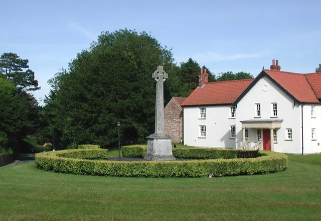
© Paul Glazzard · Geograph · CC BY-SA 2.0
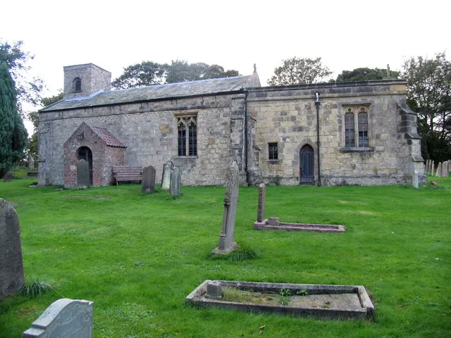
© David Rogers · Geograph · CC BY-SA 2.0
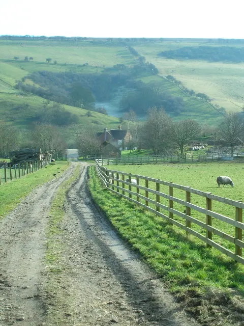
© Paul Sexton · Geograph · CC BY-SA 2.0
Images © their respective photographers, licensed under CC BY-SA 2.0 and reused here with attribution. Photographs depict listed buildings, churches and monuments near this settlement and may show neighbouring villages.
Data derived from the Open Domesday project (opendomesday.org), based on the Domesday Book dataset compiled by Professor J.J.N. Palmer and team. The Domesday Book (1086) is in the public domain.
Found an inaccuracy? [email protected]