Milford in the Domesday Book (1086)
The 1086 Domesday survey records the settlement of Milford, entered under the hundred of Morleystone in Derbyshire.
Other Settlements in Morleystone
- Bradley
- Breadsall
- Breaston
- Cellesdene
- Chaddesden
- Codnor
- Crich
- Denby
- Derby
- Draycott
- Duffield
- Hallam
- Heanor
- Herdebi
The Meaning of the Name
The name Milford is of Anglo-Saxon origin. Its final element derives from the Old English word ford, a river crossing. The first element is most likely a personal name or an early descriptive term, now difficult to recover with certainty. Taken together the name probably meant something close to ‘a ford’.
Remarkably, the name has changed little since 1086, when the Domesday scribes wrote it as Milford.
Listed Buildings Near Milford
Historic England records 71 listed buildings within about a mile of Milford. Listing protects structures of special architectural or historic interest, graded I (exceptional), II* (particularly important) and II.
Grade II
- Stone Walls, Steps and Iron Posts to Footpath Between South End of Hopping Hill and Hopping Hill Terrace, Shaw Lane - 0.49 km
- Church of the Holy Trinity - 0.5 km
- Numbers 1-14 West Terrace and 15-23 East Terrace, Hopping Hill Terrace - 0.5 km
- Railed street boundary wall, north-west end pier and south-west gate and gate piers to Holy Trinity Churchyard - 0.51 km
- K6 Telephone Kiosk - 0.52 km
- War Memorial - 0.52 km
- Milford Post Office - 0.53 km
- Hopping Hill Terrace Coal Shute Adjacent to Number 14 West Terrace - 0.53 km
- Pear Tree Cottage - 0.53 km
- Quarry Cottages - 0.53 km
- Bridge House - 0.54 km
- Cartshed (To North of War Memorial Derby Road) - 0.54 km
- Northern Premises of Bill Lomas (Motor Cycles) Limited and A Pair of Cottages Adjoining to the North - 0.54 km
- Southern Premises of Bill Lomas (Motor Cycles) Limited - 0.56 km
- 57-64, Hopping Hill - 0.56 km
- The King William - 0.58 km
- 65, Hopping Hill - 0.58 km
- Milford Ebenezer Methodist Church - 0.59 km
- Numbers 2-8 Duke’s Buildings - 0.6 km
- Milford Bridge - 0.6 km
- 1-28 Hopping Hill - 0.62 km
- Building 51 Milford Dyehouse - 0.63 km
- Brook House - 0.64 km
- 29 and 30, Hopping Hill - 0.65 km
…and 47 more listed structures in the area.
Milford Today
Today Milford lies within the administrative area of Belper.
Read more about modern Milford on Wikipedia .
Nearby Domesday Settlements
Other places recorded in the 1086 survey within a few miles:
Heritage Around Milford
Photographs of churches, listed buildings and monuments in the vicinity, contributed by volunteers to the Geograph project and reused here under a Creative Commons licence.
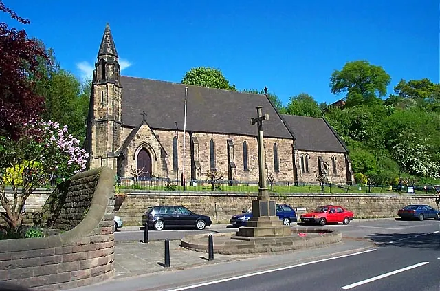
© Garth Newton · Geograph · CC BY-SA 2.0
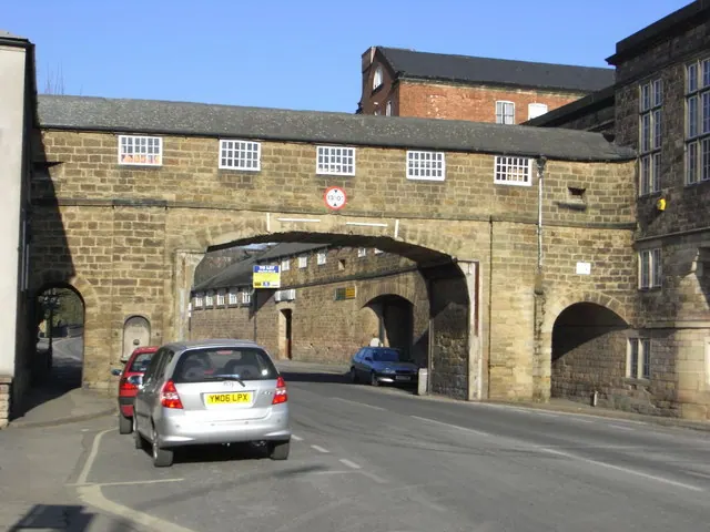
© Chris Allen · Geograph · CC BY-SA 2.0
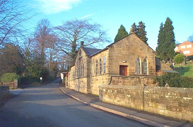
© Garth Newton · Geograph · CC BY-SA 2.0
Images © their respective photographers, licensed under CC BY-SA 2.0 and reused here with attribution. Photographs depict listed buildings, churches and monuments near this settlement and may show neighbouring villages.
Data derived from the Open Domesday project (opendomesday.org), based on the Domesday Book dataset compiled by Professor J.J.N. Palmer and team. The Domesday Book (1086) is in the public domain.
Found an inaccuracy? [email protected]