Middlewich in the Domesday Book (1086)
Middlewich appears in the Domesday Book of 1086, entered under the hundred of Middlewich in Cheshire.
Other Settlements in Middlewich
- Alsager
- Bostock
- Brereton
- Byley
- Clive
- Congleton
- Croxton
- Davenham
- Davenport
- Goostrey
- Hassall
- Kinderton
- Lach [Dennis]
- Leftwich
The Meaning of the Name
The name Middlewich is of Anglo-Saxon origin. Its final element derives from the Old English word wīc, a dwelling or (in Cheshire) a salt-working settlement, while the first element appears to represent the middle. Taken together the name probably meant something close to ’the middle salt town’.
Remarkably, the name has changed little since 1086, when the Domesday scribes wrote it as Middlewich.
Listed Buildings Near Middlewich
Historic England records 38 listed buildings within about a mile of Middlewich. Listing protects structures of special architectural or historic interest, graded I (exceptional), II* (particularly important) and II.
Grade II*
- Church of St Michael and All Angels - 0.3 km
- Kinderton Hall - 0.56 km
- 64, St Ann’s Road - 0.7 km
Grade II
- Kinderton Mill - 0.15 km
- Sundial South of West Bay of Church of St Michael and All Angels - 0.3 km
- 10, Hightown - 0.34 km
- 25, Queen Street - 0.42 km
- 28, Wheelock Street - 0.42 km
- 33 and 33A, Lewin Street - 0.43 km
- Trent and Mersey Canal, Three Locks and Two Intermediate Basins, With Dry Dock Off Upper Basin - 0.43 km
- Trent and Mersey Canal, Big Lock and Footbridge - 0.57 km
- Canal Stables and Sawpit House - 0.58 km
- 8, Southway - 0.58 km
- Trent and Mersey Canal, House and Attached Canal Office - 0.58 km
- Trent and Mersey Canal, Canal Milepost at Ngr 7064 6585 - 0.59 km
- Brunner Mond Middlewich War Memorial - 0.65 km
- 62, St Ann’s Road - 0.7 km
- Cooke Family Tomb in Middlewich Cemetery Circa 80 Metres South of Mortuary Chapels - 0.71 km
- 66, St Ann’s Road - 0.71 km
- Newton Old Hall - 0.71 km
- Mortuary Chapels Archway and Spire in Middlewich Cemetery - 0.71 km
- Well in Rear Garden of Number 3 (Newton Old Hall) - 0.72 km
- Newton Hall - 0.72 km
- Gates and Railings to Middlewich Cemetery - 0.73 km
…and 14 more listed structures in the area.
Scheduled Monuments Near Middlewich
Scheduled monuments are nationally important archaeological sites given legal protection. 3 lie within roughly a mile of Middlewich:
- Murgatroyd’s Brine Works - 0.55 km
- Kinderton Hall moated site, two annexes, five fishponds, garden and prospect mound - 0.6 km
- King Street Roman fort, Harbutt’s Field - 0.61 km
Middlewich Today
Today Middlewich lies within the administrative area of Cheshire East, and the settlement recorded a population of 14,416 at the 2021 census. Nine and a half centuries separate that figure from the small rural community the Domesday survey recorded here in 1086.
Read more about modern Middlewich on Wikipedia .
Nearby Domesday Settlements
Other places recorded in the 1086 survey within a few miles:
Heritage Around Middlewich
Photographs of churches, listed buildings and monuments in the vicinity, contributed by volunteers to the Geograph project and reused here under a Creative Commons licence.
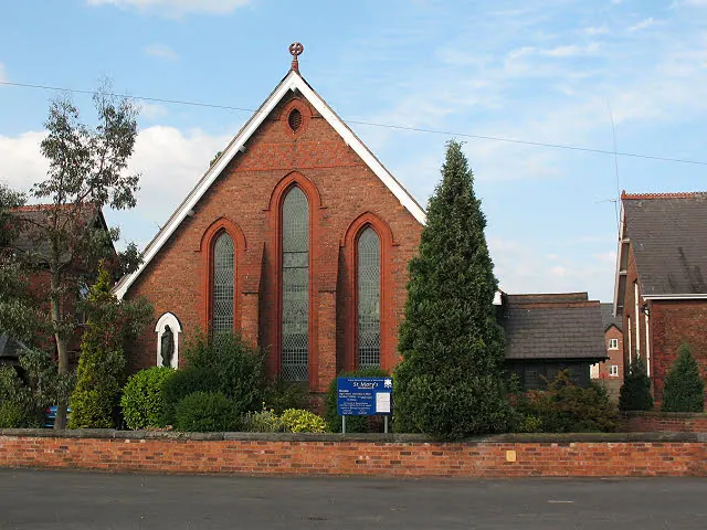
© Stephen Craven · Geograph · CC BY-SA 2.0
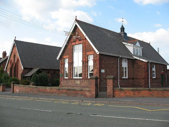
© Stephen Craven · Geograph · CC BY-SA 2.0
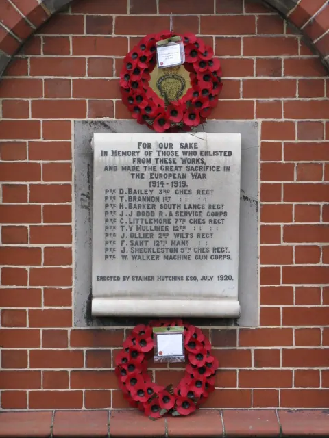
© Peter Whatley · Geograph · CC BY-SA 2.0
Images © their respective photographers, licensed under CC BY-SA 2.0 and reused here with attribution. Photographs depict listed buildings, churches and monuments near this settlement and may show neighbouring villages.
Data derived from the Open Domesday project (opendomesday.org), based on the Domesday Book dataset compiled by Professor J.J.N. Palmer and team. The Domesday Book (1086) is in the public domain.
Found an inaccuracy? [email protected]