Middleton Hall in the Domesday Book (1086)
The 1086 Domesday survey records the settlement of Middleton Hall, entered under the hundred of Amounderness in Yorkshire.
Other Settlements in Amounderness
- Aighton
- Aldcliffe
- Aldingham
- Arkholme
- Aschebi
- Ashton [Hall]
- Ashton [on Ribble]
- Austwick
- Barbon
- Bardsea
- Bare
- Barnoldswick
- Barton
- Beetham
The Meaning of the Name
The name Middleton Hall is of Anglo-Saxon origin. Its final element derives from the Old English word tūn, a farmstead or village, while the first element appears to represent the middle. Taken together the name probably meant something close to ’the middle farmstead’.
Remarkably, the name has changed little since 1086, when the Domesday scribes wrote it as Middleton Hall.
Listed Buildings Near Middleton Hall
Historic England records 19 listed buildings within about a mile of Middleton Hall. Listing protects structures of special architectural or historic interest, graded I (exceptional), II* (particularly important) and II.
Grade II*
- Curtain Wall to West and North West and Barn to North West of Middleton Hall - 0.09 km
- Curtain Wall to South-west of Middleton Hall - 0.1 km
- Middleton Hall - 0.11 km
- Outbuilding Adjoining North East Angle of Middleton Hall and Adjoining Wall - 0.11 km
- Hallbeck - 1.05 km
Grade II
- Milestone at Sd 625 879 - 0.45 km
- Barn to North-east of Swan Inn - 0.88 km
- House to North of Beck Side Farm - 1.03 km
- Low Hallbeck - 1.03 km
- Barn Approximately 100M to East of Hallbeck - 1.03 km
- Bridge to North-east of Low Hallbeck - 1.04 km
- House to North West of Beck Side Farm - 1.04 km
- Barn to North West of Beck Side Farm - 1.04 km
- Barn to North of Beck Side Farm - 1.05 km
- Outbuilding Approximately 30M to North-east of Low Hallbeck - 1.05 km
- Barn Immediately West of Hallbeck - 1.06 km
- Barn to South-west of High Hallbeck Cottage - 1.16 km
- High Hallbeck Cottage - 1.17 km
- High Hallbeck - 1.17 km
Scheduled Monuments Near Middleton Hall
Scheduled monuments are nationally important archaeological sites given legal protection. 3 lie within roughly a mile of Middleton Hall:
- Middleton Hall, curtain wall with gatehouse - 0.09 km
- Saucer barrow, 350m east of Middleton Hall - 0.49 km
- High Stockdale Bridge - 0.64 km
Middleton Hall Today
Today Middleton Hall lies within the administrative area of South Lakeland, and the settlement recorded a population of 110 at the 2021 census. Nine and a half centuries separate that figure from the small rural community the Domesday survey recorded here in 1086.
Read more about modern Middleton on Wikipedia .
Nearby Domesday Settlements
Other places recorded in the 1086 survey within a few miles:
- Barbon - 5.1 km S
- Sedbergh - 5.8 km NE
- Mansergh - 5.8 km SW
- Old Hutton - 6.1 km W
- Casterton - 8.0 km S
- Kirkby Lonsdale - 8.1 km S
Heritage Around Middleton [Hall]
Photographs of churches, listed buildings and monuments in the vicinity, contributed by volunteers to the Geograph project and reused here under a Creative Commons licence.
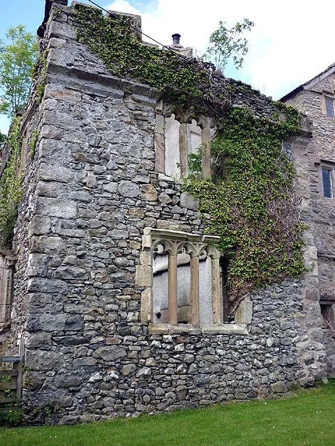
© Karl and Ali · Geograph · CC BY-SA 2.0
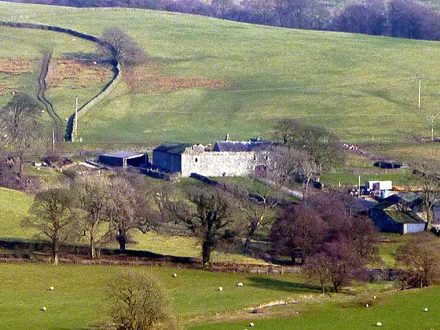
© Karl and Ali · Geograph · CC BY-SA 2.0
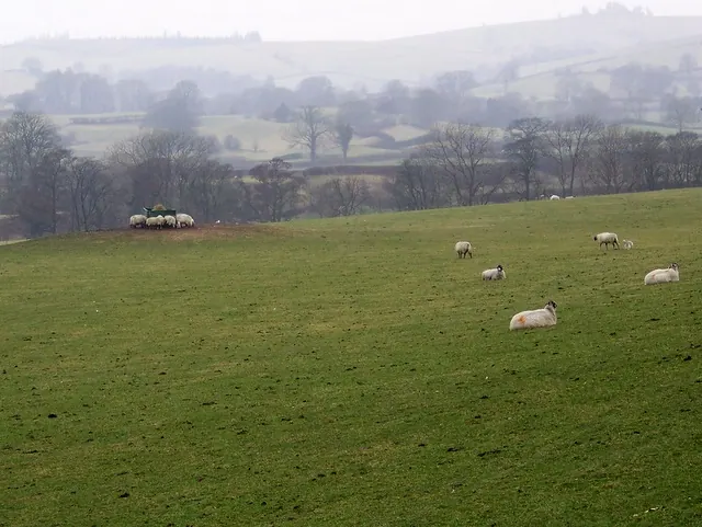
© Maigheach-gheal · Geograph · CC BY-SA 2.0
Images © their respective photographers, licensed under CC BY-SA 2.0 and reused here with attribution. Photographs depict listed buildings, churches and monuments near this settlement and may show neighbouring villages.
Data derived from the Open Domesday project (opendomesday.org), based on the Domesday Book dataset compiled by Professor J.J.N. Palmer and team. The Domesday Book (1086) is in the public domain.
Found an inaccuracy? [email protected]