Middlethorpe in the Domesday Book (1086)
Middlethorpe appears in the Domesday Book of 1086, entered under the hundred of Ainsty in Yorkshire.
Other Settlements in Ainsty
- Acaster [Malbis]
- Acaster [Selby]
- Acomb
- Appleton [Roebuck]
- Askham [Bryan]
- Askham [Richard]
- Bickerton
- Bilbrough
- Bilton
- Bishopthorpe
- Bithen
- Bolton [Percy]
- Catterton
- Colton
The Meaning of the Name
The name Middlethorpe is of Scandinavian origin. Its final element derives from the Old Norse word þorp, an outlying or secondary farmstead, while the first element appears to represent the middle. Taken together the name probably meant something close to ’the middle outlying farm’.
Names of this type are a fingerprint of Scandinavian settlement: they cluster across the old Danelaw, where Norse-speaking settlers renamed or founded villages from the late 9th century onward.
Remarkably, the name has changed little since 1086, when the Domesday scribes wrote it as Middlethorpe.
Listed Buildings Near Middlethorpe
Historic England records 29 listed buildings within about a mile of Middlethorpe. Listing protects structures of special architectural or historic interest, graded I (exceptional), II* (particularly important) and II.
Grade I
- Bishopthorpe Palace and Chapel - 0.66 km
Grade II*
- Middlethorpe Hall - 0.31 km
- The Stables to Bishopthorpe Palace - 0.64 km
- Gatehouse and Walls Adjoining to Bishopthorpe Palace - 0.69 km
Grade II
- Bishopthorpe walled kitchen gardens, their associated brick lean-to buildings and canalised stream - 0.32 km
- Dovecote Approximately 50 Metres South East of Middlethorpe Hall - 0.35 km
- Folly in Grounds of Bishopthorpe Palace - 0.43 km
- Middlethorpe Manor - 0.54 km
- Church of St Andrew - 0.59 km
- Brewsters Cottage and Brewhouse - 0.63 km
- Bishopthorpe Garth - 0.65 km
- War Memorial - 0.67 km
- Sundial Approximately 10 Metres South-east of Bishopthorpe Palace - 0.68 km
- Wall and archway adjoining Bishopthorpe Palace to right - 0.7 km
- Garth Cottage and Garth Mews, Gatehouses to Bishopthorpe Garth - 0.71 km
- Priory Corner - 0.75 km
- Ruined Church of St Andrew - 0.76 km
- Stables, Wall and Gate-piers to the Whitehouse - 0.77 km
- The Whitehouse - 0.78 km
- The Cottage - 0.78 km
- Chestnut Cottage - 0.79 km
- The Chantry - 0.8 km
- The Ebor Inn - 0.85 km
- Fulford Hall - 1.13 km
…and 5 more listed structures in the area.
Middlethorpe Today
Today Middlethorpe lies within the administrative area of Bishopthorpe.
Read more about modern Middlethorpe on Wikipedia .
Nearby Domesday Settlements
Other places recorded in the 1086 survey within a few miles:
- Bithen - 0.0 km N
- Water Fulford - 1.0 km E
- Bishopthorpe - 1.0 km S
- Mulede - 1.0 km S
- Mulehale - 1.0 km S
- Mulhede - 1.0 km S
Heritage Around [Middle]thorpe
Photographs of churches, listed buildings and monuments in the vicinity, contributed by volunteers to the Geograph project and reused here under a Creative Commons licence.
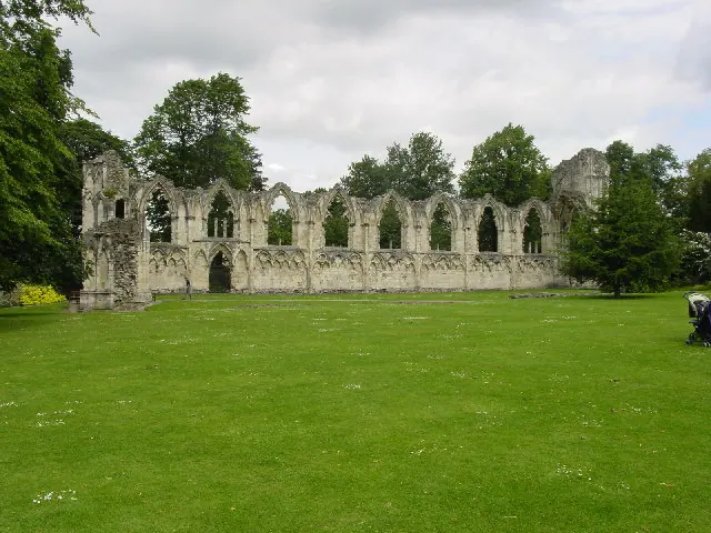
© Lyall Duffus · Geograph · CC BY-SA 2.0
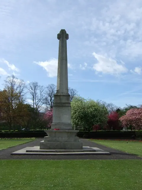
© Stanley Howe · Geograph · CC BY-SA 2.0
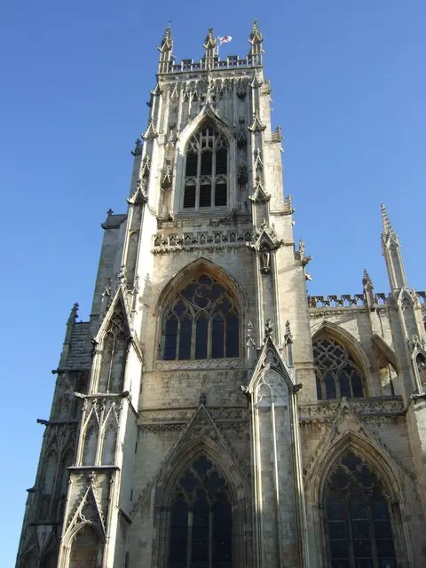
© Stanley Howe · Geograph · CC BY-SA 2.0
Images © their respective photographers, licensed under CC BY-SA 2.0 and reused here with attribution. Photographs depict listed buildings, churches and monuments near this settlement and may show neighbouring villages.
Data derived from the Open Domesday project (opendomesday.org), based on the Domesday Book dataset compiled by Professor J.J.N. Palmer and team. The Domesday Book (1086) is in the public domain.
Found an inaccuracy? [email protected]