Meltham in the Domesday Book (1086)
The 1086 Domesday survey records the settlement of Meltham, entered under the hundred of Agbrigg in Yorkshire.
Other Settlements in Agbrigg
- Ackton
- Almondbury
- Austonley
- Bradley
- Cartworth
- Crigglestone
- Crofton
- Dalton
- Emley
- Farnley [Tyas]
- Flockton
- Fulstone
- Golcar
- Hepworth
The Meaning of the Name
The name Meltham is of Anglo-Saxon origin. Its final element derives from the Old English word hām, a homestead or village. The first element is most likely a personal name or an early descriptive term, now difficult to recover with certainty. Taken together the name probably meant something close to ‘a homestead’.
Remarkably, the name has changed little since 1086, when the Domesday scribes wrote it as Meltham.
Listed Buildings Near Meltham
Historic England records 46 listed buildings within about a mile of Meltham. Listing protects structures of special architectural or historic interest, graded I (exceptional), II* (particularly important) and II.
Grade II
- Bank Buildings - 0.22 km
- Meltham Hall - 0.27 km
- 19 and 21, Thick Hollins Road - 0.3 km
- 13-17, Thick Hollins Road - 0.3 km
- Well Head in Grounds of Meltham Hall - 0.33 km
- Old Milestone at Junction With Holmfirth Road - 0.35 km
- 110-120, Huddersfield Road - 0.4 km
- 96, 98 and 100, Huddersfield Road - 0.44 km
- 68, 70 and 72, Huddersfield Road - 0.45 km
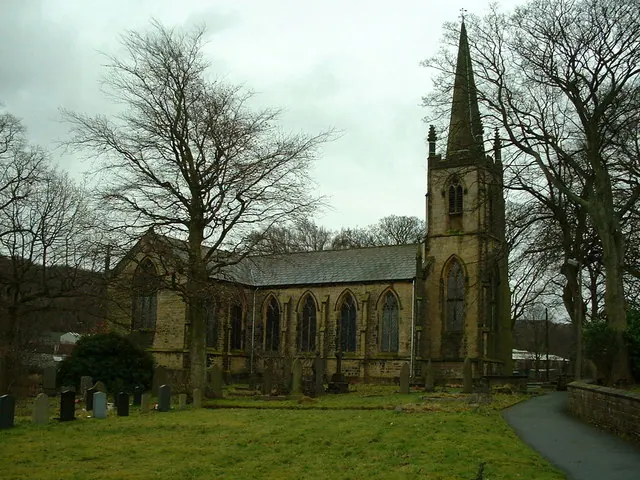
- Church of St James - 0.46 km
- 55-61, Huddersfield Road - 0.56 km
- 53, Huddersfield Road - 0.58 km
- Guide Stoop Junction With Wilshaw Road - 0.58 km
- 18 and 20, Holmfirth Road - 0.6 km
- Kissing Gate and Gate Piers at Mid Point of Footpath Number 44 - 0.67 km
- Kissing Gate and Gate Piers at Junction With Footpath Number 44 - 0.68 km
- Church of St Bartholomew - 0.68 km
- 23 and 25, Greens End Road - 0.73 km
- Heady Fields Houses and Attached Barns - 0.75 km
- 1, Mean Lane - 0.75 km
- 8, 10 and 18, Slaithwaite Road - 0.83 km
- Boundary Stone Adjacent to Office Block to Bent Ley Mills - 0.87 km
- Bent Ley Mill - 0.87 km
- 5, Sefton Lane - 0.88 km
…and 22 more listed structures in the area.
Scheduled Monuments Near Meltham
Scheduled monuments are nationally important archaeological sites given legal protection. 1 lies within roughly a mile of Meltham:
Meltham Today
Today Meltham lies within the administrative area of Kirklees, and the settlement recorded a population of 9,012 at the 2021 census. Nine and a half centuries separate that figure from the small rural community the Domesday survey recorded here in 1086.
Read more about modern Meltham on Wikipedia .
Nearby Domesday Settlements
Other places recorded in the 1086 survey within a few miles:
- South Crosland - 2.2 km NE
- Upperthong - 2.8 km SE
- Austonley - 3.2 km S
- Honley - 3.6 km NE
- Cartworth - 5.0 km SE
- Holme - 5.0 km S
Heritage Around Meltham
Photographs of churches, listed buildings and monuments in the vicinity, contributed by volunteers to the Geograph project and reused here under a Creative Commons licence.
© Nigel Homer · Geograph · CC BY-SA 2.0

© Humphrey Bolton · Geograph · CC BY-SA 2.0

© Humphrey Bolton · Geograph · CC BY-SA 2.0
Images © their respective photographers, licensed under CC BY-SA 2.0 and reused here with attribution. Photographs depict listed buildings, churches and monuments near this settlement and may show neighbouring villages.
Data derived from the Open Domesday project (opendomesday.org), based on the Domesday Book dataset compiled by Professor J.J.N. Palmer and team. The Domesday Book (1086) is in the public domain.
Found an inaccuracy? [email protected]