Melmerby in the Domesday Book (1086)
The 1086 Domesday survey records the settlement of Melmerby, entered under the hundred of Land of Count Alan in Yorkshire.
Other Settlements in Land of Count Alan
- Achebi
- Agglethorpe
- Ainderby [Mires]
- Ainderby [Quernhow]
- Aiskew
- Aldbrough
- Allerthorpe [Hall]
- Ascam
- Ascham
- Asebi
- Aske [Hall]
- Askrigg
- Aysgarth
- Baldersby
The Meaning of the Name
The name Melmerby is of Scandinavian origin. Its final element derives from the Old Norse word bý, a farmstead or village. The first element is most likely a personal name or an early descriptive term, now difficult to recover with certainty. Taken together the name probably meant something close to ‘a farmstead’.
Names of this type are a fingerprint of Scandinavian settlement: they cluster across the old Danelaw, where Norse-speaking settlers renamed or founded villages from the late 9th century onward.
Remarkably, the name has changed little since 1086, when the Domesday scribes wrote it as Melmerby.
Listed Buildings Near Melmerby
Historic England records 16 listed buildings within about a mile of Melmerby. Listing protects structures of special architectural or historic interest, graded I (exceptional), II* (particularly important) and II.
Grade II
- Old Farmhouse - 0.05 km
- Manor House and Stable Range to Rear Right - 0.06 km
- Hillside Farmhouse With Attached Outbuildings - 0.09 km
- Barn Approximately 30 Metres to North-west of Mile House West (At Ngr 0768 8533) - 0.17 km
- Hall Garth Farmhouse With Attached Outbuilding - 0.19 km
- Town Foot Farmhouse - 0.71 km
- Pear Tree House - 0.91 km
- Ghyll Farmhouse - 0.97 km
- Clovelley Dene - 0.99 km
- House to West of Clovelley Dene - 1.0 km
- Coverley Farmhouse, Dale View and Railings - 1.1 km
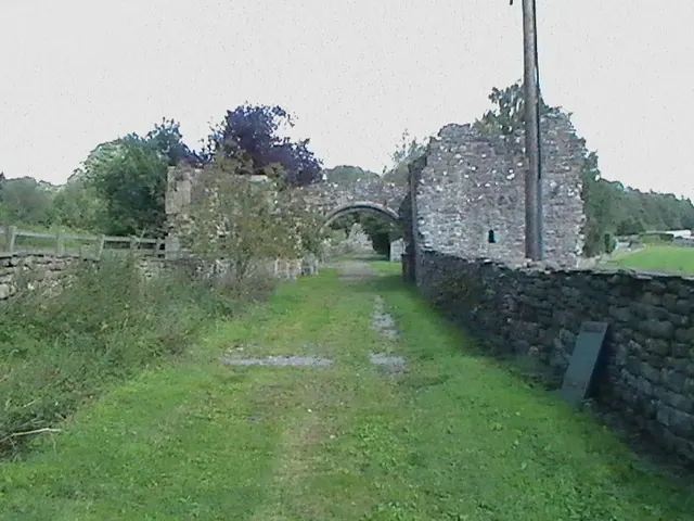
- St Simon’s Chapel Ruins - 1.13 km
- Lime-kiln Approximately 15 Metres South-east of St Simon’s Chapel Ruins - 1.16 km
- Foresters Arms Inn - 1.18 km
- Seaton House - 1.26 km
- Crag View - 1.27 km
Melmerby Today
Today Melmerby lies within the administrative area of Richmondshire, and the settlement recorded a population of 37 at the 2021 census. Nine and a half centuries separate that figure from the small rural community the Domesday survey recorded here in 1086.
Read more about modern Melmerby on Wikipedia .
Nearby Domesday Settlements
Other places recorded in the 1086 survey within a few miles:
- Agglethorpe - 1.4 km NE
- Carlton - 1.4 km SW
- Caldbergh - 2.0 km E
- West Scrafton - 2.0 km S
- Coverham - 3.2 km E
- West Witton - 3.2 km N
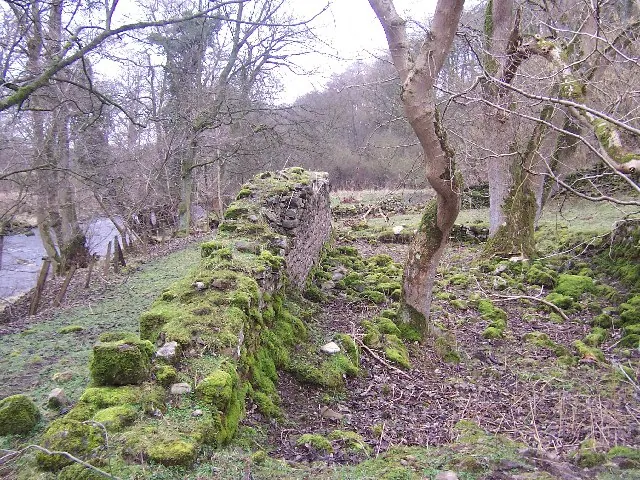
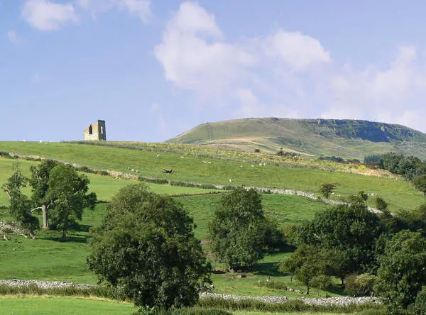
Heritage Around Melmerby
Photographs of churches, listed buildings and monuments in the vicinity, contributed by volunteers to the Geograph project and reused here under a Creative Commons licence.
© Chris Heaton · Geograph · CC BY-SA 2.0
© Anthony Harrison · Geograph · CC BY-SA 2.0
© BC · Geograph · CC BY-SA 2.0
Images © their respective photographers, licensed under CC BY-SA 2.0 and reused here with attribution. Photographs depict listed buildings, churches and monuments near this settlement and may show neighbouring villages.
Location
54.2649°N, -1.8848°W · Land of Count Alan hundred, Yorkshire
View larger map on OpenStreetMap →Data derived from the Open Domesday project (opendomesday.org), based on the Domesday Book dataset compiled by Professor J.J.N. Palmer and team. The Domesday Book (1086) is in the public domain.
Found an inaccuracy? [email protected]