Martin Garth in the Domesday Book (1086)
The 1086 Domesday survey records the settlement of Martin Garth, entered under the hundred of Dic in Yorkshire.
Other Settlements in Dic
- Aislaby
- Allerston
- Appleton [le Moors]
- Aschelesmersc
- Aschilesmares
- Barton [le Street]
- Baschebi
- Baschesbi
- Brompton
- Burniston
- Burton [Dale]
- Cawthorn
- Cayton
- Chigogemers
The Meaning of the Name
The origin of the name Martin Garth is not securely established from its modern form alone; like many settlement names in the North it likely combines an Old English or Old Norse personal name with a landscape term.
Remarkably, the name has changed little since 1086, when the Domesday scribes wrote it as Martin Garth.
Listed Buildings Near Martin Garth
Historic England records 27 listed buildings within about a mile of Martin Garth. Listing protects structures of special architectural or historic interest, graded I (exceptional), II* (particularly important) and II.
Grade I
- Church of St Matthew - 0.8 km
Grade II*
- All Saints Church - 1.09 km
Grade II
- Pinfold - 0.55 km
- Martin Garth - 0.69 km
- West End Farmhouse - 0.69 km
- The Holt - 0.71 km
- Manor Farmhouse - 0.72 km
- Village Hall and Attached House - 0.76 km
- Outbuilding Approximately 10 Metres North of Cairnsmore - 0.78 km
- The Forge and Attached Outbuildings - 0.8 km
- Churchyard Cross Approximately 2 Metres South of Porch of Church of St Matthew - 0.8 km
- Church Lane Cottage - 0.81 km
- Home Farmhouse - 0.82 km
- The Old Road House - 0.84 km
- The Kennels - 0.89 km
- Bay Nigg - 0.9 km
- Pasture Cottage - 0.96 km
- North House and Attached Outbuildings - 1.02 km
- Icehouse Approximately 15 Metres North of All Saints Church - 1.07 km
- Bridge - 1.1 km
- Church Lychgate - 1.12 km
- The Downe Arms - 1.14 km
- School and Attached School House - 1.14 km
- 40 and 41, Wykeham Village - 1.16 km
…and 3 more listed structures in the area.
Nearby Domesday Settlements
Other places recorded in the 1086 survey within a few miles:
- Hutton Buscel - 1.0 km E
- Preston Hill - 1.0 km E
- Wykeham - 1.0 km S
- Ruston - 1.4 km SW
- Newton - 2.0 km E
- West Ayton - 2.0 km E
Heritage Around Martin [Garth]
Photographs of churches, listed buildings and monuments in the vicinity, contributed by volunteers to the Geograph project and reused here under a Creative Commons licence.
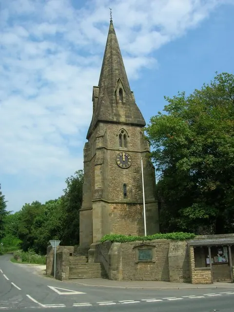
© JThomas · Geograph · CC BY-SA 2.0
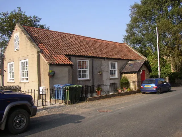
© Humphrey Bolton · Geograph · CC BY-SA 2.0
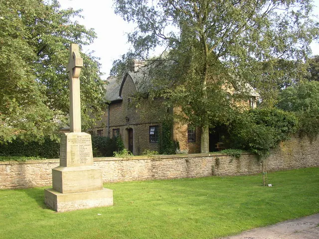
© Humphrey Bolton · Geograph · CC BY-SA 2.0
Images © their respective photographers, licensed under CC BY-SA 2.0 and reused here with attribution. Photographs depict listed buildings, churches and monuments near this settlement and may show neighbouring villages.
Data derived from the Open Domesday project (opendomesday.org), based on the Domesday Book dataset compiled by Professor J.J.N. Palmer and team. The Domesday Book (1086) is in the public domain.
Found an inaccuracy? [email protected]