Marske by the Sea in the Domesday Book (1086)
Marske by the Sea is named in the Domesday Book, compiled by Norman commissioners in 1086, entered under the hundred of Langbaurgh in Yorkshire.
Other Settlements in Langbaurgh
- Acklam
- Airy [Holme]
- Aislaby
- Arnodestorp
- Baldebi
- Barnaby
- Barwick
- Battersby
- Bergolbi
- Berguluesbi
- Blaten [Carr]
- Borrowby
- Breck
- Brotton
The Meaning of the Name
The origin of the name Marske by the Sea is not securely established from its modern form alone; like many settlement names in the North it likely combines an Old English or Old Norse personal name with a landscape term.
Remarkably, the name has changed little since 1086, when the Domesday scribes wrote it as Marske by the Sea.
Listed Buildings Near Marske by the Sea
Historic England records 31 listed buildings within about a mile of Marske by the Sea. Listing protects structures of special architectural or historic interest, graded I (exceptional), II* (particularly important) and II.
Grade I
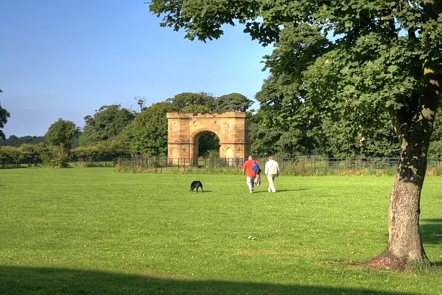
- Marske Hall - 0.33 km
Grade II
- 162, High Street - 0.16 km
- Garage to North East of the Ship Inn - 0.16 km
- K6 Telephone Kiosk Adjacent to Garage to North East of the Ship Inn - 0.16 km
- 2, Church Street - 0.17 km
- 158, High Street - 0.17 km
- The Ship Inn - 0.17 km
- Numbers 151-157 and Attached Walls - 0.19 km
- 145 and 145B, High Street - 0.2 km
- 145A, High Street - 0.2 km
- Tithe Barn - 0.23 km
- Gazebo and Garden Wall - 0.23 km
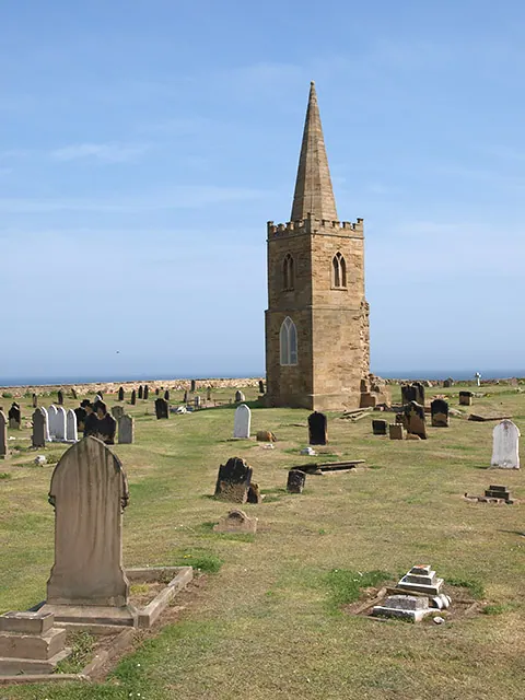
- Church of St Mark - 0.29 km
- Walls Around Grounds of Church of St Mark - 0.31 km
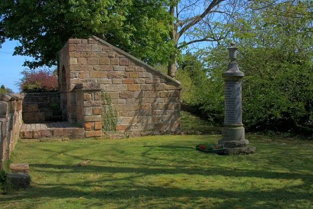
- War Memorial of Church of St Mark With Attached Piers and Linking Chains War Memorial South West of Church of St Mark With Attached Piers and Linking Chains - 0.32 km
- 91A, High Street - 0.33 km
- Garden walls and attached storage buildings to the rear of Marske Hall - 0.33 km
- Storage Building North West of Marske Hall - 0.36 km
- Dovecote Rear of Number 26 With Wall Attached to Gardens of Numbers 26 and 28 (Not Included) - 0.37 km
- Garden Walls in Front of Marske Hall Walls Around Garden in Front of Marske Hall - 0.39 km
- 48, High Street - 0.41 km
- 62 and 64, High Street - 0.42 km
- Numbers 1 and 2 Marske Hall Cottages and Attached Stables - 0.42 km
- Old Church of St Germain - 0.42 km
…and 7 more listed structures in the area.
Scheduled Monuments Near Marske by the Sea
Scheduled monuments are nationally important archaeological sites given legal protection. 1 lies within roughly a mile of Marske by the Sea:
- Manorial settlement, dovecote and fragment of field system, immediately north of Marske Inn Farm - 0.82 km
Marske by the Sea Today
Today Marske by the Sea lies within the administrative area of Saltburn, Marske and New Marske.
Read more about modern Marske-by-the-Sea on Wikipedia .
Nearby Domesday Settlements
Other places recorded in the 1086 survey within a few miles:
- Upleatham - 3.0 km S
- Kirkleatham - 4.1 km W
- Thornton Fields - 4.5 km SW
- Skelton - 4.5 km SE
- Tocketts Farm - 5.4 km SW
- Wilton - 5.8 km SW
Heritage Around Marske [by the Sea]
Photographs of churches, listed buildings and monuments in the vicinity, contributed by volunteers to the Geograph project and reused here under a Creative Commons licence.
© Stephen McCulloch · Geograph · CC BY-SA 2.0
© Mick Garratt · Geograph · CC BY-SA 2.0
© Mick Garratt · Geograph · CC BY-SA 2.0
Images © their respective photographers, licensed under CC BY-SA 2.0 and reused here with attribution. Photographs depict listed buildings, churches and monuments near this settlement and may show neighbouring villages.
Data derived from the Open Domesday project (opendomesday.org), based on the Domesday Book dataset compiled by Professor J.J.N. Palmer and team. The Domesday Book (1086) is in the public domain.
Found an inaccuracy? [email protected]