Manchester in the Domesday Book (1086)
Manchester appears in the Domesday Book of 1086, entered under the hundred of Salford in Cheshire. The survey assessed Manchester at 9 carucates of taxable land.
At the time of the survey, Manchester supported a recorded population of 22 villagers, 5 smallholders, 5 slaves, working 13 ploughs between them.
The numbers record a sharp fall. Before 1066, Manchester was worth 9 shillings; by 1086 that had dropped to 7 shillings – a fall of 22%. Most Yorkshire villages that lost value on this scale were swept up in the Harrying of the North – William’s scorched-earth campaign of 1069–70.
Resources Recorded at Manchester (1086)
- Mills: 1 mill (valued at 5d)
- Meadow: 5 acres
Other Settlements in Salford
The Meaning of the Name
The name Manchester is of Anglo-Saxon origin. Its final element derives from the Old English word ceaster (from Latin castra), a Roman fort or walled town. The first element is most likely a personal name or an early descriptive term, now difficult to recover with certainty. Taken together the name probably meant something close to ‘a Roman fort’.
Remarkably, the name has changed little since 1086, when the Domesday scribes wrote it as Manchester.
Listed Buildings Near Manchester
Historic England records 481 listed buildings within about a mile of Manchester. Listing protects structures of special architectural or historic interest, graded I (exceptional), II* (particularly important) and II.
Grade I
- Church of St Ann - 0.22 km
Grade II*
- Bartons Building Including Barton Arcade - 0.15 km
Grade II
- National Buildings - 0.03 km
- Arkwright House - 0.05 km
- 3 St Mary’s Parsonage - 0.09 km
- Nos. 98-116, DEANSGATE - 0.11 km
- 31 and 33 King Street West, including 3 Smithy Lane - 0.12 km
- Haywards Building - 0.13 km
- Blackfriars Bridge - 0.14 km
- The Crown Tavern - 0.16 km
- 4-14, KING STREET (See details for further address information) - 0.19 km
- Nos. 18 AND 20, ST ANNS SQUARE - 0.19 km
- No. 22, ST ANN’S SQUARE - 0.19 km
- No. 16, ST ANN’S SQUARE - 0.19 km
- 15 and 17 King Street - 0.19 km
- 14 and 16, Blackfriars Street - 0.19 km
- 19, King Street - 0.2 km
- War Memorial (Boer War) - 0.21 km
- Cobden Statue - 0.21 km
- 10 and 12, Blackfriars Street - 0.21 km
- Masonic Temple - 0.22 km
- Sawyers Arms Public House - 0.22 km
- 28, King Street - 0.22 km
- Old Exchange - 0.23 km
…and 457 more listed structures in the area.
Scheduled Monuments Near Manchester
Scheduled monuments are nationally important archaeological sites given legal protection. 2 lie within roughly a mile of Manchester:
- The Hanging Bridge immediately south of Manchester Cathedral - 0.34 km
- Remains of eastern wall of the Roman fort - 0.94 km
Manchester Today
Today Manchester lies within the administrative area of Salford.
Read more about modern Greengate on Wikipedia .
Nearby Domesday Settlements
Other places recorded in the 1086 survey within a few miles:
- Salford - 1.0 km W
- Baguley - 8.2 km S
- Northenden - 9.0 km S
- Ashton -under-Lyne - 10.0 km E
- Radcliffe - 10.3 km NW
- Cheadle - 10.8 km S
Heritage Around Manchester
Photographs of churches, listed buildings and monuments in the vicinity, contributed by volunteers to the Geograph project and reused here under a Creative Commons licence.
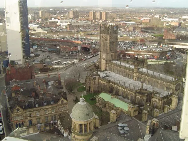
© D Williams · Geograph · CC BY-SA 2.0
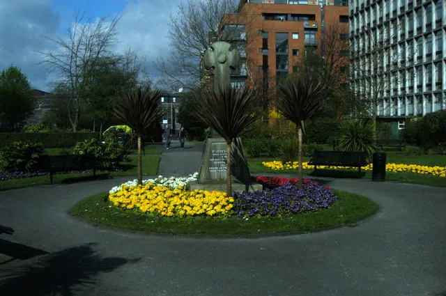
© R lee · Geograph · CC BY-SA 2.0
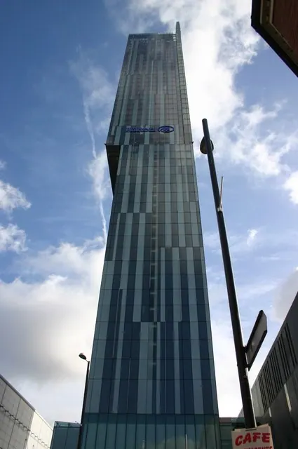
© R lee · Geograph · CC BY-SA 2.0
Images © their respective photographers, licensed under CC BY-SA 2.0 and reused here with attribution. Photographs depict listed buildings, churches and monuments near this settlement and may show neighbouring villages.
Data derived from the Open Domesday project (opendomesday.org), based on the Domesday Book dataset compiled by Professor J.J.N. Palmer and team. The Domesday Book (1086) is in the public domain.
Found an inaccuracy? [email protected]