Lonton in the Domesday Book (1086)
Lonton appears in the Domesday Book of 1086, entered under the hundred of Land of Count Alan in Yorkshire.
Other Settlements in Land of Count Alan
- Achebi
- Agglethorpe
- Ainderby [Mires]
- Ainderby [Quernhow]
- Aiskew
- Aldbrough
- Allerthorpe [Hall]
- Ascam
- Ascham
- Asebi
- Aske [Hall]
- Askrigg
- Aysgarth
- Baldersby
The Meaning of the Name
The name Lonton is of Anglo-Saxon origin. Its final element derives from the Old English word tūn, a farmstead or village. The first element is most likely a personal name or an early descriptive term, now difficult to recover with certainty. Taken together the name probably meant something close to ‘a farmstead’.
Remarkably, the name has changed little since 1086, when the Domesday scribes wrote it as Lonton.
Listed Buildings Near Lonton
Historic England records 26 listed buildings within about a mile of Lonton. Listing protects structures of special architectural or historic interest, graded I (exceptional), II* (particularly important) and II.
Grade II*
- Middleton Bridge - 1.21 km
- Middleton Bridge - 1.21 km
Grade II
- The Old Vicarage - 0.42 km
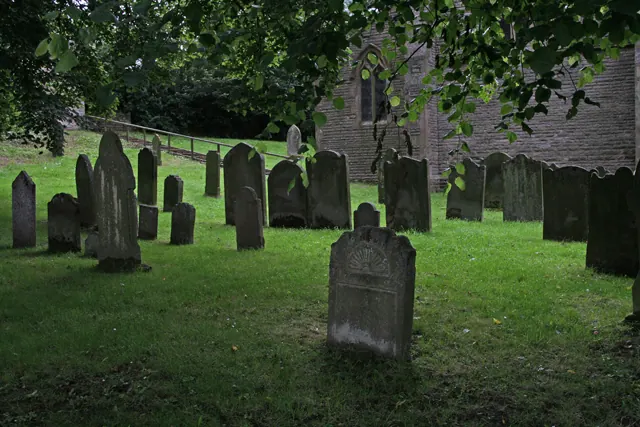
- Byre House, 10 Metres East of East End of Laithkirk Church - 0.44 km
- Laithkirk Church - 0.45 km
- Lune Railway Viaduct - 0.52 km
- Lune Bridge - 0.54 km
- Westfield House - 0.61 km
- Garden Wall and Gate Piers in Front of Westfield House - 0.64 km
- Former Farmhouse and Stable Range, 20 Metres North of Step Ends Farmhouse - 0.85 km
- Bowbank House and Attached Wing - 0.93 km
- Tap Housing Circa 10 Metres West of Number 8 - 0.94 km
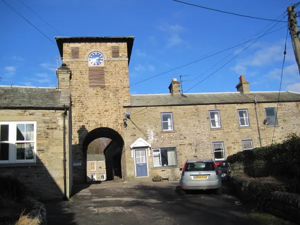
- Archway - 1.0 km
- 16, Town End - 1.01 km
- House and Wall Adjacent to Masterman Place Arch - 1.02 km
- 33, Town End - 1.02 km
- 1,2 and 3, Masterman Place - 1.04 km
- Gates, Piers and Walls South of Former Methodist Chapel - 1.09 km
- Former Chapel With Front Walls and Steps - 1.1 km
- Milestone 200 Metres East of Track to Stanhope Gate - 1.15 km
- Barn, 5 Metres West of Rosedene - 1.16 km
- Rosedene - 1.17 km
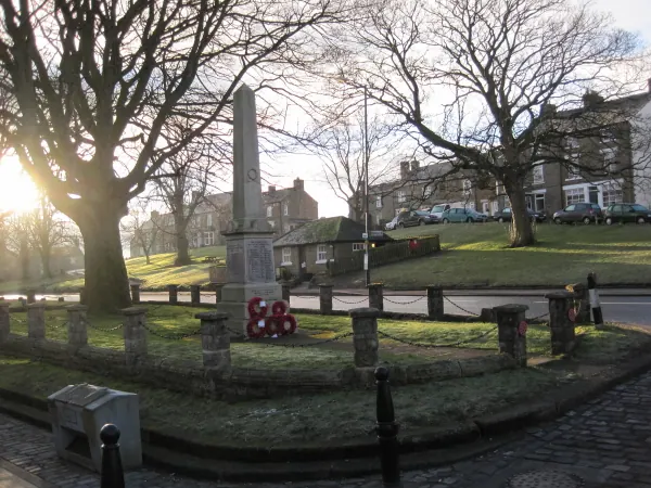
- Middleton-in-Teesdale War Memorial - 1.21 km
- Bainbridge Memorial Fountain - 1.26 km
…and 2 more listed structures in the area.
Lonton Today
Today Lonton lies within the administrative area of Holwick.
Nearby Domesday Settlements
Other places recorded in the 1086 survey within a few miles:
- Mickleton - 1.4 km SE
- Hunderthwaite - 4.2 km SE
- Romaldkirk - 4.5 km SE
- Cotherstone - 7.8 km SE
- Lartington - 9.9 km SE
Heritage Around Lonton
Photographs of churches, listed buildings and monuments in the vicinity, contributed by volunteers to the Geograph project and reused here under a Creative Commons licence.
© Les Hull · Geograph · CC BY-SA 2.0
© Helen Wilkinson · Geograph · CC BY-SA 2.0
© Les Hull · Geograph · CC BY-SA 2.0
Images © their respective photographers, licensed under CC BY-SA 2.0 and reused here with attribution. Photographs depict listed buildings, churches and monuments near this settlement and may show neighbouring villages.
Location
54.6155°N, -2.0697°W · Land of Count Alan hundred, Yorkshire
View larger map on OpenStreetMap →Data derived from the Open Domesday project (opendomesday.org), based on the Domesday Book dataset compiled by Professor J.J.N. Palmer and team. The Domesday Book (1086) is in the public domain.
Found an inaccuracy? [email protected]