Lockton in the Domesday Book (1086)
Lockton appears in the Domesday Book of 1086, entered under the hundred of Dic in Yorkshire.
Other Settlements in Dic
- Aislaby
- Allerston
- Appleton [le Moors]
- Aschelesmersc
- Aschilesmares
- Barton [le Street]
- Baschebi
- Baschesbi
- Brompton
- Burniston
- Burton [Dale]
- Cawthorn
- Cayton
- Chigogemers
The Meaning of the Name
The name Lockton is of Anglo-Saxon origin. Its final element derives from the Old English word tūn, a farmstead or village. The first element is most likely a personal name or an early descriptive term, now difficult to recover with certainty. Taken together the name probably meant something close to ‘a farmstead’.
Remarkably, the name has changed little since 1086, when the Domesday scribes wrote it as Lockton.
Listed Buildings Near Lockton
Historic England records 19 listed buildings within about a mile of Lockton. Listing protects structures of special architectural or historic interest, graded I (exceptional), II* (particularly important) and II.
Grade II*
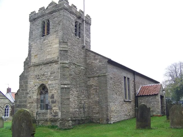
- Church of Saint Giles - 0.56 km
Grade II
- Manor Farmhouse - 0.49 km
- West View Farmhouse and Attached Wall and Railings to Front - 0.54 km
- Greystone House Greystones Cottage - 0.54 km
- Cherry Tree Farmhouse - 0.55 km
- Mount Cottage, Attached Steps and Ramped Up Wall to Front; Attached Workshop - 0.59 km
- Grange Farmhouse - 0.6 km
- Ivy Cottage - 0.61 km
- Opicana - 0.61 km
- Village Well - 0.61 km
- Box Tree Farmhouse and Box Tree Cottage - 0.63 km
- Blacksmith’s Cottage Holmlea the Haven - 0.63 km
- K6 Telephone Kiosk - 0.64 km
- Farmbuilding Approximately One Metre to West of Box Tree Farmhouse - 0.65 km
- Village Pound Attached to West of Box Tree Farmbuildings - 0.66 km
- Oak Crag - 0.73 km
- Manor Farmhouse - 1.27 km
- Lowstead Farmhouse - 1.3 km
- Glebe Farmhouse and Attached Railings to Front - 1.3 km
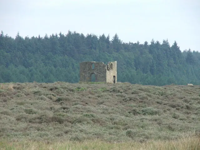
Scheduled Monuments Near Lockton
Scheduled monuments are nationally important archaeological sites given legal protection. 2 lie within roughly a mile of Lockton:
- Six round cairns at Rustif Head, 860m south east of Mount Pleasant Farm - 1.18 km
- Cross dyke on Far Black Rigg, 1060m north west of Black Dale Bridge - 1.58 km
Lockton Today
Today Lockton lies within the administrative area of Ryedale, and the settlement recorded a population of 231 at the 2021 census. Nine and a half centuries separate that figure from the small rural community the Domesday survey recorded here in 1086.
Read more about modern Lockton on Wikipedia .
Nearby Domesday Settlements
Other places recorded in the 1086 survey within a few miles:
- Levisham - 1.0 km W
- Newton - 3.0 km W
- Low Dalby - 3.2 km S
- High Blandsby - 3.6 km SW
- Kingthorpe House - 5.1 km S
- Farmanby - 5.1 km S
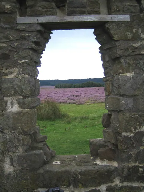
Heritage Around Lockton
Photographs of churches, listed buildings and monuments in the vicinity, contributed by volunteers to the Geograph project and reused here under a Creative Commons licence.
© Maigheach-gheal · Geograph · CC BY-SA 2.0
© Phil Catterall · Geograph · CC BY-SA 2.0
© Steve Partridge · Geograph · CC BY-SA 2.0
Images © their respective photographers, licensed under CC BY-SA 2.0 and reused here with attribution. Photographs depict listed buildings, churches and monuments near this settlement and may show neighbouring villages.
Data derived from the Open Domesday project (opendomesday.org), based on the Domesday Book dataset compiled by Professor J.J.N. Palmer and team. The Domesday Book (1086) is in the public domain.
Found an inaccuracy? [email protected]