Little Woolton in the Domesday Book (1086)
Little Woolton is named in the Domesday Book, compiled by Norman commissioners in 1086, entered under the hundred of [West] Derby in Cheshire.
Other Settlements in [West] Derby
- Ainsdale
- Allerton
- Argarmeles
- Aughton
- Barton
- Bootle
- Childwall
- Dalton
- Downholland
- Formby
- Halsall
- Hurlston
- Huyton
- Ince [Blundell]
The Meaning of the Name
The name Little Woolton is of Anglo-Saxon origin. Its final element derives from the Old English word tūn, a farmstead or village. The first element is most likely a personal name or an early descriptive term, now difficult to recover with certainty. Taken together the name probably meant something close to ‘a farmstead’.
Remarkably, the name has changed little since 1086, when the Domesday scribes wrote it as Little Woolton.
Listed Buildings Near Little Woolton
Historic England records 56 listed buildings within about a mile of Little Woolton. Listing protects structures of special architectural or historic interest, graded I (exceptional), II* (particularly important) and II.
Grade II
- 78 and 80, Halewood Road - 0.56 km
- Gateway to Gateacre Hall Hotel - 0.62 km
- Signpost Opposite Number 66 - 0.71 km
- Kingsley - 0.76 km
- Church of St Stephen - 0.76 km
- Church Cottages - 0.8 km
- Numbers 8 and 9 and Front Garden Wall - 0.8 km
- Church Cottages - 0.8 km
- Numbers 5,6, and 7 and Front Garden Wall - 0.81 km
- 5-9, Halewood Road - 0.81 km
- Numbers 3 and 4 and Front Garden Wall - 0.82 km
- Church Cottages - 0.82 km
- Numbers 1 and 2 and Front Garden Wall - 0.83 km
- The Brown Cow - 0.84 km
- Drinking Fountain - 0.88 km
- Former Clegg’s factory building - 0.88 km
- 42, Gateacre Brow - 0.89 km
- Jubilee Memorial - 0.9 km
- 38 and 40, Gateacre Brow - 0.9 km
- 34, Gateacre Brow - 0.91 km
- 28A, 28B, 28C, 28D, Gateacre Brow - 0.92 km
- The Black Bull Public House - 0.94 km
- Unitarian Chapel - 0.94 km
- 1-7, Grange Lane - 0.96 km
…and 32 more listed structures in the area.
Little Woolton Today
Today Little Woolton lies within the administrative area of Liverpool.
Nearby Domesday Settlements
Other places recorded in the 1086 survey within a few miles:
- Wibaldeslei - 1.0 km W
- Much Woolton - 1.4 km SW
- Allerton - 2.0 km W
- Childwall - 2.2 km NW
- Tarbock - 3.0 km E
- Roby - 4.0 km N
Heritage Around [Little] Woolton
Photographs of churches, listed buildings and monuments in the vicinity, contributed by volunteers to the Geograph project and reused here under a Creative Commons licence.
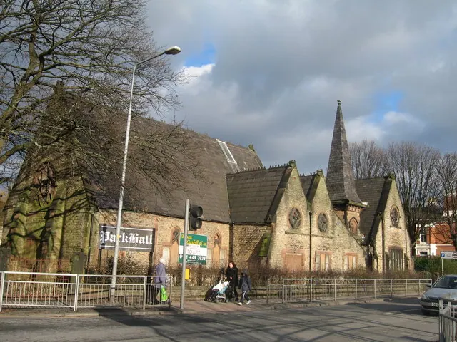
© Sue Adair · Geograph · CC BY-SA 2.0
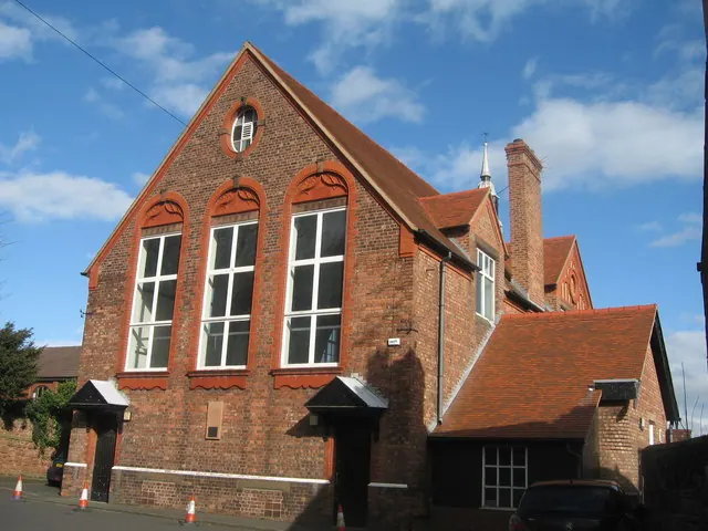
© Sue Adair · Geograph · CC BY-SA 2.0
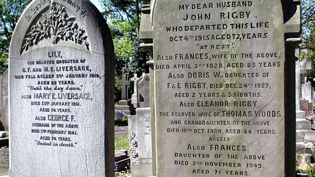
© Peter Tarleton · Geograph · CC BY-SA 2.0
Images © their respective photographers, licensed under CC BY-SA 2.0 and reused here with attribution. Photographs depict listed buildings, churches and monuments near this settlement and may show neighbouring villages.
Data derived from the Open Domesday project (opendomesday.org), based on the Domesday Book dataset compiled by Professor J.J.N. Palmer and team. The Domesday Book (1086) is in the public domain.
Found an inaccuracy? [email protected]