Little Chester in the Domesday Book (1086)
Little Chester is named in the Domesday Book, compiled by Norman commissioners in 1086, entered under the hundred of Morleystone in Derbyshire.
Other Settlements in Morleystone
- Bradley
- Breadsall
- Breaston
- Cellesdene
- Chaddesden
- Codnor
- Crich
- Denby
- Derby
- Draycott
- Duffield
- Hallam
- Heanor
- Herdebi
The Meaning of the Name
The origin of the name Little Chester is not securely established from its modern form alone; like many settlement names in the North it likely combines an Old English or Old Norse personal name with a landscape term.
Remarkably, the name has changed little since 1086, when the Domesday scribes wrote it as Little Chester.
Listed Buildings Near Little Chester
Historic England records 129 listed buildings within about a mile of Little Chester. Listing protects structures of special architectural or historic interest, graded I (exceptional), II* (particularly important) and II.
Grade I
- St Marys Bridge Chapel - 0.75 km
- St Helens House Including Attached Former School Buildings and Front Wall - 0.88 km
Grade II*
- Stone House Prebend - 0.35 km
- St Marys Bridge - 0.73 km
- Roman Catholic Church of St Mary - 0.82 km
Grade II
- Mansfield Road Bridge (SPC8 6) - 0.24 km
- Derwent House - 0.36 km
- Church of St Paul - 0.39 km
- Little Chester War Memorial - 0.39 km
- Handyside Arch Bridge (Over River Derwent) - 0.47 km
- Town Goods Shed in St Mary’s Goods Yard - 0.51 km
- Former Aitons Works - 0.56 km
- Grain Warehouse to South of Town Goods Shed in St Mary’s Goods Yard - 0.58 km
- St Alkmunds Well - 0.61 km
- Accumulator Tower to the South of Grain Warehouse in St Mary’s Goods Yard - 0.61 km
- 6 Bollards at Junction With Well Street - 0.64 km
- 1-16, North Parade - 0.69 km
- St Marys Bridge House - 0.75 km
- Kingston Terrace Including Forecourt Walls, Railings and Gate Piers - 0.76 km
- Wall and Railing on East Side of Road - 0.82 km
- Austwick - 0.84 km
- Convent of Mercy - 0.86 km
- Silk Mill Museum Of Making - 0.88 km
- 21-24, Duffield Road - 0.88 km
…and 105 more listed structures in the area.
Scheduled Monuments Near Little Chester
Scheduled monuments are nationally important archaeological sites given legal protection. 5 lie within roughly a mile of Little Chester:
- Littlechester Roman site - 0.3 km
- Roman bath house at Parker’s Piece - 0.34 km
- Derby Racecourse Roman vicus and cemetery - 0.65 km
- St Mary’s Bridge - 0.73 km
- Darley Abbey (remains of) - 1.01 km
Little Chester Today
Today Little Chester lies within the administrative area of City of Derby.
Read more about modern Little Chester on Wikipedia .
Nearby Domesday Settlements
Other places recorded in the 1086 survey within a few miles:
Heritage Around [Little] Chester
Photographs of churches, listed buildings and monuments in the vicinity, contributed by volunteers to the Geograph project and reused here under a Creative Commons licence.
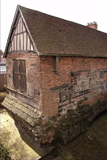
© Jerry Evans · Geograph · CC BY-SA 2.0
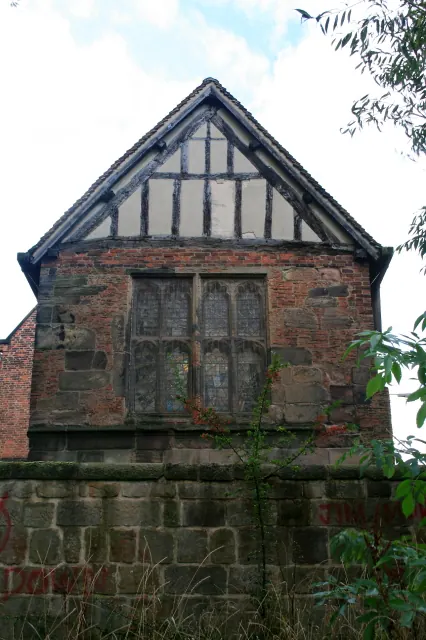
© David Lally · Geograph · CC BY-SA 2.0
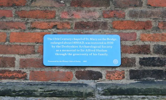
© David Lally · Geograph · CC BY-SA 2.0
Images © their respective photographers, licensed under CC BY-SA 2.0 and reused here with attribution. Photographs depict listed buildings, churches and monuments near this settlement and may show neighbouring villages.
Data derived from the Open Domesday project (opendomesday.org), based on the Domesday Book dataset compiled by Professor J.J.N. Palmer and team. The Domesday Book (1086) is in the public domain.
Found an inaccuracy? [email protected]